Topanga State Park is a quiet retreat, surrounded by L.A. sprawl but retaining its rural character. The state park is sometimes billed as “the largest state park within a city limit in the U.S.”
The name Topanga is from the Shoshonean Indian dialect. Until the 1880s, there was little permanent habitation in the canyon. Early settlers tended vineyards, orchards, and cattle ranches.
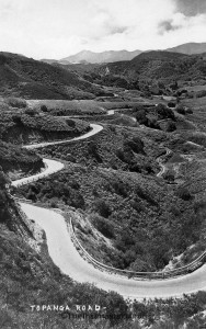
The drive into Topanga Canyon to take a hike has been part of the hiking experience for 100 years.
In the 1920s, the canyon became a popular weekend destination for Los Angeles residents. Summer cabins were built along Topanga Creek and in surrounding hills. For $1 round trip fare, tourists could board a Packard auto stage in Santa Monica and be driven up Pacific Coast Highway and Topanga Canyon Road to the canyon’s scenic spots.
Most Topanga trails are good fire roads. In the heart of the state park, the hiker will discover Eagle Rock, Eagle Spring and get topographically oriented to Topanga.
I have a particular fondness for Topanga Canyon, having resided there and hiked there often during my grad school days. The park definitely offers four-season hiking: On a blustery winter day, city and canyon views are superb, in springtime, the hillsides are colored with wildflowers, and autumn offers great hiking weather and clear-day vistas.
Summer, too, has its charms. It’s doubtful any poets will rhapsodize about such summer bloomers as bursage, mugwort, Indian milkweed, chaparral pea or ashyleaf buckwheat, though the scarlet petals of the California fuchsia and the tiny pink petals of the slim aster do have a certain charm. Just get an early start!
DIRECTIONS TO TOPANGA STATE PARK
From Topanga Canyon Boulevard, turn east on Entrada Road; that’s to the right if you’re coming from Pacific Coast Highway. Follow Entrada Road by turning left at every opportunity until you arrive at Topanga State Park. The trailhead is at the end of the parking lot.
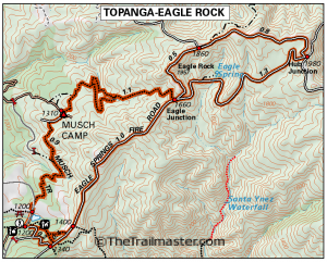
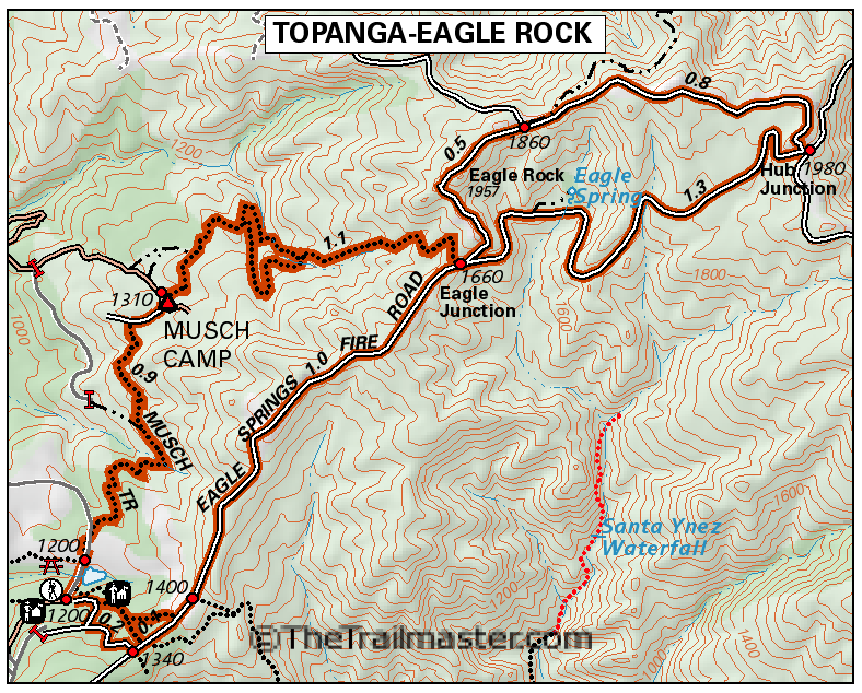
Topanga State Park Map by TomHarrisonMaps.com (click to enlarge)
THE HIKE
From the Topanga State Park parking lot, follow the distinct trail eastward to a signed junction, where you’ll begin hiking on Eagle Springs Road. You’ll pass through an oak woodland and through chaparral country. The trail slowly and steadily gains about 800 feet in elevation on the way to Eagle Rock. When you reach a junction, bear left on the north loop of Eagle Springs Road to Eagle Rock. A short detour will bring you to the top of the rock.
To complete the loop, bear sharply right (southwest) at the next junction, following the fire road as it winds down to Eagle Spring. Past the spring, you return to Eagle Spring Road and retrace your steps back to the trailhead.
Three-mile long Musch Ranch Trail, which passes from hot chaparral to shady oak woodland, crosses a bridge and passes the park pond, is another fine way to return to the trailhead.
Interested in more hikes in the Santa Monica Mountains? Check out my guide: Hike the Santa Monica Mountains

