John McKinney

  • Hike On Halloween: New Holiday Tradition

    Hike On Halloween: New Holiday Tradition

    Hike on Halloween and start a new holiday tradition. There’s likely a place in your neck of the woods that’s just a little bit spooky or has a scary-sounding name.

    HIKE. Carve it on a pumpkin and remind yourself that autumn is a great season for hiking.
    HIKE. Carve it on a pumpkin and remind yourself that autumn is a great season for hiking.

    The Trailmaster has been pleased to note an upswing in hikers hitting the trail on or near other holidays, both sacred and secular. The “New Year’s Day Hike,” is now embraced by parks departments across the country. Easter Sunday hikes and Christmas hikes are very popular, and lots of hiking takes place over Presidents Day, Memorial Day and Labor Day weekends. Thanksgiving hikes can be wonderful multi-generational outings with family and friends.

    I suppose the real reason I want to encourage taking a hike on Halloween is that for too many people in too many places in the country, Halloween marks the END OF THE HIKING SEASON. It’s NOT an official end of the hiking season (no governmental agency or hiking authority declares Halloween to be the end of hiking season, but nevertheless at the end of October, scores of hikers hang up their hiking boots until the following spring.

    OK, if you live in a really cold place, with lots of snow on the ground by Halloween, I understand why your hiking season is over. But what really bugs The Trailmaster is that Halloween is often the end of hiking season for those in warmer climes, even for those fortunate to live in regions with four-season hiking.

    So let’s get out there and take a Halloween hike–preferably to a scary-sounding or spooky-looking place to hike.

    Take a Halloween Hike! And "Spooky Trails to You."
    Take a Halloween Hike! And “Spooky Trails to You.”

    Halloween always makes me think of the large number of California locales with deathly and devilish names that I’ve hiked to over the years. In Southern California, trails lead to the Devil’s Punchbowl in the Mojave Desert and Devil’s Canyon in the San Gabriel Mountains. For a devil of a time, follow Devil’s Slide Trail into the San Jacinto Mountains or the Devil’s Backbone Trail up to Mt. Baldy.

    California’s national parks have their share of trails to scary-sounding places. Take a hike in Devil’s Postpile National Monument or trek to Bumpass Hell and Devil’s Kitchen in Lassen Volcanic National Park.

    Death Valley National Park is likely the nation’s best place for a Halloween hike. Hit the trail to the Funeral Mountains, Skull Mountains, Coffin Peak, Deadman’s Pass, Dante’s View, Devil’s Golf Course or Hell’s Gate.

    Here’s wishing you Happy Halloween and Happy Trails.

    Hike On,
    John McKinney
    The Trailmaster

  • Hiker Boxes: Share and Share Alike

    Hiker Boxes: Share and Share Alike

    I love the very idea of a hiker boxes, and of course the huge help they can be to the hiker who needs more food, or who forgot or lost some gear.

    Recently I re-supplied my son Daniel and his two buddies, who are hiking the John Muir Trail, near the trail’s midpoint at Edison Lake. Right outside the Vermillion Valley Resort café/store stood two hiker boxes—one for food and one for gear. I was pleased to observe hikers adding to the hiker boxes and taking what they needed. There were smiles all around—on the faces of the hikers who gave and on the hikers who received.

    John Muir Trail hikers are pretty happy to find these hiker boxes at Vermillion Valley Resort, located near the midpoint of the trail.
    John Muir Trail hikers are pretty happy to find these hiker boxes at Vermillion Valley Resort, located near the midpoint of the trail.

    What Are Hiker Boxes?

    By definition a hiker box is a box you find located along a long-distance trail where you can leave or take supplies. Hiker boxes can be found at backcountry stores or other businesses, lodges, outfitters or volunteer organizations.

    Common items in a hiker box include:

    • Food, often left when a hiker tires of eating something or bought and brought more than needed.
    • Gear someone decided was unnecessary and so just extra weight

    At Vermillion Valley Resort, the hiker box with the food contained everything from the very healthiest of vegetarian backpacking dinners to cans of Spam, plus lots of granola and trail mix. And who knew there could be so many different kinds of just-add-water meals with rice or noodles?

    "What looks good for dinner?" This Hiker Box along the John Muir Trail was full of foodstuffs ranging from candy bars to $10 freeze-dried meals.
    “What looks good for dinner?” This Hiker Box along the John Muir Trail was full of foodstuffs ranging from candy bars to $10 freeze-dried meals.

    The hiker box with gear held lots of bottles of biodegradable soap, bandannas, and blister kits. Clothing for the taking included hiking shorts, fleece pullovers and a sports bra.

    As I watched the happy JMT hikers add and take items from the hiker boxes, it occurred to me that sharing is what hiking is all about. In this time when so many people are disconnected from the great outdoors, it’s certainly a perfect time for hikers to share the joy of hiking with the many who hike and the many more who do not what it means to be a hiker.

    Let’s share with our trail companions the health and wellness benefits of hiking. Let’s share with friends and family members that wonderful perspective on the natural world gained by walking through it at two or three miles an hour.

    And when we hikers have an extra bottle of mosquito repellant, a freeze-dried beef stroganoff dinner or a trekking pole, let’s be sure to share and leave it in the hiker box for the next hiker who comes along.

    Interested in more hiker terms? Check out my Hiking from A to Z: A Dictionary of Words and Terms Used by Hikers

  • Mount Hollywood Trail from Griffith Observatory

    Mount Hollywood Trail from Griffith Observatory

    Griffith Park’s best-known hike leads to the top of 1,625-foot Mount Hollywood, the park’s premiere peak. Mount Hollywood is not the mountain crowned by the historic Hollywood sign; however, the Mount Hollywood Trail to it delivers great views of Mt. Lee and the bold HOLLYWOOD lettering across its summit. Mount Hollywood can be hiked by way of several different trails but the route from Griffith Observatory is by far the most popular.

    https://www.youtube.com/watch?v=g2NW4fLJM8w

    Mount Hollywood Trail

    From Griffith Observatory to Mount Hollywood is 3 miles round trip with 500-foot elevation gain

    On clear days the entire basin is spread out before you from the San Gabriel Mountains to the Pacific Ocean. Sometimes mounts San Gorgonio, Baldy and San Jacinto can be seen. The view at night can be spectacular, too.

    Griffith Observatory opened to the public in 1935 and has been a cultural institution, tourist attraction and L.A. landmark ever since. Closed in 2002 for an extensive renovation, the observatory reopened in 2006, retaining its Art Deco exterior and adding all new exhibits and a theater.

    The 2007 Griffith Park came dangerously close to the observatory, seared Mt. Hollywood and severely damaged Captain’s Roost and Dante’s View, two lovely rest stops along the trail to Mt. Hollywood. Post fire replanting efforts have greatly benefited Dante’s View.

    The trailhead for Mount Hollywood is named for longtime park volunteer Charlie Turner.
    The trailhead for Mount Hollywood is named for longtime park volunteer Charlie Turner.

    Artist-writer Dante Orgolini, an immigrant of Italian descent, began planting a two-acre retreat of pine, palm and pepper trees high on the south-facing slope of Mt. Hollywood in 1965. British-born retired insurance agent Charlie Turner took over as caretaker in 1978 after Orgolini’s death and, for the next 15 years, until he was nearly 90, hiked to the garden virtually every morning to tend the plants. The trailhead for Mount Hollywood is named for Turner.

    DIRECTIONS TO MOUNT HOLLYWOOD TRAIL

    From Los Feliz Boulevard, take Vermont Avenue into the park. Follow signs to the observatory and park in the north end of the lot farthest from the observatory near the signed and landscaped Charlie Turner Trailhead.

    Mount Hollywood Map by Mark Chumley (click to enlarge)
    Mount Hollywood Map by Mark Chumley (click to enlarge)

    THE HIKE

    A brief ascent along the narrow ridgeline dividing Vermont Canyon on the east and Western Canyon on the west leads to Berlin Forest. Among the trees planted by L.A.’s German sister city officials, is a whimsical sign pointing northeast to Berlin, 6,000 miles away.

    The path traverses the top of the Vermont Canyon Road tunnel and about 0.9 mile out reaches a four-way junction on the brushy shoulder of Mount Hollywood. The left branch loops around the west side, the right around the east side.

    Ascend the right (east) branch of the Mount Hollywood Trail to Dante’s View, where a water fountain and picnic tables suggest a rest stop for hikers. Dedicated volunteers maintain the garden. Continue the short distance to the top of Mt. Hollywood and enjoy the view.

    Return the way you came or descend the western loop of the Mt. Hollywood Trail past Captain’s Roost, a rest stop, to a junction with Charlie Turner Trail.

    Interested in more hikes near Griffith Park and the Hollywood Hills? Check out my guide HIKE Griffith Park and Hollywood Hills

  • Hiking in Hot Weather

    Hiking in Hot Weather

    Hot and bothered after a mid-day hike?

    Well, it’s no wonder.

    Recent studies have shown that the optimum temperature range for long-distance walks or hikes is 50 to 55 degrees F. Above this range is considered hiking in hot weather, when a hiker’s performance degrades as much as two percent for every five-degree increase in temperature.

    Broad-brimmed hats help hikers keep a cool head in hot weather.
    Broad-brimmed hats help hikers keep a cool head when hiking in hot weather.

    As temperatures rise, hikers must adjust their routine. Too much sun, too much hiking and too little fluid intake can make even a strong hiker an accident waiting to happen. Heat cramps, heat exhaustion and heat stroke can result. A hike near home can be just as deadly as a trek across Death Valley, but heat illnesses and deaths are preventable by taking the right precautions.

    The main environmental factors contributing heat-related illnesses are temperatures above 90 degrees F., humidity above 80 percent and sunlight exposure (partial to full) and dehydration.

    Of course, “Wait ‘til it cools off” is always the best advice for the hiker contemplating a hike in the heat. But some hikers like it hot and, if you’re determined to hit the trail in the heat, you must take the right precautions.

    Tips for Hiking in Hot Weather

    • Time your hike for the cool of the day—early morning is best, late evening second best. Avoid midday when the sun’s rays are directly overhead, and late afternoon when the earth has absorbed the sun’s rays but the heat hasn’t dissipated at all.
    • Wear a hat. A baseball cap will do, but a better bet is an expedition-type hat that has protective flaps to cover the neck. Another style is the wide-brimmed bucket hat; again, don’t worry about looking geeky on the trail.
    • Apply sunblock on all exposed skin. Read the product directions: some varieties of sunblock need to be put on some time before exposure in order to be effective.
    • Wear loose fitting, light-colored, lightweight clothing.
    • Carry—and drink—lots of water.
  • Talks by John McKinney

    Inspiration for the Great Trail We Call Life

    When John McKinney says, “Take a hike,” people do.

    Willingly. With smiles on their faces.

    The Trailmaster’s unique insights, gained from the natural world and the “real world,” teach, inspire and entertain. Along with suggesting we all “take a hike” (in the most positive and encouraging way of course!), John shares heartwarming and hilarious tales of his trails across California and around the world.

    Organizations that ask John McKinney to share his trails and tales include:

    • Corporations, Nonprofits, Schools, Associations
    • Health and Wellness
    • Conservation, Parks, Outdoors
    • Hikers and Trails
    • Faith-based

    About John McKinney

    Author and hiking expert John McKinney, aka The Trailmaster, has written a thousand articles and more than 30 books about hiking including Hiking on the Edge: Dreams, Schemes and 1600 Miles on the California Coastal Trail and Hiking the Holy Mountain: Tales of Monks and Miracles on the Trails of Mount Athos, Greece.

    John McKinney inspires audiences with his talks, including "Hiking the Holy Mountain" and "Getting Back on the Nature Trail"
    John McKinney inspires audiences with his talks, including “Hiking the Holy Mountain” and “Take a Hike, Change Your Life”

    For 17 years, John served as the Los Angeles Times Hiking Columnist. The intrepid Eagle Scout the only one to hike and write about all 278 California state parks, and to solo hike the entire California coast.

    John has served on the board of the American Hiking Society, trained hike leaders for the Leukemia & Lymphoma Society’s “Hike for Discovery” program, and been a longtime supporter of the California State Parks Foundation and Boy Scouts of America.

    The Heart and Soul of Hiking

    John McKinney has spent much of his career studying and gaining an understanding of the benefits of hiking—on and off the trail—as well as what motivates and inspires hikers and would-be hikers. John’s time on the trail, meeting park rangers and hikers from all over the world, as well as field research for his many books have combined to enable him to educate people on our crucial need to connect with nature.

    Trailmaster John McKinney has been featured or interviewed in major publications and media from the Los Angeles Times to NPR, and appeared on numerous regional talk shows and news programs. Many people—hikers and not—credit John’s talks, articles, books, blogs and web site, TV and radio appearances with inspiring them to hit the trail to a better life, reconnecting with nature and making positive and lasting changes in their lives.

    As John explains his mission, “I’ve hiked a lot of life trails—happy and sad, easy and challenging and, frankly, more than one path to nowhere. What I’ve learned I want to share.  Take a hike, and change your life!”

    John McKinney’s Talks

    Hiking the Holy Mountain (Keynote, adjustable length) John was compelled by extraordinary events to live through—then write about—an odyssey that took him to a remote monastery on Mt. Athos, Greece. “Hiking the Holy Mountain” tells the story of two treks around a monastic kingdom where no woman has set foot for a thousand years, encounters with a colorful cast of Greek monks, and a series of miraculous events that took place on—and off—the Holy Mountain. This spiritual adventure is one of the all-time best tales of adoption, a glorious—and sometimes hilarious—story of faith and family.

    Take a Hike, Change Your Life (Keynote, adjustable length) John reveals how time in nature can benefit us in body, mind and soul, as well strengthen us in our most important relationships. Participants enjoy John’s heartwarming—and laugh out loud—tales from the trail as John shares his unusual profession and life as a hiker. The Trailmaster has solutions and cures for the alarming rate of “Nature Deficit Disorder” that affects so many kids and adults. A key deliverable is John’s “Ten Essentials for Hikers,” inner qualities and directions that help us on the trail and off.

    Book John McKinney Now For Your Next Event

    Meeting and event planners love working with John because he’s professional, dependable, and always engages his audiences with the right mix of inspiration, information, humor and real-world insight. Contact us (Cheri@TheTrailmaster.com) or call 805-845-7102 for more information and John’s availability. Be sure to ask about special discounts on John’s books.


  • HIKE Southern California, A Day Hiker’s Guide

    Discover the Best Day Hikes in Southern California!  Hiking Expert John McKinney Connects Us with SoCal’s Most  Inspiring Trails with His Classic Guide HIKE Southern California Hike Southern California News Release

    Continuing his 30-year effort to share the region’s natural treasures with residents and visitors, John McKinney is pleased to announce publication of a new edition of the classic HIKE Southern California: A Day Hiker’s Guide. From Lost Palms Oasis to the HOLLYWOOD Sign to the top of Mt. Baldy, you’re guaranteed to find a hike you’ll like in this popular collection featuring updates of classic trails and 25 new hikes.

    Southern California Has so much to Offer

    “Other regions of the country have high peaks, pine forests, vast deserts and lovely shorelines, but only Southern California has all these environments,” explains McKinney, aka The Trailmaster. “And four-season hiking, too!”

    From waterfalls to wildflowers to wilderness areas, enjoy a diversity of hikes in: Santa Barbara & Ojai , Orange County, Griffith Park, Catalina Island, Palm Springs, Joshua Tree National Park, San Gabriel Mountains, San Bernardino Mountains, Santa Monica Mountains, San Jacinto Mountains

    Hike Southern California: A Day Hiker's Guide
    Hike Southern California: A Day Hiker’s Guide

    This 336-page book comes complete with The Trailmaster’s colorful stories and easy-to-follow maps. Take a water bottle, trail snack and this guide and:

    • Chill-out in Cold Spring Canyon, Icehouse Canyon and Winter Creek. Cool-off at Eaton Falls, Seven Falls and Holy Jim Falls.
    • Climb Mt. San Gorgonio, Mt. San Jacinto and Saddleback Peak. Get grand metropolitan vistas from atop Echo Mountain, Mt. Hollywood and Inspiration Point.
    • Hike to dozens of classic and contemporary film locations including Shangri-La in Ojai, the M*A*S*H site along Malibu Creek, and to the Planet of the Apes at Point Dume.

    “While trails and this guide have changed greatly over the years, my mission to inspire readers to take a hike in this wonderful land we call Southern California has not,” declares McKinney. “Reconnect with nature and have a wonderful time on the trail.”

    HIKE Southern California ($17.95) and TheTrailmaster hiking guides are available HERE. For more information about books and talks by John McKinney or interview requests, contact Cheri@TheTrailmaster.com, or call 805-845-7102.

    About the Author: John McKinney, aka The Trailmaster, is the author of 30 books and a thousand articles about hiking. A passionate advocate for hiking and reconnecting with nature, John shares his expertise on radio, TV, online, and as a public speaker.

  • Lost Coast Found with New Edition of Popular Map

    Lost Coast Found with New Edition of Popular Map

    A new and significantly revised edition of the popular map, California’s Lost Coast is now available. Featuring black sand beaches, redwood groves, and 60 miles of the state’s wildest coastline, the Lost Coast is a magnificent place to hike.

    Order the new California’s Lost Coast Map ($9.95)  from Wilderness Press for only $7.46 (save 25 percent). The map is also available from Amazon,  The Trailmaster Store, and California REI stores.

    New Edition of California's Lost Coast map now available
    New Edition of California’s Lost Coast map now available

    In recent years the Lost Coast has gained national—even international—attention as a top hiking destination, garnering rave reviews and earning it a place on numerous “Best Hikes” lists including:

                “North America’s 10 Most Memorable Hikes”—Backpacker

                “Great American Hikes: 20 Top Trails across the USA” —USA Today

                “Top 10 Coastal Hikes in California & Pacific Northwest”—The Guardian

    Lost Coast Brewery, located in Eureka, California, is also spreading the word about the Lost Coast to beer-lovers everywhere with its Lost Coast Ale and other award-winning beers. Its beer-making operation has increased dramatically in recent years, and Lost Coast beer is now sold around the state and across the nation, as well as in 11 countries. 

    Why Is this California’s Lost Coast?

    Sinkyone Wilderness State Park, along with the BLM’s King Range National Conservation Area to the north, comprise California’s Lost Coast, located in northern Mendocino and southern Humboldt counties. One reason the coast is “lost” is because no highways cross it. So rugged is this country, highway engineers were forced to route Highway 1 many miles inland from the coast—and the region has remained sparsely settled and unspoiled. It’s magnificent vistas and varied terrain—dense forests, prairies, bluffs and beaches—reward the visitor who plans an adventure on the Lost Coast.

    On California's Lost Coast, the rugged peaks of the King Range seem to rise right out of the surf. (photo by Bob Wick, BLM)
    On California’s Lost Coast, the rugged peaks of the King Range seem to rise right out of the surf. (photo by Bob Wick, BLM)

    The new map incorporates recent changes in facilities and access that add up to altogether better visitor experience. The BLM has upgraded 7 campgrounds and its day-use recreation areas. Trail camps in the King Range and walk-in camps in the state park have also been improved. Roads and trails are in better shape than in years past, with improved signage as well.

    California’s Lost Coast map details the BLM’s new wilderness permit system for backpackers. Those backpackers and day hikers who like to make one-way journeys will be pleased to learn of a new shuttle service that offers drop-off and pickup at all the major Lost Coast trailheads. The map highlights the new Paradise Royale Mountain Bike Trail System, a great way for mountain bikers to experience the Lost Coast.

    While field-checking his California's Lost Coast map, Trailmaster John McKinney gets the latest info from a Sinkyone Wilderness State Park ranger.
    While field-checking his California’s Lost Coast map, Trailmaster John McKinney gets the latest info from a Sinkyone Wilderness State Park ranger.

    John McKinney, author of 30 books about hiking and longtime coastal trails advocate, created the 1st edition of this map while serving as a volunteer camp host at Sinkyone Wilderness and worked closely with the AdventureKeen team to produce this 3rd edition.

    John pioneered the California Coastal Trail and wrote a narrative about his adventure: Hiking on the Edge: Dreams, Schemes, and 1600 Miles on the California Coastal Trail.

  • John McKinney: My Life as a Hiker

    Excerpted from John McKinney’s The Hiker’s Way.

    The Wonder Years My unusual career path began when I was a Boy Scout in Troop 441 in Downey, California. I lived for the monthly hikes in the mountains, deserts and forest around California, and for weeklong summer hikes in the San Gabriel Mountains and the High Sierra. Hiking was far and away my favorite merit badge earned on my way to becoming an Eagle Scout. (It should have been a tip-off that I wasn’t cut out to be a Wall Street mogul when I needed three tries to pass the test for the Personal Finances merit badge.)

    When I was fourteen, my parents sat me down for what they characterized as a frank discussion about my future.

    “John, your mother and I appreciate how fun this hiking-camping-outdoors stuff is for you,” my father began. “But let’s face it, you’re not going to be doing this as an adult.”

    “When I’m a grown-up, I’m going to keep hiking,” I declared.

    “What your father’s saying,” my mother chimed in, “is nobody makes a living by hiking.”

    “You need to take up a sport that will help you in the business world,” my father continued in the persuasive manner that garnered him salesman-of-the-year honors at the huge corporation he represented. “So we’ve decided to help you out by—”

    “Not another tennis racket,” I whined.

    “No, you’re going to be surprised,” mother cautioned, as my father disappeared into the next room, soon re-emerging with—

    “Golf clubs,” I said glumly.

    “And a certificate for eight lessons at the club,” Father enthused.

    My heart sank. I had been hoping for a new backpack. I took the golf lessons to please my parents, but my heart wasn’t in it. For me, golf was a good walk ruined, years before I ever heard of the Mark Twain quip.

    Trails and Trojans My studies for a degree in broadcast journalism from the University of Southern California proved to be somewhat useful to my life’s work; more so were my collegiate extracurricular activities. I helped found, and lead hikes for, the U.S.C. Hiking Club. While the cheerleaders for the football team looked good on TV, the coeds who hiked looked great on the trail—and that made them the most interesting and attractive on campus—at least to my way of thinking. The post-hike beers with my fellow hikers, when we talked about our next hikes and where our life paths may lead, I remember even now.

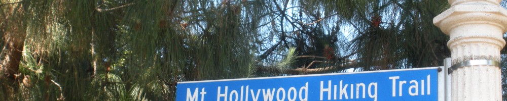
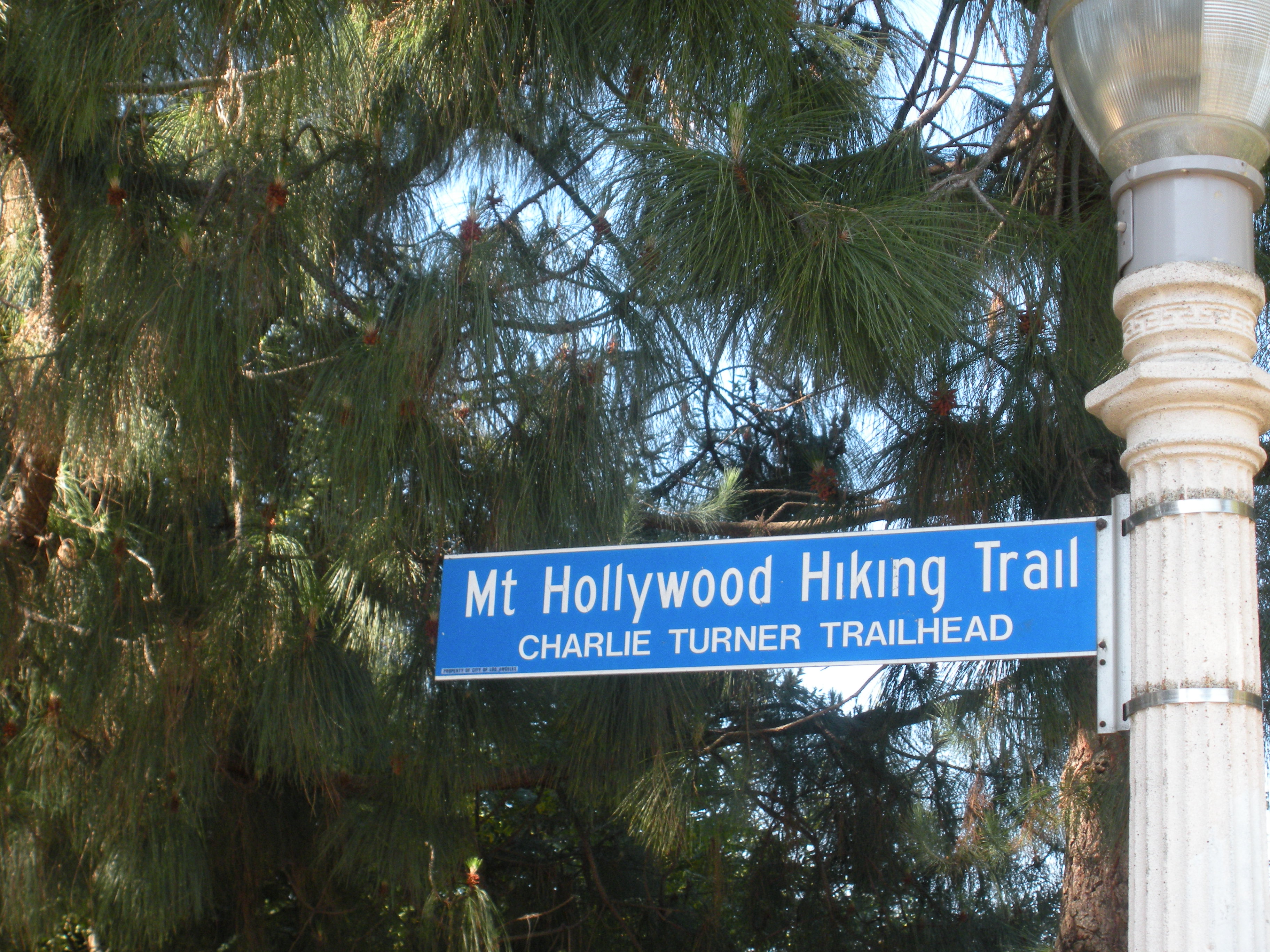
    Hikes in the Hollywood Hills For a while, I did the Hollywood hustle, working as a location scout and nature film writer by day, writing the Great American screenplay at night (If you know a producer interested in biopic about John Muir, “John of the Mountains” is a great script…) Between film screenings and pitch meetings, I went for hikes in the Hollywood Hills. I discerned that the hills are blanketed with a green-leaved, red-berried native plant called California holly—which gave Hollywood its name. I discovered I greatly preferred being on top of hills and looking down at Hollywood than being in Hollywood and looking up at the hills. What could this mean?

    Trail Writer While the industry never came through with those six- and seven-figure offers I thought my screenplays deserved, I was pleasantly surprised to learn that magazine editors would pay me two, three, and four figures to write about hiking and the great outdoors. Readers of California, Sunset and Los Angeles Times magazines enjoyed my hiking stories while Islands magazine sent me from Fiji to Kauai to Corfu to hike around the world’s islands and write about them.

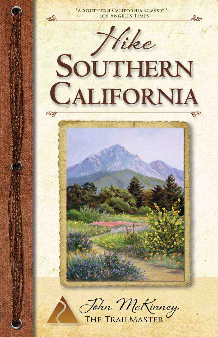
    My articles about hiking caught the attention of legendary California publisher Noel Young and his Capra Press, who signed me to write Day Hiker’s Guide to Southern California. This title, now Hike Hike Southern California, A Day Hiker’s Guide, expanded from 50 trail accounts to 150, is still popular, and remains a regional bestseller.

    In 1986, a Los Angeles Times reporter interviewed me for a story he was writing about hiking. In mid-interview, he stopped and declared: “Hey, you should be writing about this subject. Let me introduce you to the editor.”

    So began my 18-year stint as the newspaper’s hiking columnist. The weekly column proved tremendously popular. Maybe the Missing Persons song lyric, “Nobody walks in L.A.” is true; however, it seems most everybody hikes. Local parks had to assign extra staff on the weekends following some of my hike write-ups because so many hikers turned out to hit the trail.

    My Times readers liked my accounts of regional hikes but soon requested that I go farther afield to detail hikes. So off I hiked, around the West, across the East, and to intriguing hiking locales all over the U.S. I compiled the trails I described for The Times and other publications into a dozen guides, including Day Hiker’s Guide to California’s State Parks, Great Walks of New England and Great Walks of the Pacific Northwest.

    Hiking: Isn’t it Romantic? Meanwhile, even my social life revolved around hiking. I must confess I took my dates on (sometimes too) rigorous hikes and I’m sure more than one woman not-so-fondly remembers not only a bad date but the hike from hell. Fortunately, I met a gal who could not only keep step with me on the trail, but surpasses me in every other way. Cheri and I have been together since our first hike, uh, date.

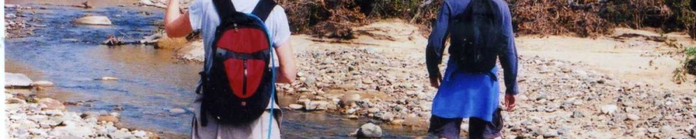
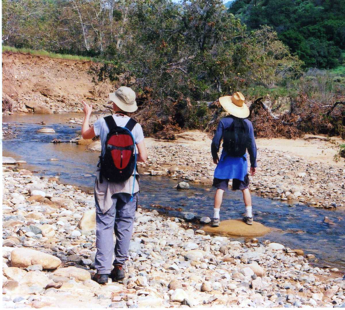
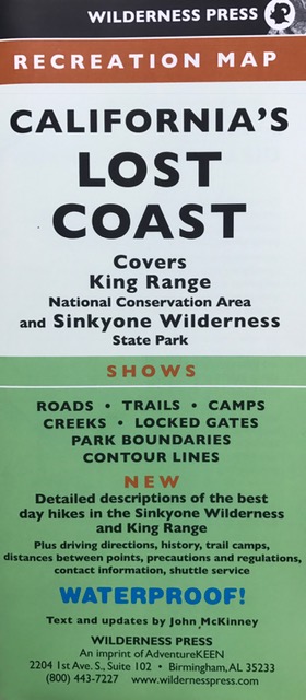
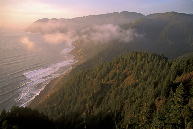
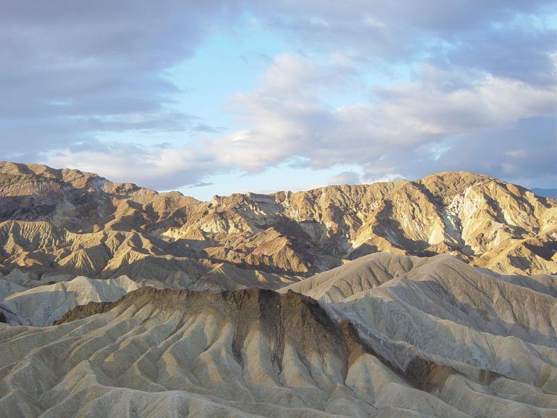
    Pioneering the California Coastal Trail Of the many lands that have called to me, spoke to me, my home shoreline and coastal mountains have called the loudest. I answered the call by agreeing to the California Coastal Trail Foundation’s request to pioneer the California Coastal Trail. And so I took a little walk—a 1,600-mile hike as it turned out—from the Mexican border to the Oregon border along California’s diverse shore, through the coast range and redwood forest. It was a life-changing hike for me, as I transformed from a sportsman with something to prove to a traveler with something to learn—and share. I wrote a narrative, Hiking on the Edge: Dreams, Schemes, and 1600 Miles on the California Coastal Trail that chronicled my adventures and the unique people and places I encountered.

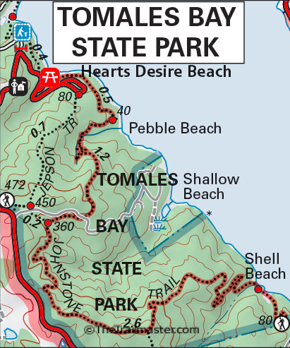
    Hiking Vacations An upscale walking vacation company headquartered in England asked me to set up a North American branch. I helped create weeklong hiking holidays from the Olympic Peninsula to Santa Fe to the coast of Maine, and let tours around Santa Barbara and Point Reyes National Seashore north of San Francisco. I thoroughly enjoyed guiding hikers form all around the U.S. and Europe and some lovely paths, getting to know some wonderful people, and learning what goes on behind the scenes in this fun and rewarding part of the travel business.

    Kids on the Trail  I enjoyed family hikes and sharing the trail with my daughter Sophia and son Daniel. I’ve learned as much from my children as they have from me, and I’ve bee delighted by the opportunity to share what we’ve learned together in a pocket guide, “HIKE with Kids,” and in four more books about hiking I’ve written for other publishers.

    Recently I’ve been quite alarmed by the rise of what the outdoors recreation community calls “Nature Deficit Disorder,” brought to our  attention by author Richard Louv in his landmark book, Last Child in the Woods. I’ve been speaking out on that topic and writing books about hiking and outdoors skills for kids, including Let’s Go Geocaching! and Let’s Go Hiking!

    Older, Wiser, The Trailmaster Nearly 20 years ago, a California newspaper reporter, who shall be held blameless and left nameless, branded me “The Trailmaster” after interviewing me for a story he wrote about hiker safety. Shortly thereafter, a radio talk show host picked up on the name and invited listeners to call in with their questions about hiking for “The Trailmaster.”

    The name is easy to remember and is as good or better than any of the other names I’ve been called: “Trails expert,” “Hike writer,” and “Hiking spokesman” as well as less flattering terms—“eco-crank,” “curmudgeon” and coastal access extremist.”

    At a certain time in life, some of us feel a calling to share our calling. For me, that time is now. It’s time to share the gospel of hiking, its rich tradition and its many benefits for body, mind and spirt.

    I make no claims to be the smartest and most eloquent spokesman for hikers, but I do have one standout ability that helps me spread the good word: I can walk and talk at the same time.

    Go on and scoff. But it’s harder than you think to hike and impart hiking wisdom at the same time, particularly with a TV camera tracking your every move. To be sure it’s an obscure talent, but one I’m delighted to use to share the hiker’s way.

  • Why I Like to Hike Death Valley

    Why I Like to Hike Death Valley

    A bighorn sheep standing watch atop painted cliffs, sunlight and shadow playing atop the salt and soda floor, a blue-gray cascade of gravel pouring down a gorge to a land below the level of the sea—these are a few of the many awesome scenes I’ll always remember and why I like to hike Death Valley National Park.

    Hike Death Valley National Park? The Forty-niners, whose suffering gave the valley its name, would have howled at the notion. “Death Valley National Park” seems a contradiction in terms, an oxymoron of the great outdoors.

    Enjoy a hike around the rim of Ubehebe Crater in Death Valley National Park.
    Enjoy a hike around the rim of Ubehebe Crater in Death Valley National Park.

    Park? Other four-letter words are more often associated with Death Valley: gold, mine, heat, lost, dead. And the four-letter words shouted by teamsters who drove the 20-mule team borax wagons across the valley floor need not be repeated.

    "Hike or Die, Death Valley" license plate frame--hopefully just for fun.
    “Hike or Die, Death Valley” license plate frame–hopefully just for fun.

    Hike? Well, “hike” is a four-letter word not commonly associated with Death Valley. However, we who like to hike Death Valley intend to subvert the dominant paradigm and share the park’s many intriguing trails.

    In fact, “Death Valley” got its name from some hikers—all be it some very unhappy ones. Looking for a shortcut to the California gold country, two groups of travelers with about 100 wagons got lost in the huge valley for weeks in December of 1849. After slaughtering their oxen and burning the wood of their wagons to cook the meat, they finally located a pass and hiked out of the valley. One of the women in the group is reported to have said, “Goodbye Death Valley!” and the name stuck.

    Even the hiker with little or no interest in geology can be awestruck by Death Valley, where the forces of the earth are exposed to view with dramatic clarity: a sudden fault and a sink became a lake. The water evaporated, leaving behind borax and above all, fantastic scenery. Although Death Valley is called a valley, in actuality it is not. Valleys are carved by rivers. Death Valley is what geologists call a graben. Here a block of the earth’s crust has dropped down along fault lines in relation to its mountain walls.

    Death Graben National Park?

    Nope. Just doesn’t have the right ring to it.

    Many of Death Valley’s topographical features are associated with hellish images—Funeral Mountains, Furnace Creek, Dante’s View, Coffin Peak and Devil’s Golf Course—but the national park can be a place of great serenity for the hiker.

    At 3.3 million acres, Death Valley is the largest national park outside of Alaska. The very notion of hiking the desert in general, and at a place like Death Valley in particular, is a surprising one to some people—even to some avid hikers. The desert that seems so huge when viewed from a car can seem even more intimidating on foot.

    Compared to forest or mountain parks, Death Valley has a limited number of signed footpaths; nevertheless, hiking opportunities abound because roads (closed to vehicles), washes, and narrow canyons serve as excellent footpath substitutes.

    The distances across Death Valley are enormous. If you only have one day, stick around the Furnace Creek Visitor Center. Take in Harmony Borax Works, Badwater, Dante’s View and hike the interpretive trail through Golden Canyon.

    For the average hiker, there’s a week or two’s worth of hiking in the park, though you can get a fair sampling of this desert in three to four days. Although it’s tempting, don’t over-schedule. Death Valley is vast, with abundant sights to see and hikes to take.

    Sunrise at Zabriskie Point (photo Daniel Mayer)
    Sunrise at Zabriskie Point (photo Daniel Mayer)

    To see as much of the park as possible, choose a different entrance and exit highway. Several routes lead into the park, all of which involve crossing one of the steep mountain ranges that isolate Death Valley from, well, everything. If you enter on Highway 127 through Death Valley Junction, exit on the scenic byway through the Panamint Valley. If you entered from the Panamint side, take your leave of the park by following Badwater Road (Highway 178) south from Furnace Creek, across the Black Mountains and Greenwater Valley to intersect Highway 127 at Shoshone.

    A particular highlight of hiking Death Valley is encountering the multitude of living things that have miraculously adapted to living in this land of little water, extreme heat and high winds. Two hundred species of birds are found in Death Valley. The brown whip-like stems of the creosote bush help shelter the movements of the kangaroo rat, desert tortoise and antelope ground squirrel. Night covers the movements of the bobcat, fox and coyote. Small bands of bighorn sheep roam remote slopes and peaks. Three species of desert pupfish, survivors from the Ice Age, are found in the valley’s saline creeks and pools.

    In spring, even this most forbidding of deserts breaks into bloom. The deep blue pea-shaped flowers of the indigo bush brighten Daylight Pass. Lupine, paintbrush and Panamint daisies grow on the lower slopes of the Panamint Mountains while Mojave wildrose and mariposa lily dot the higher slopes.

    In reality, Death Valley celebrates life. Despite the outward harshness of this land, when you hike Death Valley, you see it in a different light. As naturalist Joseph Wood Krutch put it: “Hardship looks attractive, scarcity becomes desirable, starkness takes on an unexpected beauty.”

    Hike smart, reconnect with nature and have a wonderful time on the trail.

    Hike on.

    The Trailmaster John McKinney

  • California’s Gold Country: Treasures for Hikers

    California’s Gold Country: Treasures for Hikers

    California’s Gold Country offers many treasures for the hiker. Most of the gold in California’s Gold Country was mined long ago, but the wonderful scenery in the High Sierra foothills remains, a favorite of hikers and history buffs.

    California's Gold Country trails like this one in Marshall Gold SHP, are a favorite of Trailmaster John McKinney,
    California’s Gold Country trails like this one in Marshall Gold SHP, are a favorite of Trailmaster John McKinney,

    Highway 49 pays tribute to the Gold Rush and links a wonderful collection of restored mining towns and parks that preserve the heritage of that colorful era. Marshall Gold Discovery State Historic Park, Empire Mine State Historic Park, and other Gold Country parks preserve tunnels, trails, mines, and mountains made famous by the 49ers.

    Also on the western slope of the Sierra Nevada are the famed giant sequoia groves of Calaveras Big Trees State Park. The “Big” in the park name is no exaggeration; sequoias are the largest living things on Earth.

    The Gold Country is a splendid destination in autumn. Autumn colors the trees in the Sierra foothills with gold and other fall hues.

    Highway 49 winds its way for about 350 miles through the Gold Country, a region that requires two to three packed days to explore. Choose to camp in or near the California state parks en route or make a “base camp” in a B&B or other lodging then venture out to explore the marquee Gold Country state parks—Empire Mine SHP and Marshall Gold Discovery SHP. Calaveras Big Trees State Park is well worth an entire day on its own.

    Be sure to visit the excellent Chaw'se Indian Musuem at Indian Grinding Rock SHP.
    Be sure to visit the excellent Chaw’se Indian Musuem at Indian Grinding Rock SHP.

    And wait, there’s more. Hike around Indian Grinding Rock SHP and see the impressive bedrock mortars and a reconstructed Miwok village. And you just have to take a long walk around Columbia SHP and see this restored gold rush town. After you take a hike, take the train. Head for Jamestown and visit Railtown 1897 SHP, where steam train trips are offered from April through November.

    On your tour along Highway 49 south of Sacramento, The Trailmaster recommends a trio of trails in California State Parks. These are easy to moderate hikes that offer a great intro to the scenic treasures of California’s Gold Country.

    Hike to a monument of James Marshall, who points to the spot where he discovered gold.
    Hike to a monument of James Marshall, who points to the spot where he discovered gold.

    Marshall Gold Discovery State Historic Park Monument Trail and Monroe Ridge Trail add up to a fine Gold Country ramble that offers great views, both panoramic and close-up of what is likely the single most important locale in California history. This hike (4-mile loop) visits the Marshall Monument, where a bigger-than-life figure holds a bigger-than-life gold nugget and points to the spot where he made the discovery that put California on the world map.

    Indian Grinding Rock State Historic Park Check out the amazing grinding rock—a 173-foot length of bedrock with 1,185 mortar cups, and truly something to behold. Then join two short trails: North Trail begins near the museum, follows a low ridge and loops back to a reconstructed Miwok Village. South Nature Trail tours meadowland, oak woods, plus stands of sugar pine and ponderosa pine.

    Fire scarred, but still thriving, this sequoia is one of the more unusual trees in the park's magnificent South Grove.
    Fire scarred, but still thriving, this sequoia is one of the more unusual trees in the park’s magnificent South Grove.

    Calaveras Big Trees State Park The “Big Trees” in the park name is a tip-off: Two groves of giant Sequoia redwoods are the highlights of Calaveras Big Trees State Park. Most visitors tour the easy-to-access North Grove, while hikers in the know head for the park’s more remote South Grove, which has ten times the number of big trees and is far less visited than North Grove. North Grove is protected in a “Natural Preserve,” the highest category of environmental protection offered by the state park system. South Grove Trail is 5 miles round trip with a modest 400-foot elevation gain.

    Interested in more hikes in California’s Gold Country? Check out my guide, Hike Southern California

  • Mount Baldy

    Mount Baldy

    Devil ’s Backbone Trail: From Baldy Notch via ski lift, then to Mt. Baldy summit is 6.4 miles round trip with 2,200-foot gain; (without ski lift) 13 miles round trip with 3,800-foot gain

    Mt. San Antonio, more commonly known as Mt. Baldy, is the highest peak (10,068 feet) in the mountains and visible from much of the Southland. Its summit gleams white in winter and early spring, gray in summer and fall. Old Baldy is so big and bare that it seems to be snow-covered even when it’s not.

    Baldy is a bit austere from afar, but up-close, the white granite shoulders of the mountain are softened by a forest of pine and fir. Padres of Mission San Gabriel, circa 1790, named the massive stone bulwark after Saint Anthony, a 13th-century friar from Padua, Italy. In the 1870s, gold-seekers dubbed the massive peak a more earthly “Old Baldy.”

    From Baldy Notch, Devil’s Backbone Trail offers a moderately challenging route to the summit. This popular trail is the one most hikers associate with Baldy. Clear-day views from the top offer a panorama of desert and ocean, the sprawling Southland and the Southern High Sierra.

    An alternative is to walk up a fire road to Baldy Notch. This option adds 3 miles each way and a 1,300-foot gain to the hike. The fire road switchbacks up the west side of steep San Antonio Canyon, offers a good view of San Antonio Falls, then climbs northward to the top. This fire road is subject to closure. Check with the US Forest Service before you go.

    DIRECTIONS:

    From the Foothill Freeway (210) in Claremont, exit on Baseline Road and head west one block to Padua Avenue. Turn right and drive north 1.7 miles to a stop sign and an inter¬section with Mt. Baldy Road. Turn right and drive 7.2 miles to the national forest’s Mt. Baldy Visitor Center in Mt. Baldy Village, then a few more miles up to Manker Flats. To walk up the fire road, drive to the upper end of the Manker Flats Campground. Look for a vehicle gate and a paved road.

    Those riding the ski lift will continue 0.25 mile past the campground to the Baldy Ski Lifts and free parking. Purchase a ticket and ride the ski lift up to Baldy Notch. (The lift is operated weekends and holidays all year.)

    Mount Baldy Map by TomHarrisonMaps.com (click to enlarge)
    Mount Baldy Map by TomHarrisonMaps.com (click to enlarge)

    THE HIKE:

    From Baldy Notch, a wide gravel path leads to a commanding view of the desert. Join a chair lift access/fire road, and ascend a broad slope forested in Jeffrey pine and incense cedar. The road ends in about 1.25 miles at the top of a ski lift.

    From here, a trail leads onto a sharp ridge, the Devil’s Backbone. Look north down into the deep gorge of Lytle Creek, and south into San Antonio Canyon. Pass around the south side of Mt. Harwood, “Little Baldy,” and up through scattered stands of lodgepole pine.

    Reach a tempestuous saddle (Hold onto your hat!) and continue on a steep rock-strewn pathway that zigzags past wind-bowed limber pine to the summit. Atop Baldy’s crown, rock windbreaks offer shelter. Enjoy vistas of San Gabriel and San Bernardino mountain peaks, the Mojave and the metropolis.

    Interested in more hikes in the San Gabriel Mountains? Check out my “HIKE the San Gabriel Mountains Pocket Guide at The Trailmaster Store.

  • Crystal Cove State Park Bluffs

    Crystal Cove State Park Bluffs

    Between the Pacific Coast Highway and the wide blue Pacific, and between Laguna Beach and Newport Beach, lie the beautiful blufftops of Crystal Cove State Park.

    Pathways lace Crystal Cove State Park bluffs
    Pathways lace Crystal Cove State Park bluffs

    A paved, multi-use path extends along most of the 3.2-mile length of the bluffs. Eight connector trails—dirt and paved ones as well as a boardwalk—invite the explorer to leave the main route and explore tide pools, rocky coves and sand strands and check such intriguingly named topography as Pelican Point and Little Treasure Cove.

    Be sure to visit the Crystal Cove Historical District. The funky wood-frame beach houses are in marked contrast to Newport Coast, the upscale community of luxury villas and custom homes arising on the inland side of the highway.

    The beach cottages, were acquired by State Parks when the Crystal Cove area was set aside as parkland. Three-dozen cottages have been renovated and readied for rental to vacationers.

    The beach at Crystal Cove attracts its share of surfers, swimmers and sun-bathers but still gives the feeling of being away from it all and by no means resembles one of SoCal’s mass use sandlots.

    Crystal Cove Beach as viewed from the deck of Ruby's Shake Shack
    Crystal Cove Beach as viewed from the deck of Ruby’s Shake Shack

    Park boundaries extend beyond the tideline A portion of Crystal Cove’s waters are protected in an underwater park, which attracts divers. Local conservationists planted kelp to provide habitat for the native marine life.

    Bottlenose dolphins are frequently sighted in these waters and even been known to give birth here. The creatures form birthing circles, a marvelous natural drama to witness should you be so lucky.

    Directions to Crystal Cove State Park

    Crystal Cove State Park’s Reef Point entrance is located off Pacific Coast Highway, three miles north of Laguna Canyon Road in Laguna Beach and 3.5 miles south of McArthur Boulevard in Newport Beach.

    The park’s Pelican Point Entrance boasts four parking lots, each with restrooms. At the Los Trancos entrance, a parking area on the inland side of PCH and a pedestrian tunnel leading under the highway facilitate access to the Crystal Cove Historical District.

    Interested in more hikes near Crystal Cove State Park? Check out HIKE Orange County

  • Gold Bluffs Beach a Magnificent Part of California Coastal Trail

    Gold Bluffs Beach a Magnificent Part of California Coastal Trail

    Wildlife-watching, waterfalls and a wilderness beach are highlights of a hike along the northern reaches of Gold Bluffs Beach in Redwood National Park. While even one of these en route attractions makes for a compelling hike, the mere prospect of so many engaging environments can put a hiker into sensory overload before reaching the trailhead.

    Gold Bluffs Beach and the hiking in Prairie Creek Redwoods State Park comprise one of those most inspiring lengths of the California Coastal Trail and I write about it with much enthusiasm in my narrative, “Hiking on the Edge: Dreams, Schemes and 1600 Miles on the California Coastal Trail.”

    Gold Bluffs Beach (both bluffs and beach) is prime Roosevelt elk territory. While nearby elk-viewing opportunities abound, the creatures seem all the more majestic in this wilderness setting.

    Roosevelt elk roam the bluffs above Gold Bluffs Beach in Prairie Creek Redwoods State Park. The California Coastal Trail at its most magnificent! (Photo SF Wolfman, wikimedia)
    Roosevelt elk roam the bluffs above Gold Bluffs Beach in Prairie Creek Redwoods State Park. The California Coastal Trail at its most magnificent! (Photo SF Wolfman, wikimedia)

    Waterfalls near the coast are a rarity, so the presence of three of them in close proximity to the California Coastal Trail is a special treat indeed. Gold Dust Falls, a long, slender tumbler, spills some 80 feet to the forest floor. An unnamed waterfall is located just south of Gold Dust; another is located just north.

    The hike gets off to an amazing start near the mouth of Fern Canyon. Check out The Trailmaster’s description of the Fern Canyon Hike

    This is an easy-moderate hike. From Fern Canyon to Gold Dust Falls is 2 miles round trip; to Butler Creek Backpack Camp is 4.5 miles round trip; to Ossagon Rocks is 6 miles round trip. No elevation gain to speak of.

    In the case of this hike, the journey north from Gold Bluffs Beach overshadows the destination; nevertheless, the destination—the odd Ossagon Rocks—are intriguing in their own way. The rocks resemble sea stacks, though they’re positioned right at land’s end, not in their usual offshore location.

    DIRECTIONS TO Gold BLUFFS BEACH

    From Highway 101 in Orick, drive 2 miles north to signed Davison Road. Turn left (west) and proceed 7 miles to road’s end at Gold Beach and the Prairie Creek Redwoods State Park Fern Canyon trailhead.

    THE HIKE

    Coastal Trail begins on the other side of Home Creek, an easy ford in summer, but may present a challenge during the rainy season. Usually a signpost on the north side of the creek shows the way to the start of Coastal Trail, as the California Coastal Trail is known in these parts.

    Join the path for a brief meander through the forest then out across the grass-topped dunes. The hiker is often out of sight of the surf, but never altogether removed from its thunderous roll, even when the Coastal Trail strays 0.1 mile inland.

    A mile out, the sound of falling water and an unsigned path forking right into the forest calls you to Coastal Trail’s first cascade, a long, wispy waterfall framed by ferns.

    Another 0.25 mile along the main path leads to the short connector trail leading to Gold Dust Falls. A well-placed bench offers repose and a place to contemplate the inspiring cataract. A minute or so more down the main trail delivers you to another brief spur trail and the third of Coastal Trail’s cascades.

    Coastal Trail edges from prairie to forest and reaches Butler Creek Camp, a hike-in retreat at 2.25 miles. The small camp is located at a convergence of environments—creekside alder woodland, a prairie matted with head-high native grasses, the creek mouth and the beach beyond.

    Cross Butler Creek and travel the grassy sand verbena-topped prairie for a final 0.5 mile to cross Ossagon Creek and junction with Ossagon Trail. Continue on Coastal Trail a bit farther north, then bid adieu to the path and head oceanward to Ossagon Rocks.

    Interested in more hikes near Gold Bluffs Beach? Check out HIKE the Redwoods

  • Tomales Bay State Park

    Tomales Bay State Park

    Johnstone and Jepson Trails: From Heart’s Desire Beach to Jepson Memorial Grove is 3 miles round trip with 300-foot elevation gain; to Shell Beach is 8 miles round trip

    Two lovely trails, named for a professor and a planner, explore Tomales Bay State Park. Botanist Willis Jepson, founder of the School of Forestry at the University of California, Berkeley, and author of the authoritative Manual of the Flowering Plants of California, is honored by the Jepson Trail.

    Conservationist Bruce Johnstone, Marin County planner, and his wife Elsie, worked long and hard to preserve Tomales Bay and place part of it in a state park. Johnstone Trail leads bayside from Heart’s Desire Beach to Shell Beach.

    Bay Area walkers have a little secret: When fog smothers Point Reyes and San Francisco Bay, try heading for Tomales Bay State Park. The park has a microclimate, and often has sunny days and pleasant temperatures when other neighboring coastal locales are damp and cold.

    DIRECTIONS

    From the town of Inverness, follow Sir Francis Drake Boulevard to Pierce Point Road. Turn right and drive a half-mile to the entrance to Tomales Bay State Park. Follow signs to the large parking lot at Heart’s Desire Beach.

    Point Reyes: Tomales Bay State Park by TomHarrisonMaps.com (click to enlarge)
    Point Reyes: Tomales Bay State Park by TomHarrisonMaps.com (click to enlarge)

    THE HIKE

    Signed Johnstone Trail departs from the south end of Heart’s Desire Beach and immediately climbs into a moss-draped forest of oak, bay, madrone, and wax myrtle.

    A half-mile of travel leads to Pebble Beach. At a trail junction, a short side trail goes straight down to Pebble Beach, but Johnstone Trail swings southwest and switchbacks up forested slopes. Ferns dot wetter areas of the coastal slope. The trail crosses a paved road and soon junctions.

    To continue to Shell Beach, bear left with the Johnstone Trail. The trail detours around private property, and contours over the coastal slope at an elevation of about 500 feet. The path leads through Bishop pine and a lush understory of salal and huckleberry bushes. After a few miles, the trail descends through madrone and oak forest to Shell Beach.

    Hikers content with looping back to Heart’s Desire Beach via Jepson Trail will continue straight at the above-mentioned junction. Bishop pine, along with its similar-looking piney cousins, the Monterey and knobcone, are known as fire pines, because they require the heat of fire to crack open their cones and release their seeds. Bishop pines are slow to propagate and are relatively rare in coastal California. (Another nice stand of Bishop pine is located in Montana de Oro State Park in San Luis Obispo County.)

    Surest way to distinguish a Bishop pine from its look-alike, the Monterey pine, is by counting the needles: Monterey pines have three needles to a bunch, Bishop pines have two needles to a cluster.

    From strategically placed benches, savor the fine bay views afforded by the Jepson Trail, which descends gently to Heart’s Desire Beach.

    Interested in more hikes in Point Reyes National Seashore? Check out my guide: HIKE Point Reyes.

  • Topanga State Park

    Topanga State Park

    Topanga State Park is a quiet retreat, surrounded by L.A. sprawl but retaining its rural character. The state park is sometimes billed as “the largest state park within a city limit in the U.S.”

    Eagle Springs Fire Road (Backbone Trail): To Eagle Rock via Eagle Rock/Eagle Springs Loop is 6.5 miles round trip with 800-foot elevation gain

    The name Topanga is from the Shoshonean Indian dialect. Until the 1880s, there was little permanent habitation in the canyon. Early settlers tended vineyards, orchards, and cattle ranches.

    The drive into Topanga Canyon to take a hike has been part of the hiking experience for 100 years.
    The drive into Topanga Canyon to take a hike has been part of the hiking experience for 100 years.

    In the 1920s, the canyon became a popular weekend destination for Los Angeles residents. Summer cabins were built along Topanga Creek and in surrounding hills. For $1 round trip fare, tourists could board a Packard auto stage in Santa Monica and be driven up Pacific Coast Highway and Topanga Canyon Road to the canyon’s scenic spots.

    Most Topanga trails are good fire roads. In the heart of the state park, the hiker will discover Eagle Rock, Eagle Spring and get topographically oriented to Topanga.

    I have a particular fondness for Topanga Canyon, having resided there and hiked there often during my grad school days. The park definitely offers four-season hiking: On a blustery winter day, city and canyon views are superb, in springtime, the hillsides are colored with wildflowers, and autumn offers great hiking weather and clear-day vistas.

    Summer, too, has its charms. It’s doubtful any poets will rhapsodize about such summer bloomers as bursage, mugwort, Indian milkweed, chaparral pea or ashyleaf buckwheat, though the scarlet petals of the California fuchsia and the tiny pink petals of the slim aster do have a certain charm. Just get an early start!

    DIRECTIONS TO TOPANGA STATE PARK

    From Topanga Canyon Boulevard, turn east on Entrada Road; that’s to the right if you’re coming from Pacific Coast Highway. Follow Entrada Road by turning left at every opportunity until you arrive at Topanga State Park. The trailhead is at the end of the parking lot.

    Topanga State Park Map by TomHarrisonMaps.com (click to enlarge)
    Topanga State Park Map by TomHarrisonMaps.com (click to enlarge)

    THE HIKE

    From the Topanga State Park parking lot, follow the distinct trail eastward to a signed junction, where you’ll begin hiking on Eagle Springs Road. You’ll pass through an oak woodland and through chaparral country. The trail slowly and steadily gains about 800 feet in elevation on the way to Eagle Rock. When you reach a junction, bear left on the north loop of Eagle Springs Road to Eagle Rock. A short detour will bring you to the top of the rock.

    To complete the loop, bear sharply right (southwest) at the next junction, following the fire road as it winds down to Eagle Spring. Past the spring, you return to Eagle Spring Road and retrace your steps back to the trailhead.

    Three-mile long Musch Ranch Trail, which passes from hot chaparral to shady oak woodland, crosses a bridge and passes the park pond, is another fine way to return to the trailhead.

    Interested in more hikes in the Santa Monica Mountains? Check out my guide: Hike the Santa Monica Mountains

  • Malibu Creek State Park

    Malibu Creek State Park

    Crags Road, High Road Trails: From Main Parking Area to Century Lake is 2.8 miles round trip with 100-foot elevation gain; to M*A*S*H site is 6 miles round trip with 200-foot gain

    Before land for Malibu Creek State Park was acquired in 1974, it was divided into three parcels belonging to Bob Hope, Ronald Reagan and 20th Century Fox. Although the park is still used for moviemaking, it’s primarily a haven for day hikers and picnickers.

    Today the state park preserves more than 7,000 acres of rugged country in the middle of the Santa Monica Mountains.

    The trail along Malibu Creek explores the heart of the state park. It’s an easy, nearly level walk that visits a dramatic rock gorge, Century Lake and several locales popular with moviemakers.

    Fans of the long-running TV show, M*A*S*H, will enjoy making the pilgrimage to the site where so many episodes were filmed. Some rusted vehicles, interpretive panels, a picnic table and helicopter pad are at the site. The prominent Goat Buttes that tower above Malibu Creek were featured in the opening shot of each episode.

    DIRECTIONS

    From Pacific Coast Highway, turn inland on Malibu Canyon Road and proceed 6.5 miles to the park entrance, 0.25 mile south of Mulholland Highway. If you’re coming from the San Fernando Valley, exit the Ventura Freeway (101) on Las Virgenes Road and continue four miles to the park entrance.

    Malibu Creek State Park Map by TomHarrisonMaps.com (click to enlarge)
    Malibu Creek State Park Map by TomHarrisonMaps.com (click to enlarge)

    THE HIKE

    From the parking area, descend a staircase near the restrooms at the western edge of the parking lot. Cross a small bridge, passing signs marked “Backcountry Trails.” Crags Road soon forks into a high road and a low road. Go right and walk along the oak-shaded high road, which makes a long, lazy left arc as it follows the north bank of Malibu Creek. You’ll reach an intersection and turn left on a short road that crosses a bridge over Malibu Creek.

    Moviemakers and hikers are two groups who appreciate the beauties of Malibu Creek.
    Moviemakers and hikers are two groups who appreciate the beauties of Malibu Creek.

    Gorge Trail is well worth a detour; follow it upstream a short distance to the gorge, one of the most dramatic sights in the Santa Monica Mountains. Malibu Creek makes a hairpin turn through 400-foot volcanic rock cliffs and cascades into aptly named Rock Pool. The Swiss Family Robinson television series and some Tarzan movies were filmed here, as were a number of scenes from the “Planet of the Apes” series of flicks.

    Retrace your steps back to the high road and bear left toward Century Lake. As the road ascends you’ll be treated to a fine view of Las Virgenes Valley. When you gain the crest of the hill, you’ll look down on Century Lake. Near the lake are hills of porous lava and topsy-turvy sedimentary rock layers that tell of the violent geologic upheaval that formed Malibu Canyon. A side trail leads down to the lake which was scooped out by members of Crag’s Country Club, a group of wealthy, turn-of-the-20th century businessmen who had a nearby lodge.

    The road follows a (usually) dry creek bed though, after a good rain, it can be wet and wild going. Soon after passing a junction with the Lost Cabin Trail, you’ll reach the M*A*S*H site.

    Interested in more hikes in the Santa Monica Mountains? Check out my guide: HIKE the Santa Monica Mountains

  • Point Reyes: All About Earthquakes

    Point Reyes: All About Earthquakes

    Earthquake Trail: 0.6 mile

    Earthquake Trail uses old photographs and other displays to explain the seismic forces unleashed by the great 1906 San Francisco earthquake. This well-done and entertaining geology lesson is particularly relevant because most of the land west of the San Andreas Fault Zone is within boundaries of Point Reyes National Seashore.

    Plates forming the earth’s crust do not always creep quietly past each other. In 1906 they clashed violently, and the result was California’s worst natural disaster. During the great quake, Point Reyes was shoved 16.4 feet to the northwest. A cow barn, located near the park rangers’ headquarters, was ripped in two. A corner of the barn stayed on the foundation and the rest was carried sixteen feet away.

    The San Andreas Fault is long (780 miles), narrow (one mile) and deep (20 miles). For obvious reasons, the fault is much-studied by scientists and as a result much research is available to share with the public. Surely a hike along Earthquake Trail is one of the most interesting ways to learn more about this great maker and shaker of continents.

    Paved and fully accessible for all visitors, the nearly flat trail is an engaging experience for all ages. On this memorable nature trail view creeks and fences that were rearranged by the 1906 quake.

    And Earthquake Trail is more than an earth science lesson. The path also offers a friendly intro to the parkland’s meadow and woodland communities. Even the most time-pressed  tourist will enjoy walking the trail.

    DIRECTIONS TO EARTHQUAKE TRAIL:

    Bear Valley Visitor Center is located just outside the town of Olema, 35 slow and curving miles north of San Francisco on Highway 1. A quicker route is by Highway 101, exiting on Sir Francis Drake Boulevard, and traveling 20 miles to Olema. Turn right on Coast Highway 1, proceed 0.1 mile, then turn left on Bear Valley Road, which leads 0.4 mile to parking for the Point Reyes National Seashore Visitor Center. Earthquake Trail begins at the southeast corner of the Bear Valley Picnic Area, right across the road from the Bear Valley Visitor Center.

    Point Reyes - Earthquake Trail by TomHarrisonMaps.com (click to enlarge)
    Point Reyes – Earthquake Trail by TomHarrisonMaps.com (click to enlarge)

    THE HIKE

    Study the interpretive panel of the San Andreas Fault in relief and walk into the meadow. Earthquake Trail soon forks: arrows on the pavement suggest you bear left (east).

    View photos of the San Francisco Earthquake and follow the trail amidst tangles of blackberry to an oak woodland and crosses a bridge over a branch of Olema Creek.

    The path curves south and passes more interpretive panels. Be sure to read the story of the cow caught in…well, I won’t spoil the colorful tale. Suffice it to say that it’s the best-known urban legend—rural legend, really—of Point Reyes.

    And finally, make sure you walk the short side trail to inspect a 16-foot break in the old fence line; this is the showstopper, a memorable illustration of the power of the quake of 1906 and quakes to come.

    Interested in more hikes in Point Reyes National Seashore? Check out HIKE Point Reyes

  • Mt Baden-Powell

    Mt Baden-Powell

    Mt. Baden-Powell Trail: From Vincent Gap to summit is 8 miles round trip with 2,800-foot elevation gain

    This trail and peak honor Lord Baden-Powell, a British Army officer who founded the Boy Scout movement in 1907. The well-engineered trail, grooved into the side of the mountain by the Civilian Conservation Corps in the mid-1930s, switchbacks up the northeast ridge to the peak.

    Mount Baden-Powell is the spectacular conclusion to the Scouts' Silver Moccasin Trail across the San Gabriel Mountains. (photo by Eekster)
    Mount Baden-Powell is the spectacular conclusion to the Scouts’ Silver Moccasin Trail across the San Gabriel Mountains. (photo by Eekster)

    The peak was once known as North Baldy, before Southern California Boy Scouts lobbied the Forest Service for a name change. Mt Baden-Powell is the terminus of the scouts’ 53-mile Silver Moccasin Trail, a rugged week-long backpack through the San Gabriels.

    I have fond memories of hiking Mt. Baden-Powell with my own Scout Troop 441 more than 40 years ago. It’s one of those hikes that I enjoy doing over and over again, and that I like to share with friends.

    The trail follows a moderate, steady grade to the top of the mountain, where there’s a monument honoring Powell. On the summit, you’ll meet those ancient survivors, the limber pines, and be treated to superb views across the Mojave Desert and down into the Iron Fork of the San Gabriel River.

    DIRECTIONS:

    Take the Angeles Crest Highway (2) for 53 miles from La Cañada to the Vincent Gap Parking Area. The signed trailhead is at the northwest edge of the parking area. If you’re coming from the east, take Interstate 15 to the Wrightwood exit, three miles south of Cajon Pass. Proceed 8 miles west on Highway 138 to its intersection with Highway 2. Turn left on Highway 2 and drive 14 miles to the trailhead.

    Mt Baden-Powell Map by TomHarrisonMaps.com (click to enlarge)
    Mt Baden-Powell Map by TomHarrisonMaps.com (click to enlarge)

    THE HIKE:

    Begin the ascent from Vincent Gulch Divide, a gap separating the upper tributaries of the San Gabriel River to the south from Big Rock Creek to the northwest. The trail switchbacks southwest through Jeffrey pine and fir. The trail numbers more than three dozen of these switchbacks; however, so many inspiring scenes compete for the hiker’s attention it’s hard to get an accurate count.

    In 1.5 miles, a side trail (unmarked) leads a hundred yards to Lamel Spring, an inviting resting place and the only dependable water en route.

    With increased elevation, the switchbacks grow shorter and steeper and the vegetation changes from fir to lodgepole pine. Soon, even the altitude-loving lodgepoles give way to the heartiest of pines, the limber pine. A half-mile from the summit, around 9,000 feet in elevation, the first of these squat, thick-trunked limber pines come into view.

    The hike to the summit of Mt Baden-Powell leads past hardy limber pine. (photo by Mitch Barrie)
    The hike to the summit of Mt Baden-Powell leads past hardy limber pine. (photo by Mitch Barrie)

    To Limber Pine Forest: A tiny sign points right (southwest) to the limber pine stand, 0.125 mile. These wind-loving, subalpine dwellers are one of the few living things that can cope with the rarefied atmosphere. Pinus flexilis, botanists call the species, for its long, droopy, flexible branches. They bow and scrape like hyperextended dancers and appear to gather all their nourishment from the wind.

    Back on the main trail, a few more switchbacks bring you atop the ridge where Mt. Baldy can be glimpsed. Walk along the barren crest and intersect the Pacific Crest Trail. PCT swoops off to Little Jimmy Spring.

    Continue past the limber pines to the summit. A concrete monument pays homage to Lord Baden-Powell. Enjoy the superb view out across the Mojave to the southern Sierra and east to Baldy, San Gorgonio and San Jacinto.

    Interested in more hikes in the San Gabriel Mountains? Check out HIKE the San Gabriel Mountains

  • Eaton Canyon

    Eaton Canyon

    Eaton Canyon Trail:

    From the Nature Center to Eaton Falls is 3 miles
    round trip with 200-foot gain

    Late one August afternoon in 1877, John Muir set out from Pasadena to begin his exploration of the San Gabriel Mountains. The great naturalist was very impressed with Eaton Falls, as he wrote in his book, The Mountains of California: “It is a charming little thing, with a low, sweet voice, singing like a bird, as it pours from a notch in a short ledge, some thirty-five or forty feet into a round mirror-pool.”

    Judge Benjamin Eaton channeled and piped the canyon’s waters to nearby ranches. The judge’s neighbors laughed when he planted grapevines, but the vines were quite successful and commanded a high price. Soon many other San Gabriel Valley farmers planted vineyards.

    Eaton Canyon Falls is a splendid little hike; getting to the upper falls, though, can be treacherous.
    Eaton Canyon Falls is a splendid little hike; getting to the upper falls, though, can be treacherous.

    Much of the canyon named for Judge Eaton is now part of Eaton Canyon Natural Area. The park’s nature center has exhibits that emphasize Southern California flora and fauna. Nature trails explore a variety of native plant communities—chaparral, coastal sage, and oak-sycamore woodland.

    Eaton Canyon is a busy place on weekends. Family nature walks are conducted by docent naturalists; the park also has birdwalks, natural history classes and children’s programs.

    The walk up Eaton Canyon to the falls is an easy one, suitable for the whole family. Eaton Canyon Trail leads through a wide wash along the east side of the canyon to a junction with Mt. Wilson Toll Road; ambitious hikers can join the road for a steep ascent of Mt. Wilson.

    DIRECTIONS:

    From the Foothill Freeway (210) in Pasadena, exit on Altadena Drive. Proceed north 1.7 miles to the signed entrance of Eaton Canyon County Park. Turn right into the park and leave your car in the large lot near the nature center.

    Eaton Canyon Map by TomHarrisonMaps.com (click to enlarge)
    Eaton Canyon Map by TomHarrisonMaps.com (click to enlarge)

    THE HIKE:

    From the parking lot, hike through the attractive grounds of the nature center. Cross the creek, then meander beneath the boughs of large oak trees and pass a junction with a connector trail that leads to the Mt. Wilson Toll Road.

    The trail leads along the wide arroyo. Eaton Canyon has been widened considerably by repeated floods that have washed away canyon walls floods and spread alluvium, or water-transported sand and rock, across the canyon floor. It takes a hearty group of drought-resistant plants to survive in this soil. Notice the steepness of the canyon’s walls. Early Spanish settlers called the canyon “El Precipio.”

    After a mile’s travel from the nature center, reach the Mt. Wilson Toll Road bridge. A right turn on the toll road will take you on a long, steep ascent to the top of Mt. Wilson. A left turn on Mt. Wilson Toll Road leads a very short distance to the unsigned junction with Altadena Crest Trail. Walking 0.5 mile on Altadena Crest Trail to a vista point rewards the hiker with great clear-day views of the Los Angeles Basin.

    To reach Eaton Falls, continue straight up Eaton Canyon wash. Rock-hop across the creek several times as you walk to trail’s end at the falls. (Don’t climb the falls; people have recently been injured and killed doing this.)

    Interested in more hikes in the San Gabriel Mountains? Check out my guide: HIKE the San Gabriel Mountains

  • Point Reyes: Bear Valley and Arch Rock

    Point Reyes: Bear Valley and Arch Rock

    From Bear Valley Visitor Center to Arch Rock is 8.8 miles round trip

    What’s not to like about a fairly flat footpath that leads through lovely forest, across wide meadows and ends at a drop-dead gorgeous overlook above the ocean? No wonder Bear Valley Trail, a former wagon road, is one of the most popular paths in the national seashore.

    DIRECTIONS

    Bear Valley Visitor Center is located just outside the town of Olema, 35 slow and curving miles north of San Francisco on Highway 1. A quicker route is by Highway 101, exiting on Sir Francis Drake Boulevard, and traveling 20 miles to Olema. Turn right on Coast Highway 1, proceed 0.1 mile, then turn left on Bear Valley Road, which leads 0.4 mile to parking for the Point Reyes National Seashore Visitor Center and the trailhead.

    Bear Valley and Arch Rock
    Point Reyes – Bear Valley Hiking Map by TomHarrisonMaps.com (click to enlarge)

    THE HIKE

    Bear Valley Trail leads through open meadow and, after 0.2 mile, passes a junction with Mt. Wittenberg Trail, which ascends Mt. Wittenberg.

    Beyond this junction, the trail enters a forest of Bishop pine and Douglas fir. Your path is alongside Bear Valley Creek. Notice that the creek flows north, in the opposite direction of Coast Creek, which accompanies Bear Valley Trail from Divide Meadow to the sea. This strange drainage pattern is one more example of how the mighty San Andreas Fault can shape the land.

    A half-mile along, pass a junction with Meadow Trail and, after almost another mile of travel, arrive at Divide Meadow, 1.6 miles from the trailhead. Well-named Divide Meadow divides Bear Valley Creek from Coast Creek. Bordered by Douglas fir, the meadow is a fine place for a picnic, as well as being a popular destination/turnaround point for many hikers. It’s also, literally, the hike’s high point (about 360 feet above sea level).

    Re-entering the forest, shady Bear Valley Trail continues another 1.5 mile to a junction with northbound Baldy Trail and southbound Glen Trail. At the 3.2-mile mark, Bear Valley Trail narrows from road to footpath (from which bikes are banned), and heads for the coast in the shade of Douglas fir.

    Four miles along, the trail ends at a junction with Coast Trail. Follow the signs to Arch Rock, past a second junction with Coast Trail.

    Near the ocean, the path crosses through coastal scrub and arrives at an open meadow on the precipitous bluffs above Arch Rock. Unpack your lunch and admire the sea stacks.

    Careful hikers can reach the arch by following a sketchy, eroded path down to Coast Creek, and then scramble over rocks to the ocean. The arch is accessible at very low tide. Keep an eye on the tides because you don’t want to get stranded on this beach.

    Be warned, though: Arch Rock, in the National Park Service view, is an overlook point with no beach access. For hikers who have just got to get to the beach, The Trailmaster recommends heading for Kelham Beach, accessible from Kelham Beach Trail, 0.8 mile north on Coast Trail.

    Interested in more hikes in Point Reyes National Seashore? Check out my guide: HIKE Point Reyes.