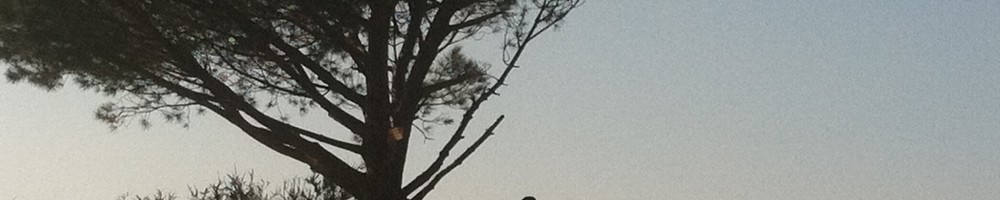
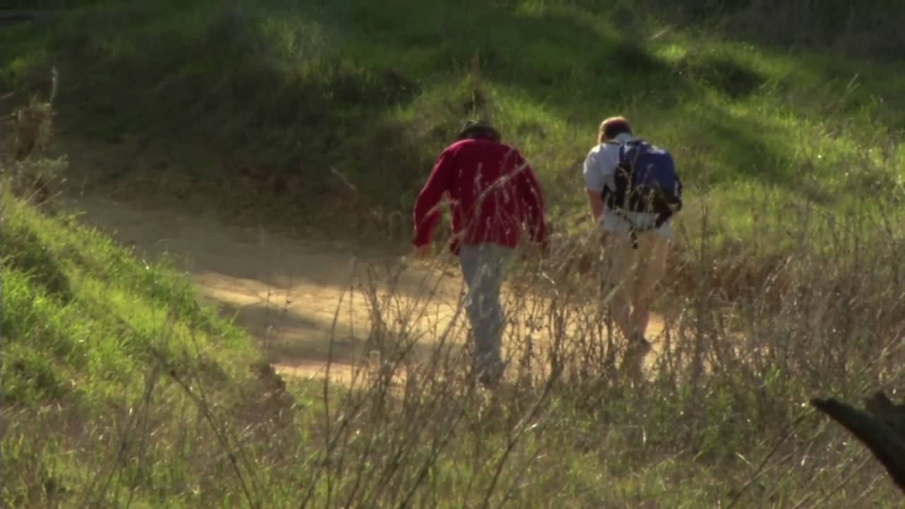
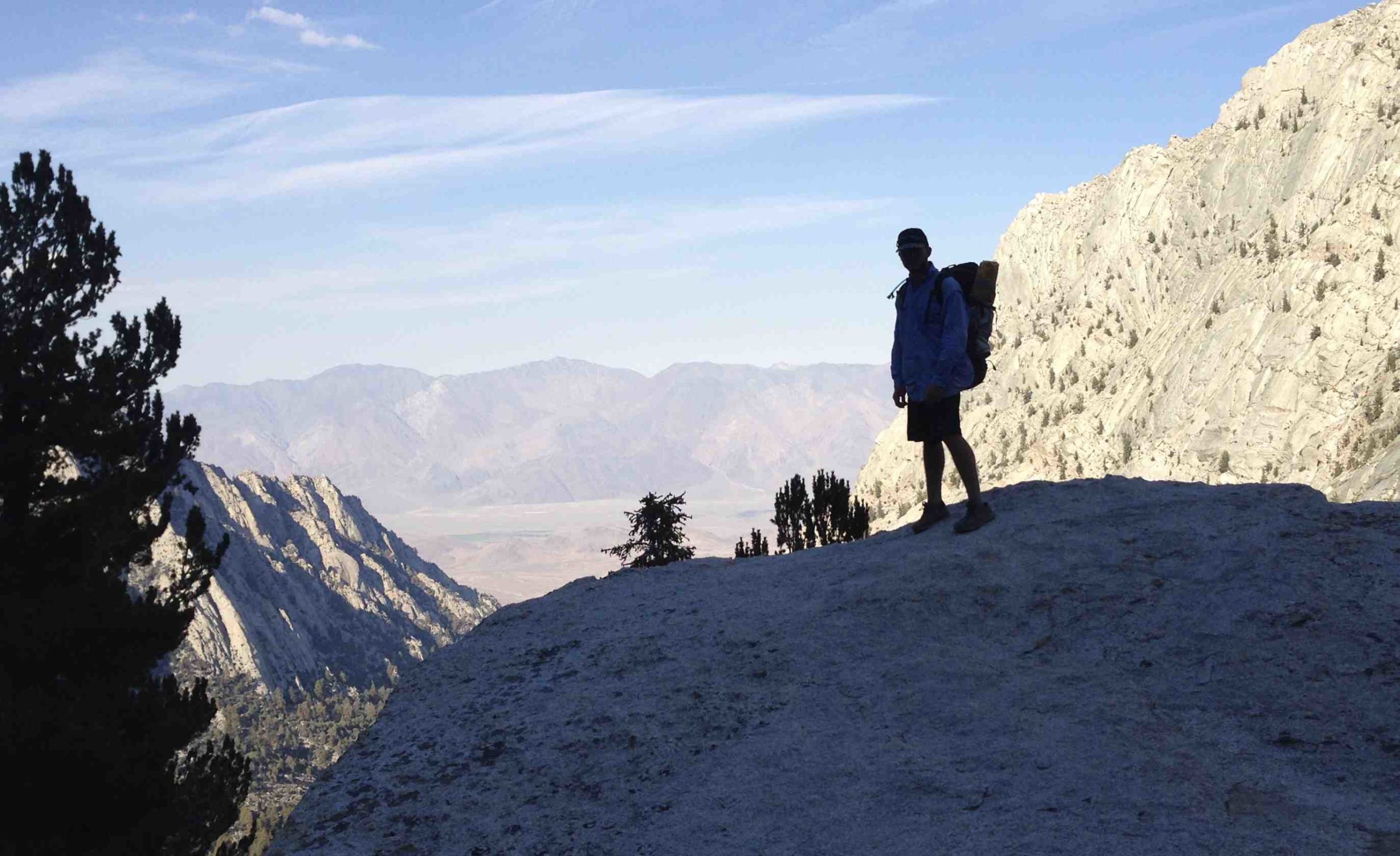
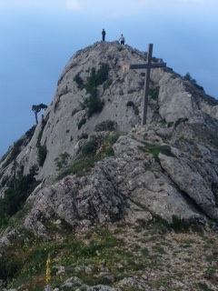
Wonder View Trail leads to the 1,820-foot summit of Cahuenga Peak, high point of the Hollywood Hills. The narrow and steep path (a true hiker’s route) continues to nearby Mt. Lee, which hosts the famed HOLLYWOOD Sign.
This trail is sure to become increasingly traveled with the recent closure of the Beachwood Dive trailhead, for many years the most popular way to hike to the HOLLYWOOD Sign.
Wonder View Trail: From Wonder View Drive to Cahuenga Peak is 2.4 miles round trip with 900-foot elevation gain; to Mt Lee is 3.2 miles round trip
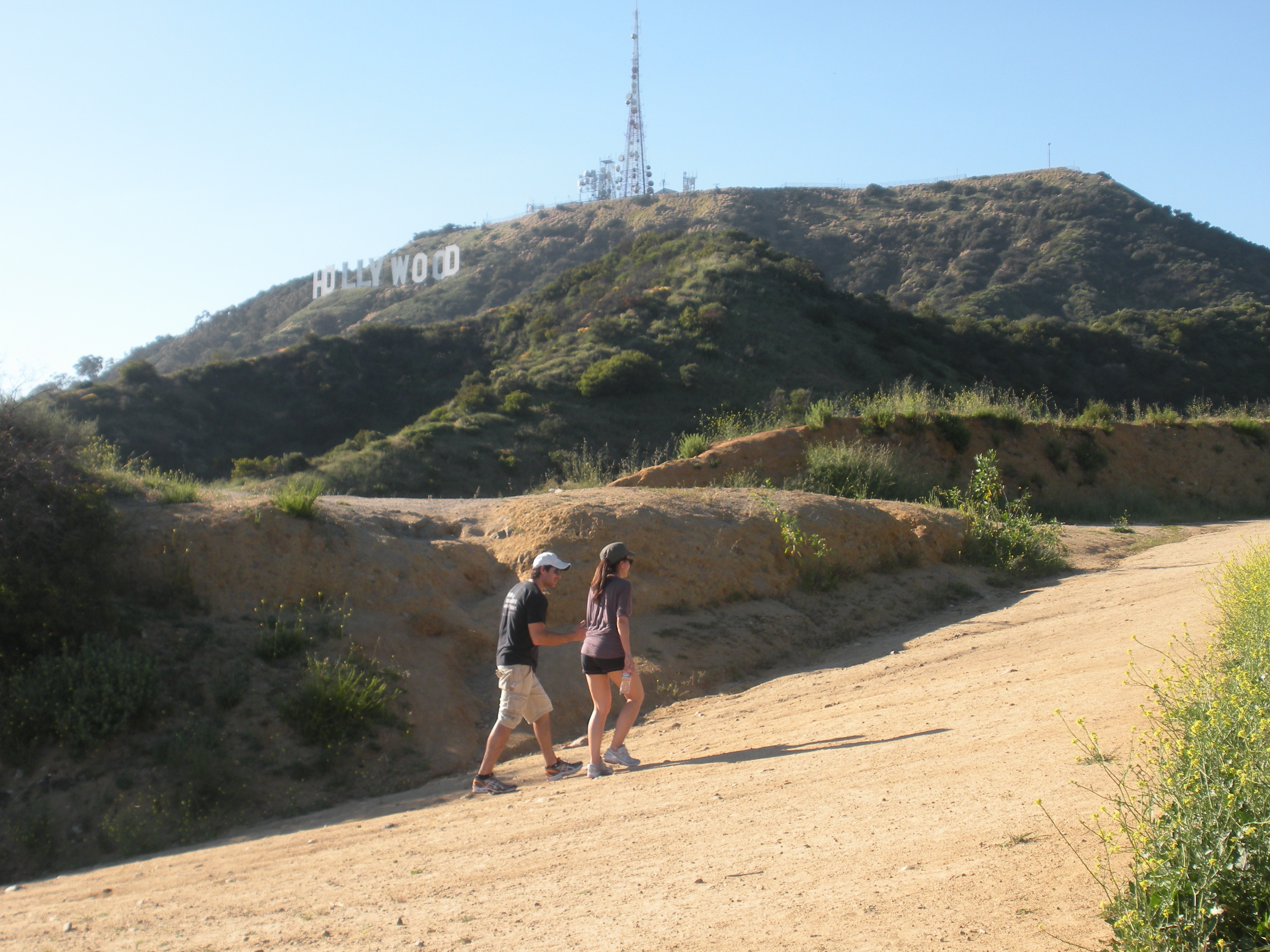
Visitors from across the nation and around the world take a hike to the famed Hollywood Sign.
In 2010, hikers and movie fans from across the nation and around the world were delighted to learn that creative conservation efforts, combined with fundraising from private and public sectors, succeeded in purchasing the peak and adding it to Griffith Park.
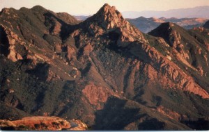
As the story goes, Cahuenga Peak piqued the interest of aircraft mogul (and movie producer) Howard Hughes, who purchased it in the 1930s with the intention of building a mountaintop love nest for Ginger Rogers. She turned him down and the property remained undeveloped (a minor miracle in SoCal) until 2002 when a group of Chicago developers bought the land from the Hughes estate.
When the developers announced plans to subdivide the peak into luxury estates, local conservationists, film fans, and celebs rallied to “Save the Peak.” Some $12 million was raised to purchase the 138-acre site. Hollywood notables, including Steven Spielberg and Tom Hanks, plus the Tiffany & Company Foundation, Hugh Hefner and Aileen Getty contributed serious cash, as did state and local agencies.
As the story goes, Cahuenga, which names a pass, a peak and nowadays a boulevard was once a native Shoshone village located on the banks of the Los Angeles River near present-day Universal City. The peak is the 12th highest in the Santa Monica Mountains.
DIRECTIONS
From Highway 101 in North Hollywood, exit on Barham Boulevard and head north 0.3 mile. Turn right on Lake Hollywood Drive and continue 0.5 mile to intersect Wonder View Drive (which has no street parking). Park alongside Lake Hollywood Drive.
Cahuenga Peak by Mark Chumley (click to enlarge)
THE HIKE
Walk 0.25 mile up paved Wonder View Drive to its end. Hike past a yellow vehicle gate on dirt road 300 feet to unsigned Wonder View Trail on your right. Begin a steep eastward ascent east, zigzagging up the south slope of Cahuenga Peak. Enjoy wonderful views of Mt. Lee with its forest of antennae, Griffith Observatory, Mt. Hollywood and downtown L.A.
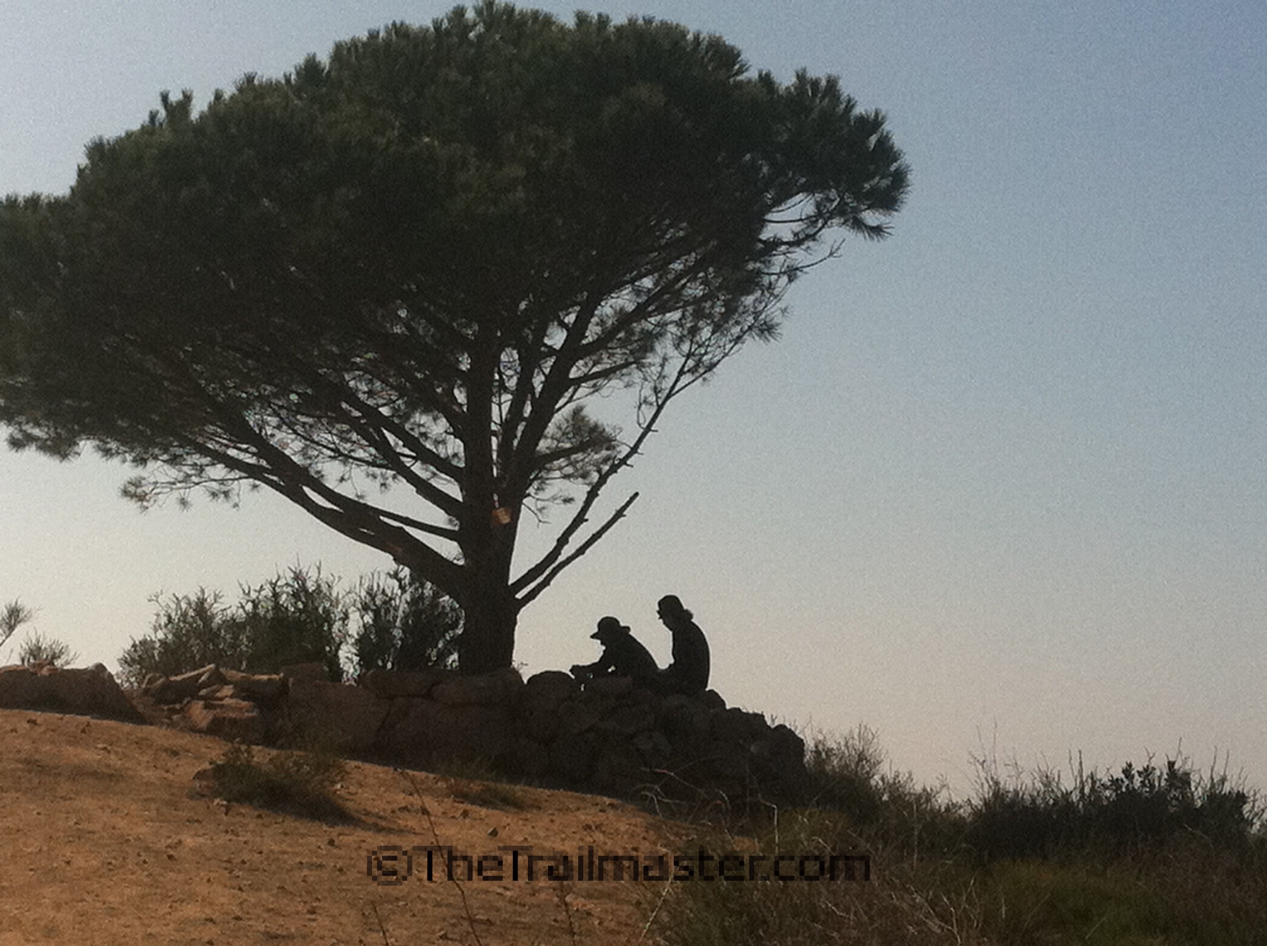
Walk to the Wisdom Tree in a less-traveled part of Griffith Park.
After a quite aggressive half-mile climb the rough trail gains a ridgeline and splits. A short side trail leads left to a lone pine tree and the top of Burbank Peak (1,690 feet). Pause to read the summit logbook stashed below the Wisdom Tree; hikers have been know to get very creative with their philosophizing in this book. Clear-day panoramic views are terrific—particularly angles on the San Fernando Valley and San Gabriel Mountains.
Return to Wonder View Trail and hike across a ridge. The path drops to a saddle between Cahuenga Peak and Mt. Lee (1,680 feet) and ends at Mount Lee Road. Turn right and walk up the paved road for a view through chain-link fence at the HOLLYWOOD Sign.
Hike on.
John McKinney
For more great hikes, check out my new guide, Hike Griffith Park & the Hollywood Hills.
Choosing a Difficulty Level for your hike is a key to wise hike planning. Easy? Moderate? Difficult? A trail’s degree of difficulty—also called its difficulty level or difficulty rating—can greatly vary hiking time. Good hike planning means choosing a hike for your abilities and for the amount of time you have to spend on the trail.
Park agencies and guidebook writers often assist hikers out by rating the degree of challenge a trail presents to the average hiker. Of course the “average” hiker varies widely as does the average hiker’s skills, experience and conditioning. No matter how skilled the trail-evaluator, “degree of difficulty” for a particular hike or trail is inevitably subjective.
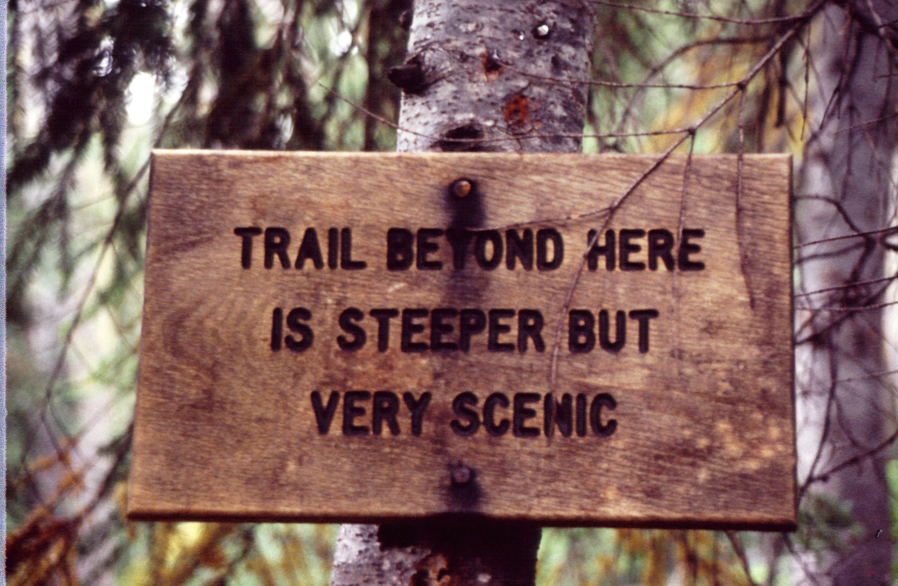
A more lyrical way to describe a hike’s difficulty level: “Trail Beyond Here is Steeper But Very Scenic”
A path’s elevation gain and loss, exposure to elements, steepness and the natural obstacles a hiker encounters along the way (boulder field, six creek crossings, etc.) figure prominently in the hike difficulty equation, too. High or low temperatures climatic conditions also influence a hike’s difficulty rating.
During my many years as the Los Angeles Times hiking columnist, I’ve rated hikes with a modified easy-moderate-difficult system.
My Hike Difficulty Level Rating:
Easy Less than 5 miles with an elevation gain of less than 700 to 800 feet. An easy day hike is suitable for beginners and children. Moderate 5 to 10 miles with less than 2,000 feet of elevation gain. You should be reasonably fit for these. Difficult 10 miles or more, and those with more than a 2,000-foot elevation gain.
U.S. Forest Service Difficulty Level Ranking:
The U.S. Forest Service uses a Level of Difficulty system that seem to rate the hiker as much as the hike:
Easiest A trail requiring limited skill with little challenge to travel. More difficult A trail requiring some skill and challenge to travel. Most difficult A trail requiring a high degree of skill and challenge to travel. Such a hike may be at high altitude, be extremely rugged or have a major elevation gain.
By all means, challenge yourself with a moderately difficult or difficult hike. In fact, in order to reach some scenic treasures by trail you might need to take a hike that’s a real “butt-kicker,” a term used by some hikers I know but rarely used on official hike difficulty ratings.
Choose the hike that’s right for you and hit the trail to fun and adventure.
Hike on.
John McKinney
P.S. No matter how difficult the hike is, you can always wear great gear. Check out our T-Shirts!
The idea of a hike for good health has been around a long time. From William Wordsworth’s poetry to the Boy Scout Hiking merit badge pamphlet, tramping through the countryside has long been considered a tonic for good health.
Millions of Americans who like to hike believe that hiking contributes to good physical and mental health. And yet, until recently, nearly all evidence offered for the benefits of taking a hike was anecdotal and very little hiking-specific scientific research supported that belief.
Austrian researchers conducted studies demonstrating that different types of hiking have different influences on the fats and sugars in the blood. For the study, one group hiked up a ski resort mountain in the Alps and descended by cable car, while the other group rode the cable car up, and hiked down. After two months of hiking, the groups switched hiking programs and repeated the experiment.
As expected, hiking uphill proved to be a great workout and provided measurable health benefits. Unexpectedly, researchers from the Vorarlberg Institute for Vascular Investigation and Treatment discovered that hiking downhill also has unique benefits.
Both uphill and downhill hiking reduced LDL (“bad”) cholesterol. Only hiking uphill reduced triglyceride levels. The study’s surprise finding was that hiking downhill was nearly twice as effective as uphill hiking at removing blood sugars and improving glucose tolerance. A second study of uphill/downhill hiking yielded similar results.
A study commissioned by Mind, a leading British mental health charity, suggests hiking contributes to improved mental and emotional health. Researchers from the University of Essex compared the benefits of hiking a trail through the woods and around a lake in a nature park vs. walking in an indoor shopping center on people affected by depression. They found that the hikers realized far greater benefits than the mall-walkers; in fact, taking a hike in the countryside reduces depression whereas walking in a shopping center increases depression.
Results from the 2007 study showed that 71 per cent reported decreased levels of depression after hiking while 22 percent of participants felt their depression increased after walking through an indoor shopping center. Ninety percent reported their self-esteem increased after the nature hike while 44 percent reported decreased self-esteem after walking around the shopping center. Eighty-eight percent of people reported improved mood after hiking while 44.5 per cent of people reported feeling in a worse mood after the shopping center walk.
The American Hiking Society, a Washington D.C. based nonprofit that promotes hiking, produces a widely circulated fact sheet, “Health Benefits of Hiking” that relies on studies, mostly of walking, made by the august American Diabetes, American Heart, and American Lung associations to make the case. Hiking-specific research is likely to be of more value in linking hiking and good health than the general “Exercise is Good for You” studies long used by AHS and other advocacy groups, hiking experts say.
Hike for Good Health Is Catching On
Whether or not the latest research is influencing public opinion, hiking for health appears to be an idea whose time has come. The message is on cereal boxes and granola bar wrappers and a popular subject in Prevention, and many other women’s and health magazines. Glamour.com and Self.com even feature a Hiking Activity Calculator. Enter your weight, duration of your hike, the kind of hiking you’re doing (backpacking, climbing hills, etc.) and learn how many calories you blast on the trail. And from the Devon Hiking Spa in Tucson, Arizona to the New Life Hiking Spa in Killington, Vermont, hiking spas are very popular these days with those who find combining hiking with all the usual health-resort activities makes for a stress-reducing, fitness building holiday.
I’ve long observed hikers routinely making the connections between nature, themselves and good health. We can be pleased that the researchers are making the same connections.
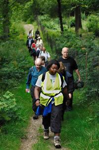
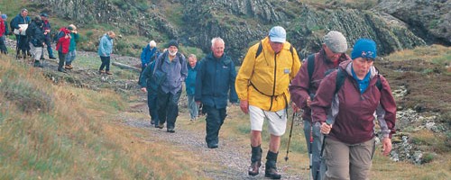
Hikers have a broad range of abilities, interests and enthusiasms. The company they choose to keep on the trail reflects that diversity. Hiking with companions has so much to offer.
If you’re accountable to someone other than yourself, you’re more apt to walk the walk. When you’re facing an early-morning start, weather that’s hot and humid or cold and rainy, general malaise or low spirits, having someone you can depend on-or who depends on you-makes a difference.
Making an appointment with someone to take a hike, keeps you accountable for actually doing the hike. All too often in our busy lives we give up what’s not critical to our work or family responsibilities, and cancel something like hiking with companions because it has no immediate benefit or practical purpose that we can see. (I understand this attitude-and have struggled with it myself. However I hope 25 years of my speaking out refutes the notion that there’s more to hiking than putting one foot in front of another.)
I’m convinced men and women are wired differently. Women can talk on the trail AND observe the scenery, while enjoying every moment of the hike. Women multitask, even on a hike.
Contrary to the teasing we get, men can walk and talk at the same time, though men also like to hike along in what I call companionable silence – together, yet a little separate, wordlessly enjoying the presence of another while simultaneously appreciating being alone with one’s own thoughts, too. Men without women have been known to go primal on the trail, enjoying the simple pleasures of sweating, scratching and burping…
Hiking with Companions: How to Choose
Finding a hiking companion means finding the right companion. Look first for a hiking companion toward your spouse, another family member or a friend. One presumes you have ready access to these individuals and have something in common with them. Time on the trail can enhance your relationships. Hiking offers a great opportunity to spend time with someone you care about.
Choose your companion carefully. Not every city friend is a good trail buddy. For truly happy trails, a good hiking companion should share the same fitness goals, pace, and nature appreciation orientation as you.
Hike on. John McKinney
P.S. Sometimes hiking with companions involves wearing matching (or coordinating) gear. Check out our great gear HERE
As a young adult I lived in the most urban section of the Santa Monica Mountains—the Hollywood Hills—and in one of the most rural parts—Topanga Canyon.
The home mountains are where I camped overnight with the scouts and learned to drive a car with a clutch. Later in life, the home mountains helped me unwind from the stresses of metropolitan life.
Going back to the 1980s, I’ve helped defend the home mountains from unwise developments, cheered supporters and chastised bureaucrats, celebrated new parklands and new trails. I even spent the greater part of a year mapping, promoting, and speaking out for the Backbone Trail, the 65-mile pathway that extends across the spine of the range.
All of which means I have a particular fondness for hiking the Santa Monica Mountains and delight in sharing my favorite trails. Wildflowers, waterfalls and wonderful scenery that’s been the backdrop for hundreds of movies and thousands of episodes of TV shows are highlights for hikers.
Spring wildflower blooms are impressive. A hike to Nicholas Flat might reveal wishbone bush, encelia, chia, Parry’s phacelia, ground-pink, scarlet bugler, goldfields… check out the “What’s Blooming?” section of the Santa Monica Mountains National Recreation Area website.
Sycamore Canyon Falls in Point Mugu State Park.
Trails lead by still waters—Nicholas Pond, Century Lake and Charmlee’s Old Reservoir—and by lively creeks in Sullivan Canyon, Malibu Canyon and Zuma Canyon. Behold surprising waterfalls in Temescal Canyon, Sycamore Canyon and La Jolla Canyon.
More movies and TV shows have been filmed in the Santa Monica Mountains than anywhere else in the world, and it’s lots of fun to hike to and through movie locations. Malibu Creek State Park, just to name one park, has served as Wales, Korea, Connecticut, and even the Planet of the Apes. Other park sites in the mountains have subbed for the Wild West, Italy, Switzerland, Asia, outer space, and a variety of fantasy locations. More than 500 productions a year take place in these mountains.
Because M*A*S*H, both the original movie and the long-running television series, was filmed here, and because what is now parkland used to be a movie ranch, Malibu Creek is the state park most associated with the film industry. Thou¬sands of visitors a year hike out to the original site of the M*A*S*H filming.
Superb trails lead through the Santa Monica Mountains.
We who love hiking in these mountains are forever grateful to Milt McAuley, who wrote trail guides and the classic Wildflowers of the Santa Monica Mountains.
“Come on an adventure, walk the trails,” urged McAuley, who hiked until shortly before his death at the age of 89. “Experience the beauty and friendship that is waiting for you.”
Bordered by two of the busiest freeways in the world—the Ventura and San Diego—they remain a near-wilderness. Within easy reach of 16 million people, they nevertheless offer solitude and plenty of silent places.
Geography
The Santa Monica Mountains is the only relatively undeveloped mountain range in the U.S. that bisects a major metropolitan area. The mountains extend from Griffith Park in the heart of Los Angeles to Point Mugu, 50 miles away. The range is 12 miles wide at its broadest point, and reaches an elevation of about 3,000 feet.
One of the few east-west trending ranges in the country, the Santa Monica Mountains can cause a little geographic confusion to the first-time visitor. Santa Monica Bay and the Malibu coastline also extend from east to west alongside the mountains so that the mountain explorer actually looks south to the ocean and heads west when hiking up-coast.
Natural Attractions
The mountains host a Mediterranean ecosystem, the only one in the country under National Park Service protection. Large stretches are open and natural, covered with chaparral and oak trees, bright in spring with wildflowers. Oak woodland and fern glens shade gentle seasonal creeks.
Largest areas of open space are in the western part of the mountains. Point Mugu State Park holds one of the finest native tall-grass prairies and one of the best sycamore groves in the state. The gorge sculpted by Malibu Creek is an unforgettable sight.
In the eastern portion of the mountains, open space is harder to come by, but those pockets that do exist are all the more valuable because they are so close to the metropolis. Canyons such as Los Liones, Caballero, Rustic and Sullivan are precious resources.
History
Ancestors of the Chumash Indians lived in the mountains as early as 7,000 years ago. Abundant food sources helped the Chumash become the largest Indian tribal group in California at the time of Juan Cabrillo’s arrival in 1542. The Chumash’s highly developed culture included oceangoing plank canoes called tomols and a system of astronomy that was both mystical and practical.
Spanish missionaries, soldiers and settlers displaced the Chumash. During the 19th century, the Santa Monicas were controlled by a few large land holdings—including Rancho Topanga-Malibu-Sequit—and used primarily for cattle ranching. As the land holdings were broken up, some ranchers supplemented their modest living by renting space to visiting horseback riders and vacationers.
Conservationists proposed Whitestone National Park in the 1930s and Toyon National Park in the 1960s, but it wasn’t until Will Rogers, Topanga, Malibu Creek and Point Mugu state parks were established in the late 1960s that the mountains received any substantial government protection. In 1978 the bill creating Santa Monica Mountains National Recreation Area was approved by Congress.
Administration
Some 70,000 acres of public land is preserved within the boundaries of the Santa Monica Mountains National Recreation Area. This represents about one-third of the 200,000 acres covered by the range.
The National Recreation Area is not one large area, but a patchwork of state, federal and county land, as well as private property still to be acquired. The major land stewards are California State Parks and the National Park Service.
For three decades the Santa Monica Mountains Conservancy, a state agency, has been particularly effective at acquiring parkland in the mountains. The Mountains Recreation and Conservation Authority manages and provides ranger services for parks that it owns and are owned by the Santa Monica Mountains Conservancy.
Hike smart, reconnect with nature and have a wonderful time on the trail. Hike on. –John McKinney
Interested in more hikes in the Santa Monica Mountains? Check out the “HIKE the Santa Monica Mountains Pocket Guide” at The Trailmaster Store.
Hiking improves mental health and is a “stress-buster,” a recent large-scale study suggests.
Researchers observed members of England’s Walking for Health program on the trail and found that group nature walks are linked with significantly lower depression, less perceived stress and enhanced mental health and well-being. Results of the study, conducted by the University of Michigan, in partnership with universities in England appear in a special issue of Ecopsychology devoted to ‘Ecopsychology and Public Health’.
England’s Walk for Health program boasts 70,000 active nature walkers. (courtesy Walk for Health)
Researchers evaluated about 2,000 participants from the Walking for Health program, an organization that helps conduct nearly 3,000 walks per week across England. Findings suggest nature walks are a powerful, if underutilized “stress buster.” Not only do such walks elevate mood, but they may also contribute to alleviating more serious conditions such as depression.
University of Michigan researchers have been working a long time in this field, particularly in the field of Attention Restoration Theory (ART), which posits that a walk in the woods helps re-focus the mind and revive the spirit. And England with its long embrace of the restorative value of walks in nature has always been on the forefront of recognizing how hiking improves move and relieves depression. I summarize the studies that show how hiking is good for you in my pocket guide, HIKE for Health and Fitness.
It was the very size of this latest study of Walking for Health program participants that caught my eye.
“We hear people say they feel better after a walk or going outside but there haven’t been many studies of this large size to support the conclusion that these behaviors actually improve your mental health and well-being,” says senior author of the study, Sara Warber, M.D., associate professor of family medicine at the University of Michigan Medical School and member of the Institute for Healthcare Policy and Innovation.
Proven Mental Health Improvements
Turns out time on the nature trail is especially beneficial for people who had recently experienced such stressful life events such as marital troubles, a serious illness or unemployment. Those under high stress especially saw a mood boost after their walks with companions in the great outdoors.
“Group walks in local natural environments may make a potentially important contribution to public health and be beneficial in helping people cope with stress and experience improved emotions,” adds Dr. Warber.
Given the increase in mental health challenges and physical inactivity in the modern world, a walk in nature might be just what the doctor ordered. And now science confirms common sense: Taking a hike is an enjoyable and accessible way for people to improve their physical and mental wellbeing.
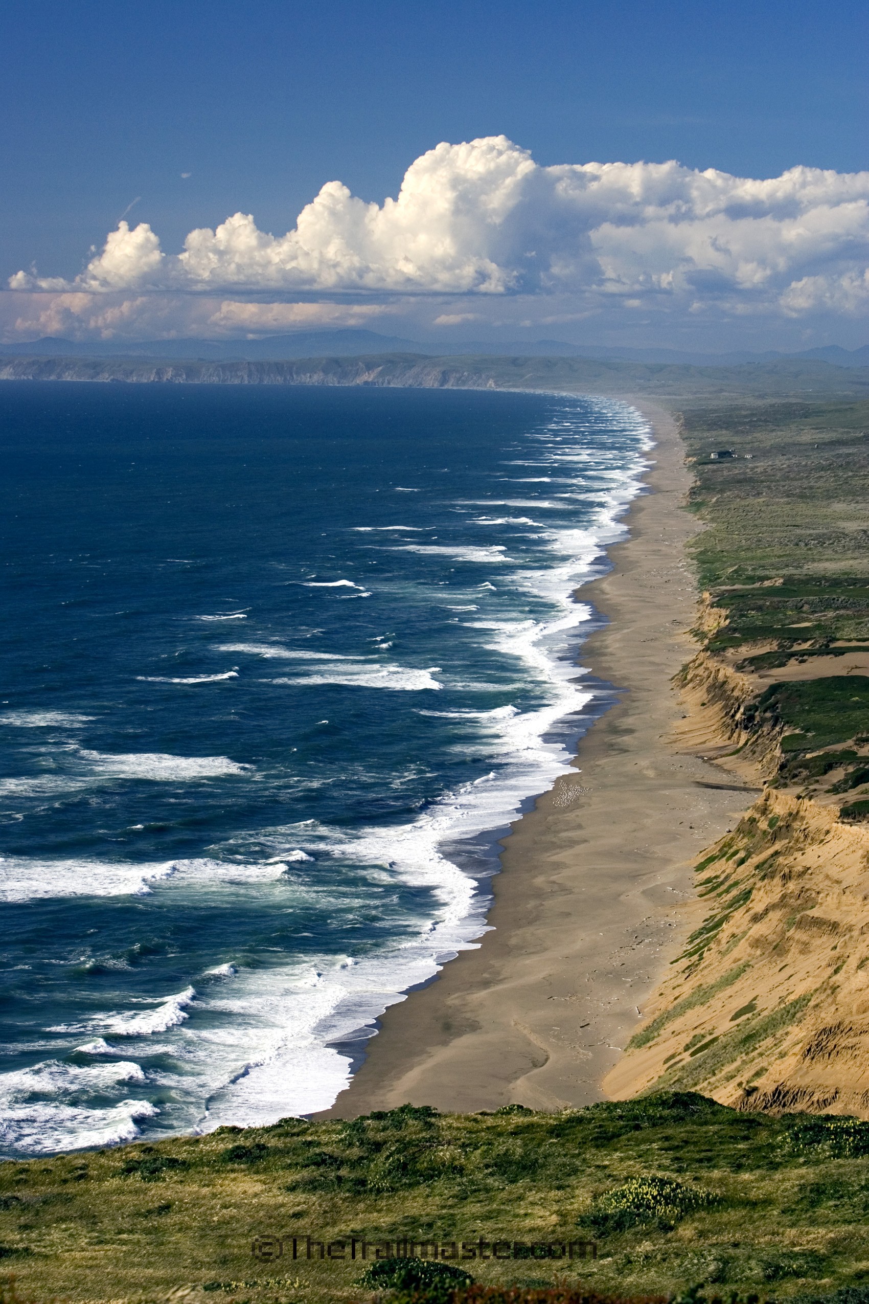
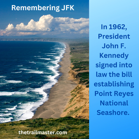
With densely forested ridges, wild and open coastal bluffs, and deserted beaches, Point Reyes National Seashore is an unforgettable place to ramble.
I’ve liked hiking Point Reyes ever since I discovered it back during my college days, but I really grew extra fond of it when I led week-long hiking adventures around the peninsula during the first decade of the 21st century. Sometimes when you have the experience of leading others along favorite trails, you learn to admire a place all the more.
Point Reyes, a haven for birds, heaven for hikers.
I usually had about a dozen hikers with me, walkers from across the nation as well as from Europe, clients of an upscale British walking vacation company. We walked the Rift Zone Trail to the back door of Point Reyes Seashore Lodge, our “base camp,” then set out on each day to discover more of the many wonders of the peninsula: Bear Valley, Arch Rock, Mt. Wittenberg, Abbotts Lagoon, Chimney Rock, Point Reyes Lighthouse, Hearts Desire Beach, Tomales Bay and Tomales Point.
My English friends say that with its moors, weirs, glens, and vales, Point Reyes Peninsula calls to mind the seacoast of Great Britain. California coast chauvinist that I am, I usually come back at them by saying that when I’ve hiked the Shetland Islands or wandered the Devon Coast, these landforms have reminded me of favorite landscapes in Point Reyes National Seashore.
I delight in the whole Point Reyes experience: kayaking Tomales Bay, cycling the back roads, camping, cheese-tasting, wildflower walks and lighthouse tours. I’ve hiked Point Reyes with friends, family and school children and everyone who ventures into this area seems to experience—and retain—some of the peninsula’s magic.
In hindsight, some conservationists believe that the drawn-out preservation process (a 30-year struggle) actually benefited Pt. Reyes because in the interim attitudes shifted a bit from parks-as-playgrounds to parks-as-nature preserves.
So few roads or recreation facilities were constructed here, and I say thank God for that. The area’s three tiny towns—Olema, Pt. Reyes Station, Inverness—have remained very small. San Franciscans have an altogether different attitude toward their wilderness-next-door than, say, Bostonians have toward summer-crowded Cape Cod National Seashore. BTW it was President John F. Kennedy who signed the legislation creating Point Reyes National Seashore in 1962.
Bear Valley is the busy hub of Pt. Reyes National Seashore, and there’s not a hotel or restaurant in sight. Lots of trails to hike, though. From the park visitor center about 40 miles of trail thread through the valley, and to the ridges and beaches beyond.
More than a hundred miles of trail meandering through the national seashore beckon the hiker to explore wide grasslands, Bishop pine and Douglas fir forest, chaparral-cloaked coastal ridges and windswept beaches. The paths range from easy beach walks and nature hikes to rugged mountain rambles. If you want to plan a backpacking trip, Point Reyes has four hike-in camps available by reservation.
And take it from someone who has walked the entire length of the California coast: the coastal trails in Point Reyes National Seashore are among the finest along the entire 1,600-mile California Coastal Trail.
Hike on. John McKinney
Interested in more Point Reyes hikes? Check out HIKE Point Reyes
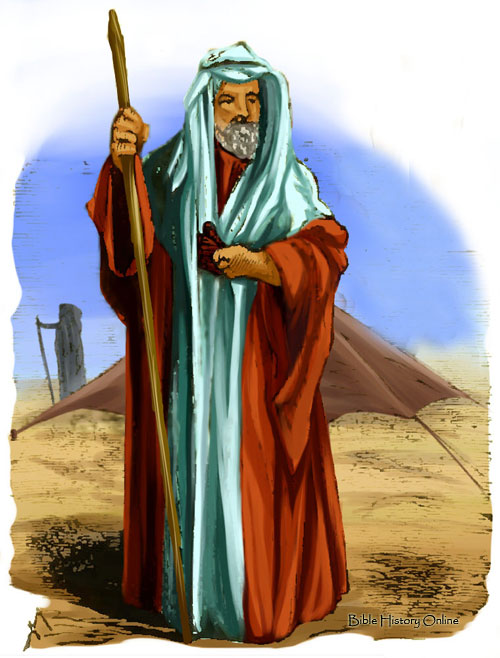
When Abraham was 99 years old, the Lord appeared before him and said: “I am God Almighty, walk before me and be blameless.”
Abraham continued his walk in every sense of the word well past the age of 100. (illustration Bible History online)
According to Genesis 17, the Lord assigned old Abraham some enormous tasks; he was to become the father of many nations and to take everlasting possession of the whole land of Canaan for himself and his descendants. Further, in order to keep covenant with the Lord he was to circumcise all the males in his household as well as all other males in the area.
Abraham complied with all of the Lord’s commands but was taken aback by one last request: Create a son with his wife Sarah.
At this point in the conversation the Bible reports: “Abraham fell face-down and laughed.”
“Will a son be born to a man a hundred years old?” asked Abraham when he pulled himself together. Then he remembered his wife—at 89 not exactly in her prime childbearing years. “Will Sarah bear a child at the age of 90?”
Virility and fertility proved not to be problems and a son was born a year later, as the Lord had promised. Abraham not only fathered Isaac, but founded the Jewish nation.
As Abraham demonstrates, there is old and there is old; that old adage “you’re only as old as you think,” has been proven time and time again since Abraham was born about 2166 B.C. Recent studies confirm that older walkers are far more fit and of far more cheerful disposition than their sedentary counterparts.
These older hikers in England’s Lake District aren’t about to hang up their boots. (photo touristnetuk.com)
Many older folks are wrongly convinced their need to walk diminishes with age, a survey conducted by the President’s Council on Physical Fitness reports. Many seniors are also apt to exaggerate the dangers of walking and their inability to walk.
Walking is a way for seniors to stay out in the world. To best resist the many paralyzing effects old age, seniors would be wise to combine the body, the mind and the heart—keeping all vigorous by continuing to walk, to learn, and to love.
Almost anyone at any age can walk—and will feel better for it. At God’s request, Abraham began walking among his people, among the lovely oak grove of Mamre, and across the desert plains of the Holy Land. Abraham, who did not receive God’s call to walk until he was 99, lived to the ripe old age of 175.
Walk until you’re 99—or older!
Footnotes
* Who are the oldest walkers you know? Why do they walk? What puts a spring in their step?
* Early sport-walker Edward Payson, at 22 years of age, caught the nation’s attention when he race-walked from Boston to Washington, D.C. to the presidential inauguration of Abraham Lincoln. More remarkably, he was still walking fast some 50 years later; when he was 71, he walked from New York to San Francisco in 105 days.
During a long tenure as the Los Angeles Times hiking columnist, my weekly column, titled “Hiking” was published in three different sections of the newspaper: first, in View (California lifestyle) on Thursdays; next, Calendar (what’s happening around town) on Fridays; and finally, Travel on Sundays.
Is Hiking a Sport?
Over the years editors of all these sections of the paper explained why hiking could fit into their particular purview: readers want to get out into nature.
One Los Angeles Times editor, though, was dead certain he didn’t want Hiking in his section.
“No way is hiking a sport,” longtime Times Sports editor Bill Dwyre told me. “A sport has to have competition.”
I was thinking fondly of Bill Dwyre, who recently retired after writing a three-times-weekly sports column for the Los Angeles Times since 2006. I enjoyed his columns–even if Dwyre did not consider hiking a “real sport.”
Doubtless most sports writers and sportscasters, along with most fans of the major sports, would agree with the old school sports columnist, though the word “competition” is nowhere to be found in the dictionary definition of sport. In fact, with sport usually defined as “any activity that gives enjoyment or recreation,” hiking is a sport according to Webster’s and other dictionaries.
Sport or not, admittedly, there’s little competition in hiking. Hikers sometimes race each other up a mountain. But that’s really trail-running, which is really running which, at its most competitive, is definitely a sport. Likely there are record-holders for completing various trails in the fewest number of hours or days, but neither hikers nor anyone else pays any attention to such feats.
So, is hiking a sport?
Recently one of my jock-ish friends spelled out the difference between “real sports” and a recreation like hiking: “Sports take place on fields and courts and so on that are made by man; hiking is something you do way out there in nature.”
What happens when we hike with gratitude? Amazing things!
“God has two dwellings: one in heaven, and the other in a meek and thankful heart,” declared Izaak Walton, the 17th century English writer now regarded as the “patron saint of fishing.”
Hike with gratitude and count your blessings–in Izaak Walton\’s England or wherever you roam
Walton’s walks by the river Dove and along the banks of many other brooks and ponds, inspired him to write “The Compleat Angler,” still regarded as the greatest book ever about fishing. His book combines practical advice on the art of angling with some highly moral and spiritual passages. Walton’s gratitude for God’s gifts, the beauties of pastoral England and the companionship of his fellows shines right through in his book, as admired now as it was when published in 1653.
“Nobody expresses their gratitude about anything or thanks me,” you say. Likely as not, you’re probably right. Try to remember the last time anyone thanked you for anything. It was probably a “Thanks-and-have-a-nice-day,” at the check-out counter from a supermarket cashier or a “Thanks for your order,” from a fast-food franchise. Such gratitude!
Now try to remember the last time anyone thanked you for anything important. It’s a dispiriting cycle: we rarely get thanks, and we rarely give it. Even those of us who try hard not to be thoughtless are often thankless–except perhaps for the one hour a week we spend inside our house of worship.
Action Item: Hike with Gratitude
My suggestion: On one walk—better yet one hike—a week use a few minutes of your time to exercise your gratitude while you stretch your limbs. List everything in your life that you are thankful for, and everything that you enjoy. Contemplate this list on your hike.
Warning: this exercise in gratitude might require considerable spiritual effort, may stretch, to the point of strain, a rarely used muscle. Expressing thanks might seem ever-so-saccharine; to the most curmudgeonly among us, it might elicit a gag response.
And yet hiking with an attitude of gratitude takes us someplace special. The way it helps us is by bringing our life into balance. Just as hiking integrates the body and mind, expressing gratitude integrates what’s all right with our world with what’s wrong.
Giving thanks brings our life into harmony. No wonder scripture, such as this passage from Psalm 92, often describes gratitude toward God as “singing praises.”
We can be thankful for possessions and money and yet for the freedom to walk the whole earth, and for the great benefits of our creative spirit, our life and health, we consider ourselves under no obligation to express any gratitude.
By expressing our gratitude, we can hike from feeling stressed to feeling blessed. A grateful thought toward heaven is the simplest of prayers.
A trail sign is a board or a post of wood, metal or some kind of synthetic material that displays written, pictorial or symbolic information about the trail and/or the surrounding area.
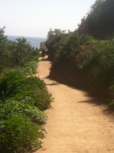
Follow the Backbone Trail to Sandstone Peak, high point of the Santa Monica Mountains.
A good trail sign boosts a hiker’s safety and peace of mind. An unclear or misleading sign can stress, mislead, even endanger a hiker. A bad sign is worse than no sign at all.
To most hikers, a sign is a sign is a sign, but others in the field-trail builders, park designers, pathway policy wonks-distinguish among five different kinds of signs, each having a distinct purpose.
Types of Trail Signs
Directional Signs help the hiker navigate from Point A to Point B. They provide the names of points-of-interest or destinations, as well as the mileage to those destinations. The way mileage is expressed varies by park agency and geography.
Older signs tend to express mileage in fractions (Deer Meadow 2 ¼) while newer ones use decimals and tenths (Deer Meadow 2.2). When fractions are used, quarter-mile increments are usually the smallest trail measurement, though occasionally eighths and even tenths are used. When trail distances are expressed with decimals, the smallest measure is usually 0.1 (one-tenth of a mile), though a few signs use one-hundredth of a mile increment (Deer Meadow 2.25).
Cautionary Signs warn of potential trail hazards such as poison ivy, bears or errant golf balls.
Regulatory Signs are the do-this and don’t-do-that placards that encourage certain behaviors (Obtain Wilderness Permit) and discourage others (No Bicycle Riding).
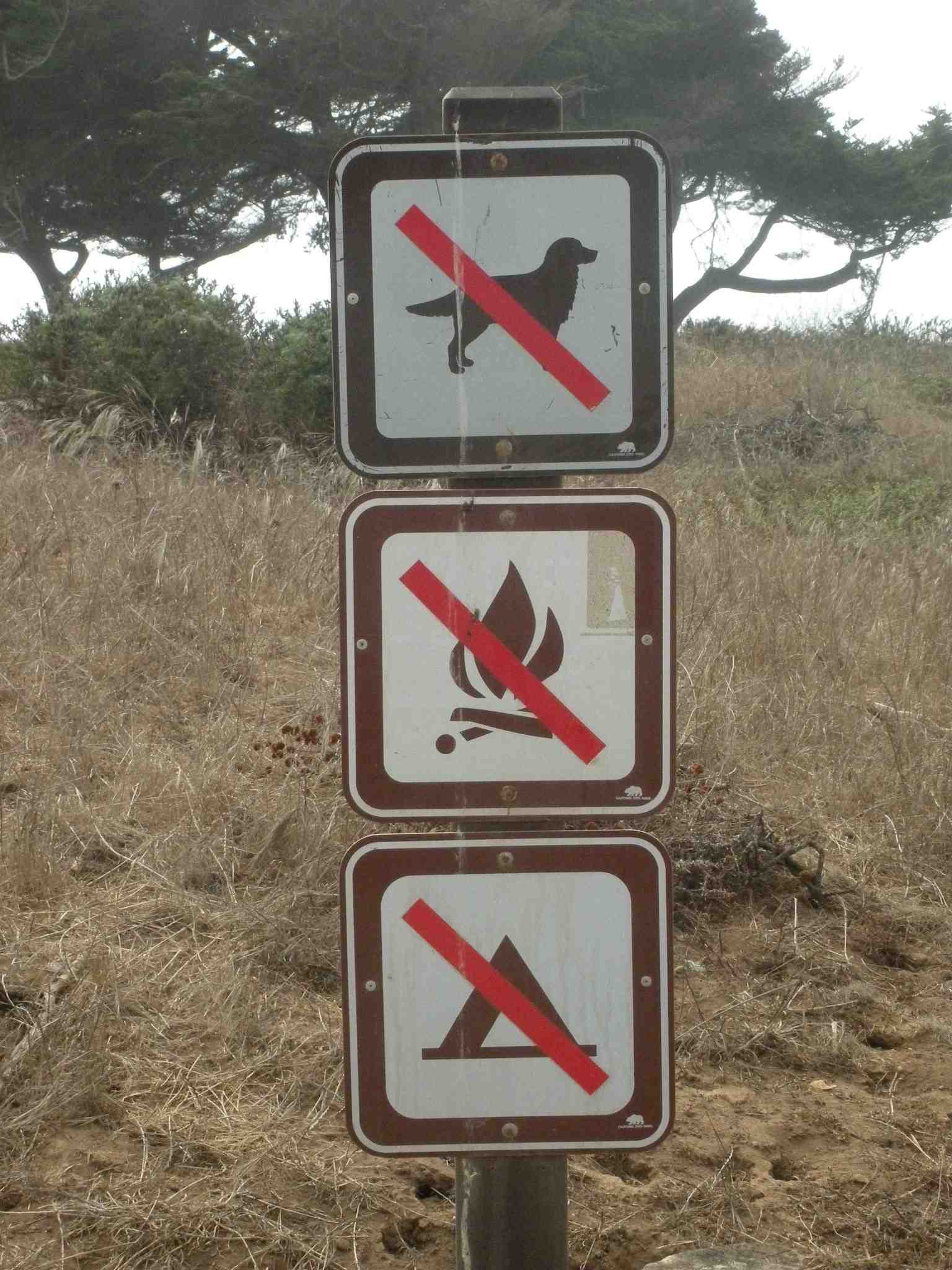
Trail Sign with a Trio of “Nos”: no dogs, no campfires, no camping.
Objective Signs give information about trail conditions (Trail not Maintained) including the type of trail surface or warn about obstacles (Bridge Out, 1.5 miles).
Cosmic Signs are definitely not yet acknowledged by park official and sign-makers, but I’d like to see them added.
If, for example, lightning strikes a tree in front of you, that’s the universe telling you to get off the mountain. Cosmic Signs can also arise from cosmic thoughts and be put on signs, just like mileage markers. God, Mother Nature, great authors and poets often provide inspiration for cosmic signs.
Runyon Canyon in the Hollywood Hills is a great place to hike. And perhaps the most popular trail in L.A. By some estimates, 35 thousand people visit Runyon Canyon every week. The canyon was closed for fourth months in 2016 for repair of a water main and was greatly missed by L.A. hikers!
No Man’s Canyon was the earliest name given to the deep arroyo that nature sculpted in the Hollywood Hills. A century-and-a-half ago, it was the wild domain of birds and rabbits, coyotes and lizards.
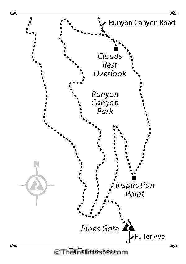
Runyon Canyon Trail: 2-mile loop with 500-foot elevation gain
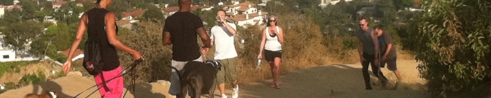
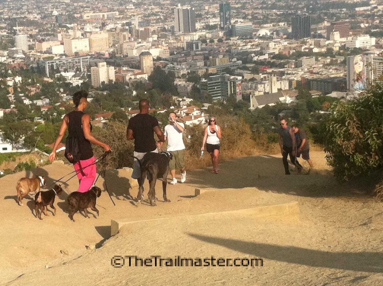
Runyon Canyon: Expect lots of two-legged and four-legged company on your hike.
Today Runyon Canyon Park is a great relief from the din of the city and a peaceful contrast to the hustle and bustle of nearby Hollywood and Sunset Boulevards. The canyon is an extremely popular place to run, hike and walk the dog—and it’s quite the social scene!
At day’s end, hundreds hit the trails and many of these after-work exercisers bring dogs. Count on lots of paws on the pathways and watch where you step.
Runyon Canyon’s unusual group of owners began with “Greek George” Caralambo, who in 1867 received title to it as a reward for his service as leader of the Army Camel Corps. Coal magnate Carmen Runyon bought the canyon in 1919 and built a hunting lodge.
Actor/singer John McCormick (hit movie, “Song of My Heart”) purchased the canyon in 1929 and built a mansion called San Patrizio. Wallace Beery, John Barrymore and Basil Rathbone were frequent guests. In 1942, millionaire arts patron Huntington Hartford bought the estate and renamed it “The Pines.” Hartford commissioned Frank Lloyd Wright to draw up plans for a futuristic resort hotel, art gallery and theater but was unable to build Huntington Hartford Play Resort.
In 1964, Kahlua importer Jules Berman purchased Runyon Canyon, razed San Patrizio mansion and tried to develop a subdivision of luxury homes. Homeowner groups fought Berman’s development plans and those of a later owner, Iranian exile Mana Vasir. Finally in 1984, the City of Los Angeles purchased Runyon Canyon and created a park.
DIRECTIONS
From the Hollywood Freeway in Hollywood, exit on Highland Avenue and head south past the Hollywood Bowl to Franklin Avenue. Turn west on Franklin and drive 0.3 mile to Fuller Avenue. Turn right and proceed a short distance to road’s end at The Pines entrance gate to Runyon Park. Street parking is where you find it.
Runyon Canyon (South) Map by Mark Chumley (click to enlarge)
THE HIKE
From the wrought-iron gate, enter Runyon Canyon Park and angle left at the first opportunity. Curve along the park’s south boundary to a second junction. Note the left fork trail (excellent longer hike option) and instead join the asphalt road ascending along the west canyon wall and begin a clockwise tour.
Ascend north amidst chaparral and bend east to a junction. (Runyan Canyon Road continues north to Mulholland Drive. See hike description.) Bend right on the dirt road and soon reach Clouds Rest Overlook, offering great clear-day vistas.
Bear right on the narrow dirt road and descend along the steeply pitched east wall of the canyon. The trail, too, gets quite steep as it descends to Inspiration Point for great views of Hollywood, and drops to the canyon floor. Walk the canyon bottom back to the trailhead.
Let us now acknowledge trail builders, of this generation, generations past and generations to come. Not all hikers appreciate the trail at their feet—but to my way of thinking, they should. Trails are a thing of beauty and a joy to behold, especially considering the time, effort, expense and, increasingly, the mastery of bureaucracy required to build one these days.
The trail-builder’s art—and it is an art as well as a science—is vastly under-appreciated, even by seasoned hikers.
Check out my video, excerpted from the pilot of “Hike On” a TV series about hiking The Trailmaster is developing for California public television:
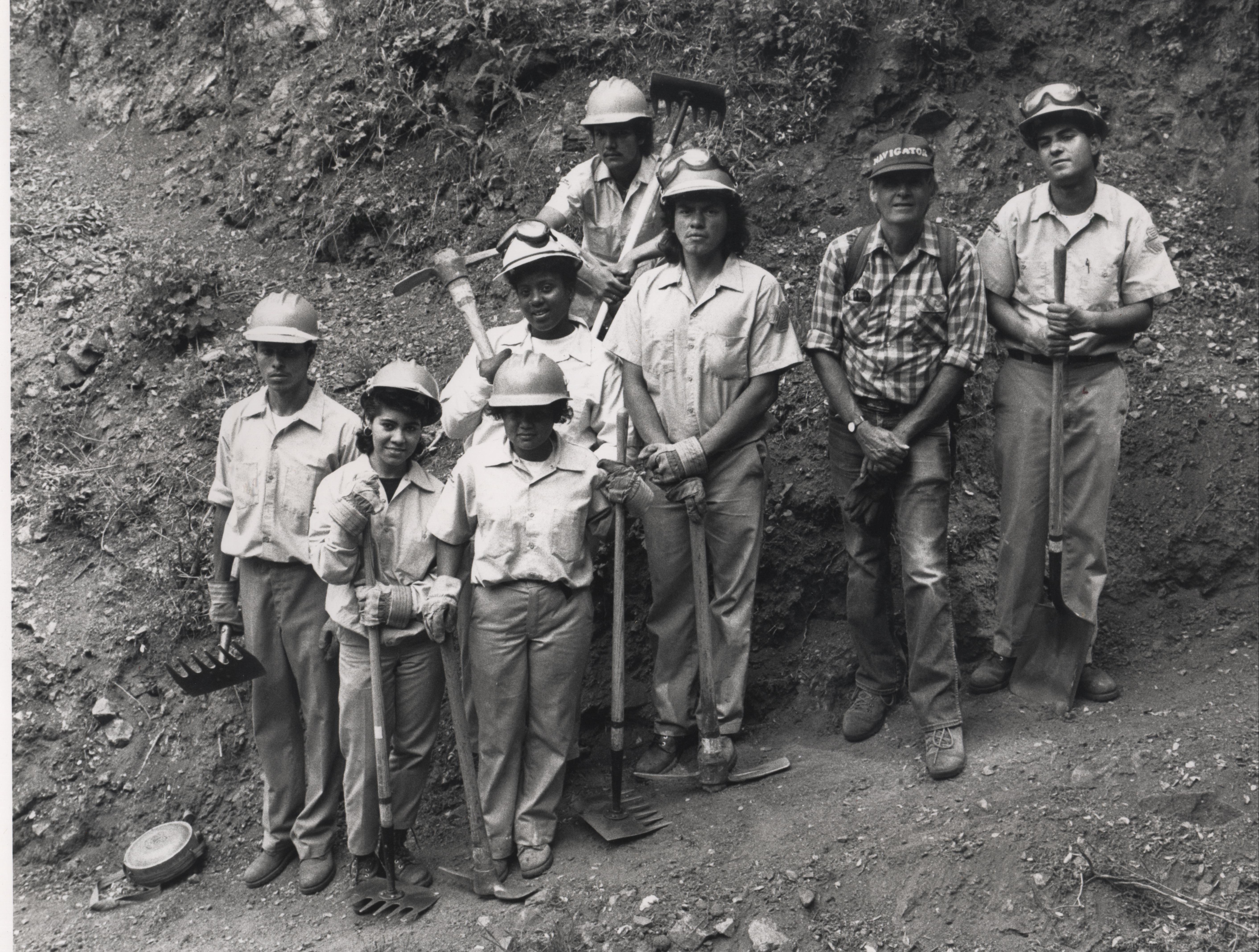
Trail builders themselves, most volunteer, some professional, are very special, dedicated people. I’ve watched trail builder Ron Webster practice his craft all over the mountains of Southern California for decades, and come to admire what he does, and the kind of dedication required, and the kind of person he is for making trail work a major part of his life’s work.
Master Trail Builder Ron Webster and his youthful trail crews worked on the Backbone and many other trails in the Santa Monica Mountains.
Webster brings solid contractual and people skills to the job, including the ability to do cost-breakdowns and construction estimates for trails, and to manage crews from a diversity of backgrounds. He’s good at working with trail crews composed of at-risk youth, at teaching young men and women to be part of a team, to take pride in their work and to master
I particularly admire how the master trail builder designs the route for a trail. After spending many, many hours on the slopes to be crossed by a new trail, Webster goes into what he calls “Alignment” in which he envisions the trail upon the mountain. It’s a combination of a Zen state and a construction blueprint.
Modern Trail Builders
Some modern day trail builders have a philosophic approach as they plan and construct the way. “A trail route is not a route from here to there. It is a place to reconnect,” states Robert Searns, founding owner of Urban Edges, Inc., a planning and development firm based in Denver, Colorado.
“In building trails, we need to think about the trail experience,” Searns explains. “What does the trail look like? What does it smell like, taste and sound like? Does the experience challenge the mind? Does it touch a chord that resonates the soul? A good trail will do that.”
I love a hand-built trail, one that goes easy on the land, one that seems almost as much a part of the geography as a streambed. A good trail is like a good guide, subtly pointing things out and picking the very best route from place to place.
Maybe it’s the outwardly stern image of the serious exercise-walker, striding with erect posture, a jabbing arm swing, and unsmiling face that suggests walkers can’t walk and laugh at the same time. Ha! A good laugh and a long walk are two terrific cures for what ails us; in tandem, they are doubly powerful.
Humor is a barrier-breaking, rapport-building, mood-elevating, healing and revealing exercise.
Like walking.
Hike on. With a sense of humor, of course.
Perhaps those who take the long walk through life a bit too seriously should consider that God most certainly has a sense of humor. God made the porcupine, the rhinoceros, the banana slug. And God made you.
I’ve always liked that description of the Almighty found in Psalm 2:4: “The one whose throne is in heaven sits laughing.”
Genesis records that when Sarah gave birth to a son at age 90, she said: “God has brought me laughter and everyone who hears about this will laugh with me.” She and her husband Abraham, then 100, named their son Isaac, which means he laughs.
An ancient Eastern Orthodox Church tradition relates that the raised-from-the-dead Lazarus laughed for years after Jesus commanded him to “Rise, take up your bed and walk.”
Ever since Norman Cousins’ landmark book, The Anatomy of an Illness, health professionals, as well as many ministers and rabbis, are rediscovering the healing power of humor. Research published in the Journal of the American Medical Association actually scientifically proved what Cousins and countless generations of anecdotal evidence had pointed out: laughter is useful in fighting serious illness.
How laughing improves our health
During a hearty laugh, the diaphragm, heart, lungs, thorax, abdomen, and even the liver and kidneys are given a gentle, even therapeutic, massage. Cousins calls laughter “Internal Jogging.” With all due respect to Cousins, who wrote his book in the 1970s at the height of the jogging boom, perhaps we should instead call laughter “Internal Walking.”
Walking, hiking and humor have one more use in common: each fights pain. Laughter, like walking, activates the human brain’s secretion of morphine-like molecules called endorphins, which in turn override pain, perk us up, and can give us “athlete’s high.” The retreat of pain is accompanied by an increase in mobility. So the more we walk and laugh, laugh and walk, the better we feel.
Only when faith falters, when heart and step are unsure, are we afraid to laugh in God’s presence. A person without a sense of humor is like a tender-footed walker, wincing at every pebble in the path.
Walk with laughter.
Footnotes
• What makes you laugh on a walk? What do you think would make you laugh?
• Want to make God laugh?
Tell him your plans.
Limerick Rut
By Madeleine Begun Kane
A woman was stuck in a rut.
She’d tripped, falling down on her butt.
She was wedged in so tight,
She might be there all night.
Seems its risky to text while you strut.
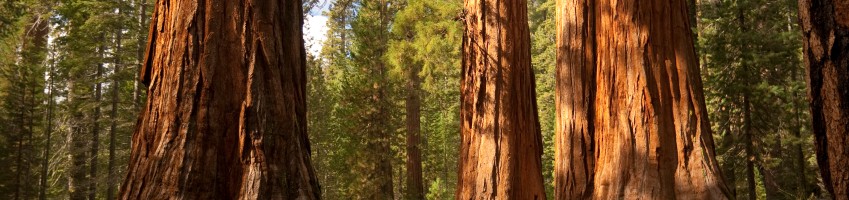
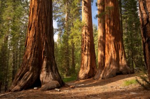
And take a hike in Sequoia and Kings Canyon National Parks.
If you only drive through you’ll be disappointed: Sequoia and Kings Canyon have the superlative scenery and postcard views found in the country’s most noted national parks, but you have to hike to find them.
Hike in the company of giants in Sequoia and Kings Canyon National Parks.
Naturally the groves of sequoia are the primary draw to both namesake Sequoia National Park and to Kings Canyon National Park. “Noblest of a noble race,” is how the great naturalist John Muir described the trees, biggest on earth, and the prime reason for the formation of the parks. General Sherman, standing 274 feet tall and measuring 36.5 feet in diameter at the base of its massive trunk, is the largest of the large trees.
Scenic 46-mile-long Generals Highway connects the national parks and offers access to the most popular sequoia groves, but auto travel is restricted to lower and middle elevations, so if you want to fully experience the park you need to hike into the Sierra Nevada high country.
Want to get away from it all? Famed High Sierra Trail extends east-west across Sequoia National Park. Nearly half of one of the great trails of the world—the 225-mile long John Muir Trail—extends through Sequoia and Kings Canyon national parks. By some accounts, a backpacker in Sequoia National Park can hike to a spot farther away from roads than anywhere else in the continental U.S.
Long-distance backpacking expeditions aren’t required to reach many of the alpine charms of Sequoia and Kings Canyon national parks. Where the road ends, an extensive trail system begins and many of the parks’ most compelling natural attractions—waterfalls, rivers, lakes, vista points and remote sequoia groves—can be reached by easy, moderate and all-day hikes.
You can choose from day hikes in what the National Park Service considers to be the five major regions of the parks: Giant Forest, Mineral King and the Foothills areas of Sequoia National Park plus the Grant Grove and Cedar Grove areas of Kings Canyon National Park.
The groves are great, but it’s possible to take many hikes in Sequoia and Kings Canyon national parks without sighting a single sequoia. Hillsides with chaparral and dotted with oaks aren’t exactly rare in California but the California Foothills ecosystem in the lower elevations around Ash Mountain in Sequoia National Park is the only one in the nation under National Park Service protection. Some foothill trails, including footpaths along forks of the Kaweah River, can be hiked all year around.
Mineral King, a gorgeous, avalanche-scoured valley ringed by rugged 12,000-foot peaks, is another area irresistible to hikers. Views from atop the Great Western Divide and the many lakes hidden in glacial cirques compel hikers to return summer after summer.
The hiking season for much of Sequoia and Kings Canyon national parks is a fairly short one. Middle elevations—5,000 to 9,000 feet—are often snow-covered from November through May. In Mineral King, and higher in the High Sierra, the season can be even shorter.
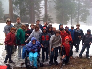
Kids love the big trees, even in spring when snow lingers in Sequoia National Park.
If you have only one day (promise yourself to return soon when you have more time!), drive from Grant Grove to Giant Forest or vice-versa and hike amidst the magnificent sequoia in each locale.
Ideally, the hiker needs at least three days to get a fair sampling of Sequoia and Kings Canyon National Parks. Take in the sequoia groves on the first day, on the second day, head for the high country (Lakes Trail is a good choice) and on the third day, take a hike in Mineral King.
Hikes in the parks are suited for a range of abilities: memorable family walks among the big trees, pleasant excursions to lakes and waterfalls, challenging hikes high into the Sierra Nevada.
More than one million visitors per year pass through the parks, and major trails are well-traveled during the summer, but I’ve rarely felt over¬whelmed by humanity when hiking in Sequoia and Kings Canyon national parks. Many hikers told me they have found quiet and tranquility on the trail to the park’s natural treasures—provided, of course, you avoid tourist-trafficked hot spots such as Moro Rock and General Sherman Tree.
When I hit the trail in Sequoia and Kings Canyon national parks, I feel as if I’m living large and hiking larger: the trees are huge, the mountains high, the canyons deep and the trail system is quite extensive—a well-maintained network of more than 800 miles. The parks offer hundreds of thousands of acres of untouched Sierra high country, of which more than 90 percent is designated wilderness. If you’re a hiker, that’s a dream come true.
Hike on.
John McKinney
Interested in more hikes in Sequoia and Kings Canyon? Check out my “HIKE Sequoia and Kings Canyon Pocket Guide” at The Trailmaster Store
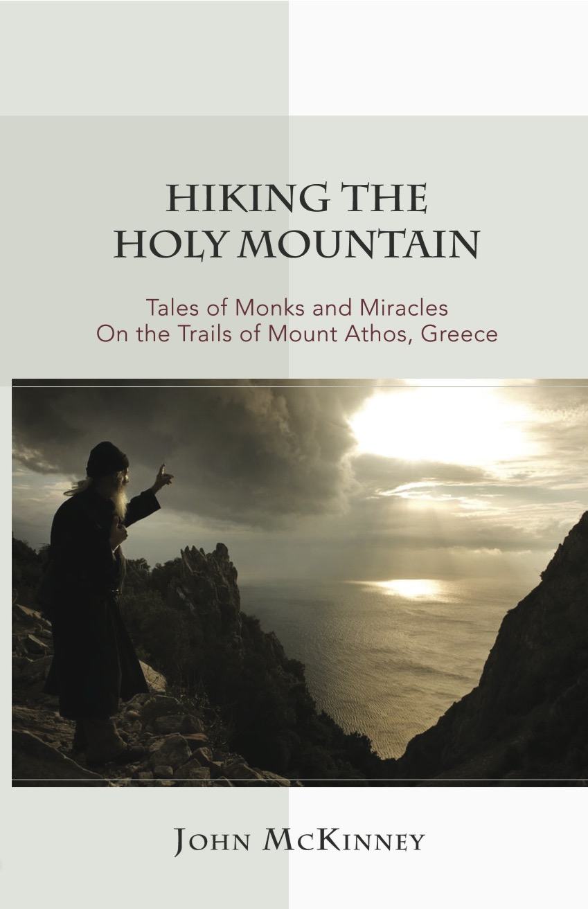
After authoring thirty books about hiking, I was compelled by extraordinary events to live through—then write about—an odyssey that took me to a remote monastery on Mt. Athos, Greece. My new book, “Hiking the Holy Mountain: Tales of Monks and Miracles on the Trails of Mount Athos, Greece,” tells the story of two treks around Mt. Athos, encounters with a colorful cast of Greek monks, and a series of miraculous events that took place on—and off—the Holy Mountain.
“Hiking the Holy Mountain: Tales of Monks and Miracles on the Trails of Mount Athos, Greece” by John McKinney
By turns glorious and hilarious, reverent and irreverent, “Hiking the Holy Mountain” narrates my progress and setbacks on the trail and within myself. My friend Spiro Deligiannis joined me on the journey and we were truly the hiking odd couple. Spiro was a tenderfoot, and I was an expert hiker. Spiro was a devout Greek Orthodox Christian and fluent in Greek, whereas my faith was shaky and my Greek was terrible. Spiro believed in the wonder-working powers of the saints and icons, while I was a skeptic who doubted all miracles.
As the Los Angeles Times hiking columnist, I had a professional purpose for my trip: to hike around the Holy Mountain and write newspaper and magazine stories about Mt. Athos, where no woman has set foot for a thousand years. What I encountered there was an epiphany that changed my life and a miracle that led to the adoption of my son.
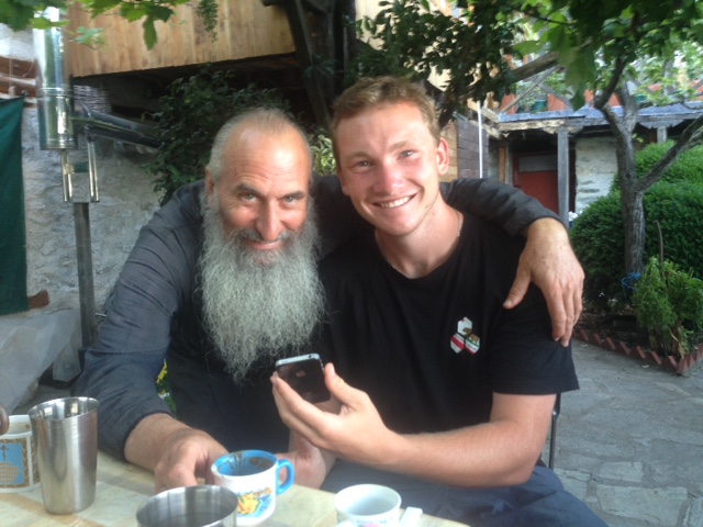
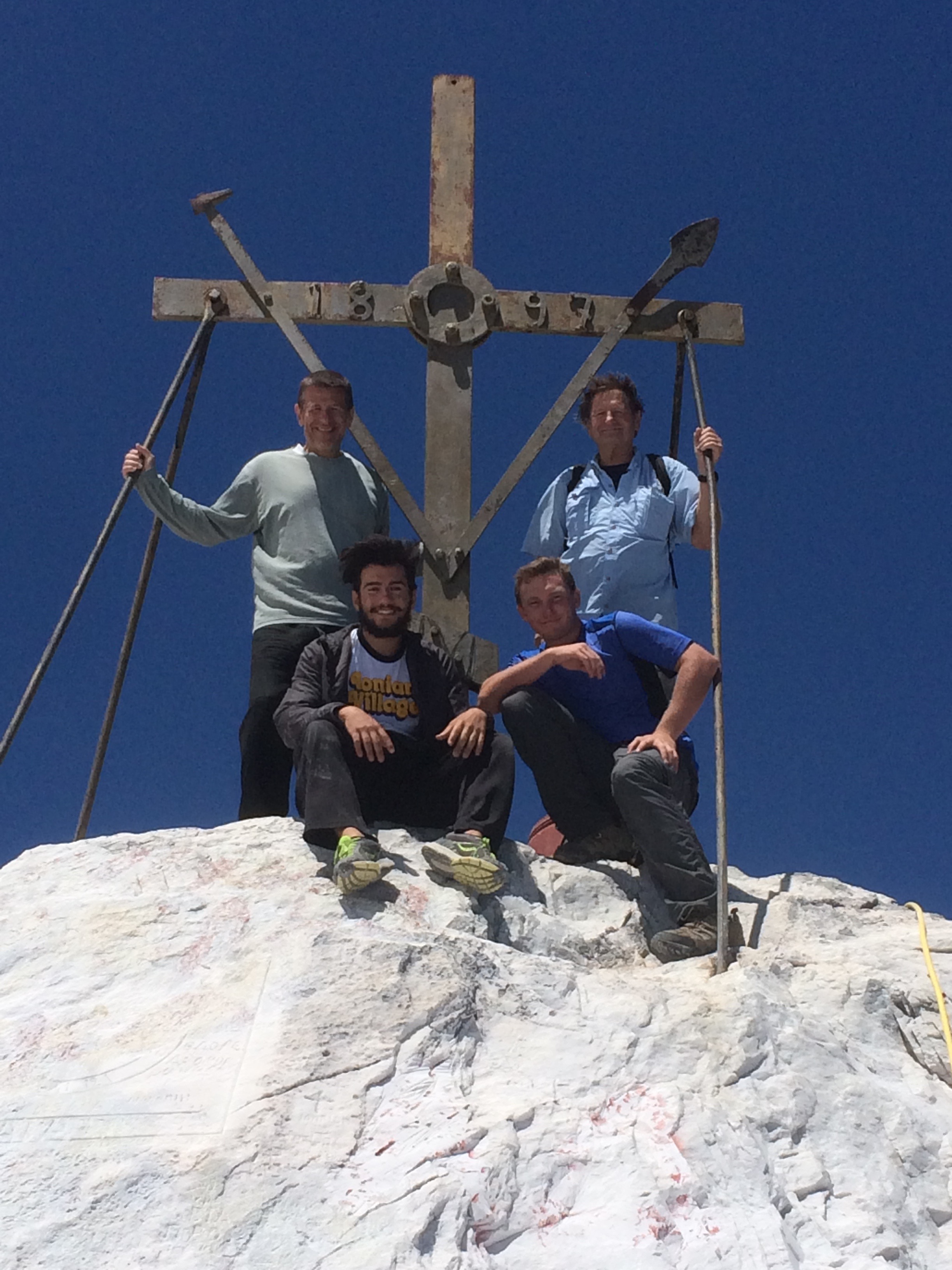
Twenty years after the first trip to the Holy Mountain, I made a second trip to Mount Athos with my son Daniel, who just graduated from high school. We traveled with Spiro Deligiannis (my trail buddy from the previous pilgrimage) and his godson Zachary Deligiannis.
“Hiking the Holy Mountain” was just released and I’m so pleased to be able to share this amazing true story with readers from across the country and around the world. Here are few photos from behind-the-scenes of “Hiking the Holy Mountain.”
Instant and Profound Connection: Father Daniel and Daniel
The story of “Hiking the Holy Mountain” began in 1994 when author John McKinney first hiked around Mount Athos.
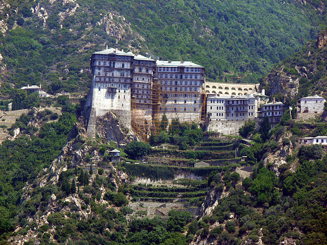
Simons Petras is literally built on a rock, quite the impressive sight for the approaching hiker.
Natural light and candle light illuminate the extraordinary churches on Mount Athos.
I’ve walked and written about more than ten thousand miles of trail, and I can attest that hiking up the Holy Mountain is surely the most spirit-stirring hike I’ve ever taken.
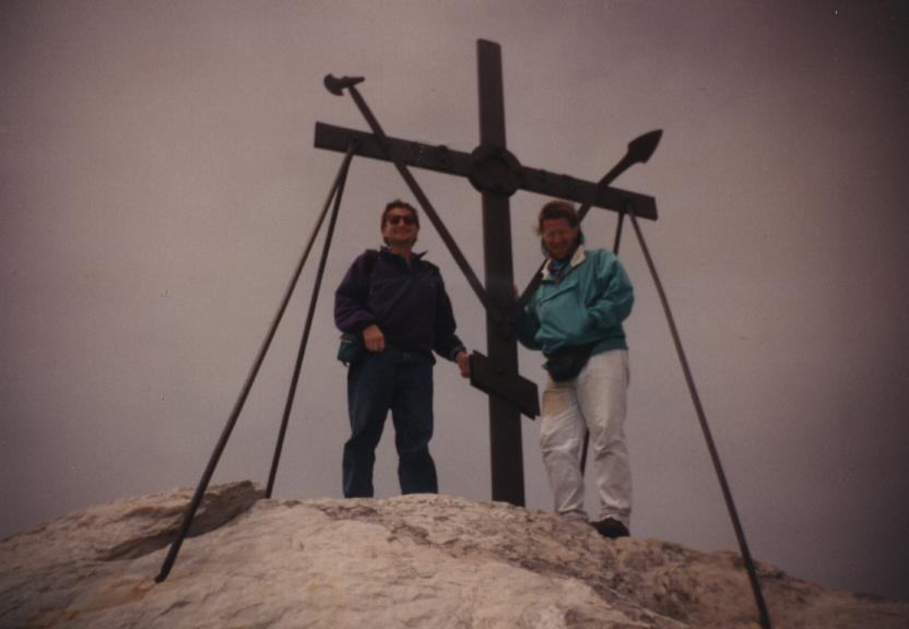
Atop Mt. Athos at last. Twenty years ago, Spiro and I hiked to the summit in a virtual white-out.
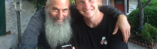
On my first hike of the Holy Mountain in 1994 I met Father Daniel, who makes icons of wood, and who would forever change my life.
Daniel appears heaven-sent in this photo. Indeed he was.
I feel so blessed for the opportunity to hike the Holy Mountain with my son Daniel, 18, who just graduated from high school.
This promontory by Panaghia Chapel offers hikers glorious views of the Mt Athos coastline.
Atop the Holy Mountain (L-R top) Spiro Deligiannis and John McKinney; Zach Deligiannis and Daniel McKinney.
Father Daniel graciously welcomed Daniel (L, holding the icon of the Prophet Daniel that Father Daniel made for him) along with John, Zachary and Spiro.
John McKinney, aka The Trailmaster, is the author of a thousand articles and 30 books about hiking, including Hiking on the Edge: Dreams, Schemes and 1600 Miles on the California Coastal Trail and Hiking the Holy Mountain: Tales of Monks and Miracles on the Trails of Mount Athos, Greece.
John McKinney, author and speaker
For 18 years, he wrote a weekly hiking column for the Los Angeles Times, and the intrepid Eagle Scout has hiked and enthusiastically described more then ten thousand miles of trail across California and around the U.S. A proud Californian, John is the only one to have visited and written about all 270 California State Parks and to solo-hike the entire length of the California Coast.
In an effort to encourage more hikers and would-be hikers to reconnect with nature and discover California’s best day hikes, John created The Trailmaster Best Day Hikes Series. “Every trail tells a story,” says John, whose books are known as much for their colorful tales as they are for their descriptions of trails.
An experienced public speaker, John shares his unique trail philosophy and the many mental, physical, and spiritual benefits of hiking with his inspiring Talks, “Take a Hike, Change Your Life” and “Hiking the Holy Mountain.”
A passionate advocate for hiking and our need to reconnect with nature, John McKinney shares his expertise on radio, TV, in print and online. He is currently in development with Hike On, a half-hour show about hiking for California public television.
Hiking the Holy Mountain a Talk by John McKinney (Keynote, adjustable length)
“We can’t thank you enough for your exceptional presentation. You inspired many with your experiences on Mount Athos, and stories of the miracle you received.”—Judie Christopoulos, President, Philoptochos Society, St. Sophia Greek Orthodox Cathedral
“The presentation by John McKinney on “Hiking the Holy Mountain” made to the Brothers of our local Chapter of AHEPA and subsequently to the parishioners of our St. Barbara Greek Orthodox Church was a beautiful and moving experience for all attendees. His book and talk wonderfully transforms doubt into faith.—Ernest Kolendrianos, MD, AHEPA Chapter 243
“Hiking the Holy Mountain” is John’s most popular talk. While the ‘plot’ and colorful cast of Greek monks in “Hiking the Holy Mountain” seem like they came from a movie script, this is very much a true story! Audiences love this tale of ancient traditions, modern-day faith and family.
“I was a reluctant pilgrim to say the least,” John admits. “But one thing I’ve learned from all my time on the trail is that on this amazing path we call life, we’re often compelled to change direction.”
“Hiking the Holy Mountain” is John’s most popular talk. Audiences love this inspiring tale of ancient traditions, modern-day faith and family.
John was compelled by extraordinary events to live through—then tell the story about—an odyssey that took him to a remote monastery on Mt. Athos, Greece. “Hiking the Holy Mountain” is the story of two treks around a monastic kingdom where no woman has set foot for a thousand years, encounters with a colorful cast of Greek monks, and a series of miraculous events that took place on—and off—the Holy Mountain. This spiritual adventure is one of the all-time best tales of adoption, a splendid hiking narrative, and a story of faith and family that will be long remembered.
By turns glorious and hilarious, reverent and irreverent, “Hiking the Holy Mountain” narrates John’s progress and setbacks on the trail and within himself. His friend Spiro joined him on the journey and they were truly the hiking odd couple. Spiro was a tenderfoot, and John was an expert hiker. Spiro was a devout Greek Orthodox Christian and fluent in Greek, whereas John’s faith was shaky and his Greek was terrible. Spiro believed in the wonder-working powers of the saints and icons, while John was a skeptic who doubted all miracles.
As the Los Angeles Times hiking columnist, John had a professional purpose for his first trip: to hike around the Holy Mountain and write newspaper and magazine stories about the trails and natural beauty of Mt. Athos. What he encountered there was an epiphany that changed his life and a miracle that led to the adoption of his son.
The drama builds with a return hike of the Holy Mountain eighteen years later, to introduce his son to the Holy Mountain, to the monk who foretold his arrival into the family, and to the saint who the monks believe granted John and his family the miracle that blessed their lives.
Contact John McKinney
Contact us by email (Cheri@TheTrailmaster.com) about John McKinney’s Hiking the Holy Mountain Talk or give us a call at 805-845-7102 to book John for your next event. Be sure to ask about copies of John McKinney’s new book: “Hiking the Holy Mountain: Tales of Monks and Miracles on the Trails of Mount Athos, Greece.”
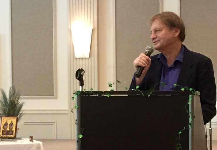
After his presentations, like this one at the St. Sophia Philoptochos, there’s time to talk one on one, and get autographed copies of John’s new book, “Hiking the Holy Mountain.”
Brothers and Sisters. From the time Adam and Eve were exiled from Paradise, humankind has mourned its lost relationship with the natural world.
Adam took a fall for us all. Never again would he or Eve or any of the billions of humans who followed them walk the Earth without sin against God, against one another, and against nature.
Adam’s fall corrupted nature. Adam’s fall corrupted human nature. Adam’s fall was the hiker’s fall.
Hikers fall. Rarely. Frequently. Softly. Seriously. All hikers eventually fall. And just as we fall when we are hiking in nature, we fall and we fall short in our care of nature.
Listen now to the cry of Creation.
Today we are more disconnected from nature than ever before. We chop down the great trees of the world—in the cold forests of the north, in the tropical rainforests, and in the woods near our homes. We foul streams and rivers, lakes and oceans. Every day another species of plant or animal is lost from earth for all time.
We want more than we need, and take more than we need from nature. We fail to moderate our desire for material things, which causes us to view nature as a commodity and merely as a collection of resources to be used as food and fuel. We refuse to acknowledge nature is more than the sum of its resources.
To reconnect with nature, reconnect with God, and remember that it’s you, not another, that is the cause of the despoiling of nature. The hiker’s contribution to halting the abuse of nature is for each of us individually to correct ourselves.
Begin the restoration of nature by restoring yourself.
Do not seek more control over the holy forests, the holy mountains, or the holy waters. Do not seek more control over other people.
Instead, control yourself. Learn from the monks: Take personal responsibility for your own thoughts and actions toward nature. Avoid blaming others for the abuse of nature, and do not hide behind broad excuses about corrupt politics, a perverted economy, and immoral humanity.
Begin the restoration of nature by restoring yourself. One fitting time for self-reflection is during Great Lent, which should be a period of repentance and reduced commercial activity. But no need to wait for Lent; bring a little bit of Lent on each hike. Give up blame. Set aside anger. Give thanks for God’s many blessings, for friends and family, and for the natural world around you.
Make nature the stuff of your prayers. Bring the tall mountain, roaring river, and singing bird into the sanctuary of your heart. An appreciation of the beauty and power of nature adds to appreciation of our Lord. When we are right with God, we will do right for nature.
Hike as children of light. Leave ego and arrogance at the trailhead and you shall see and hear nature in all its glory. In nature, find refuge from cities full of idols. In nature, find yourself. In nature, find the Holy Spirit or allow the Holy Spirit to find a way into your heart.
Blessed be the one who loves to hike and blessed be the one who hikes to love.
Remember the words from the Holy Mountain of St. Silvan the Athonite: “The heart that has learned to love, has pity for all creation.”
Love the red dawns, golden sunsets, and sky of many colors.
Love the still waters, burbling streams, and thundering waterfalls.
Love the ancient oaks, the cedars, and the palms.
Love the sandy beach, rocky shore, and tide pools.
Love the desert dunes, slot canyons, and badlands.
Love the lupine, the lilies, and the daffodils.
Love every day of God’s light. Love everything in nature, and you shall discover the heavenly mystery in all living things. And once you have discovered it, you will come to feel it more and more, as you hike mile after mile, and with each passing day and week and year of your life.
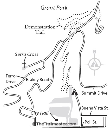
From City Hall to Grant Park Overlook is 2 miles round trip with 300-foot elevation gain
Finally, after 95 years, Ventura’s Grant Park has a hiking trail.
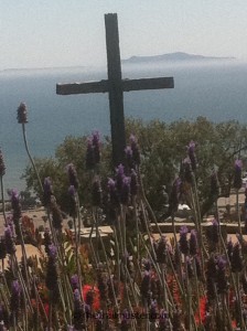
Before construction of the path, Grant Park’s primary attraction was Serra Cross honoring Father Junipero Serra, the Franciscan monk who founded Ventura Mission and many more in California. First erected in 1782 as a navigation aid for travelers bound for Buenaventura by land and sea, the cross crowning the summit of the park has often been renovated and replaced. This park was badly burned in the Thomas Fire; check with park authorities for the latest access information.
Serra Cross: spiritual uplift, romance and grand clear-day vistas.
The view from the cross is commanding: the Ventura coastline, Anacapa and Santa Cruz islands and the wide blue Pacific. And romantic, too. Generations of Venturans have exchanged wedding vows at Serra Cross.
Construction and funding of the hiking trail was spearheaded by promoters of a plan to create a botanical garden with an emphasis on flora of the Ventura coast. Backers of Ventura Botanical Garden envision plantings in five areas representing the world’s Mediterranean climates: Chile, Australia, The Mediterranean, South Africa and, of course, Ventura.
Beginning at Ventura’s century-old City Hall, the twisty trail ascends sage and cactus-dotted slopes. Venturans and visitors are oriented to the coast; the pathway may change that outlook and integrate the city’s hillside backdrop into public consciousness.
Businessman Kenneth Grant planned to build an observatory on his hilltop property but gave up on that plan and in 1918 donated 107 acres to the city of Buenaventura. Some proud Venturans envision transforming Ventura via Grant Park in the same way San Francisco was transformed by Golden Gate Park.
DIRECTIONS
From Highway 101 northbound, exit on California Street. Stay in the center lane, make a right and drive 3 blocks north. Turn right on Poli Street, then make an immediate left into the parking lot behind City Hall. (From Highway 101 southbound, exit on Ventura Avenue. Turn right on Thompson Boule¬vard, make a left on California Street and drive 3 blocks north. Turn right on Poli Street, then left into the parking lot behind City Hall.) Locate the trailhead in the upper parking lot.
Grant Park Map by Mark Chumley (click to enlarge)
THE HIKE
Begin the gentle grade with numerous switchbacks ascending slopes cloaked with the coastal sage community. Get better and better views as you climb. Lupine and other wildflowers dot the slopes in spring.
Get grand ocean vistas from a new trail that links Ventura City Hall with Grant Park and Serra Cross.
Trail-builders unearthed cobblestones used a century ago to form terraces for agriculture. They were possibly built by Chinese immigrants, who were restricted at the time from owning more level and tillable parcels. About 200 feet of stone wall was incorporated into the trail design.
The path ends at the park road. Go right 0.2 mile to a vista point. The 360-degree panorama includes mountains, metro Ventura, Ag-Land, Channel Islands and the wide blue Pacific. Turn left and walk 0.3 miles along the road to reach Serra Cross. Reach Serra Cross by trail by improvising a route via pathways paralleling the road.


 Going back to the 1980s, I’ve helped defend the home mountains from unwise developments, cheered supporters and chastised bureaucrats, celebrated new parklands and new trails. I even spent the greater part of a year mapping, promoting, and speaking out for the Backbone Trail, the 65-mile pathway that extends across the spine of the range.
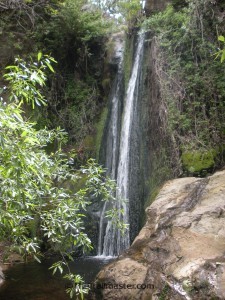


