HIKE California Coast

  • Crystal Cove State Park Bluffs

    Crystal Cove State Park Bluffs

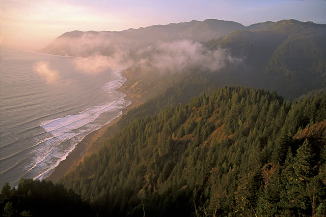
    Between the Pacific Coast Highway and the wide blue Pacific, and between Laguna Beach and Newport Beach, lie the beautiful blufftops of Crystal Cove State Park.

    Pathways lace Crystal Cove State Park bluffs
    Pathways lace Crystal Cove State Park bluffs

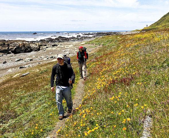
    A paved, multi-use path extends along most of the 3.2-mile length of the bluffs. Eight connector trails—dirt and paved ones as well as a boardwalk—invite the explorer to leave the main route and explore tide pools, rocky coves and sand strands and check such intriguingly named topography as Pelican Point and Little Treasure Cove.

    Be sure to visit the Crystal Cove Historical District. The funky wood-frame beach houses are in marked contrast to Newport Coast, the upscale community of luxury villas and custom homes arising on the inland side of the highway.

    The beach cottages, were acquired by State Parks when the Crystal Cove area was set aside as parkland. Three-dozen cottages have been renovated and readied for rental to vacationers.

    The beach at Crystal Cove attracts its share of surfers, swimmers and sun-bathers but still gives the feeling of being away from it all and by no means resembles one of SoCal’s mass use sandlots.

    Crystal Cove Beach as viewed from the deck of Ruby's Shake Shack
    Crystal Cove Beach as viewed from the deck of Ruby’s Shake Shack

    Park boundaries extend beyond the tideline A portion of Crystal Cove’s waters are protected in an underwater park, which attracts divers. Local conservationists planted kelp to provide habitat for the native marine life.

    Bottlenose dolphins are frequently sighted in these waters and even been known to give birth here. The creatures form birthing circles, a marvelous natural drama to witness should you be so lucky.

    Directions to Crystal Cove State Park

    Crystal Cove State Park’s Reef Point entrance is located off Pacific Coast Highway, three miles north of Laguna Canyon Road in Laguna Beach and 3.5 miles south of McArthur Boulevard in Newport Beach.

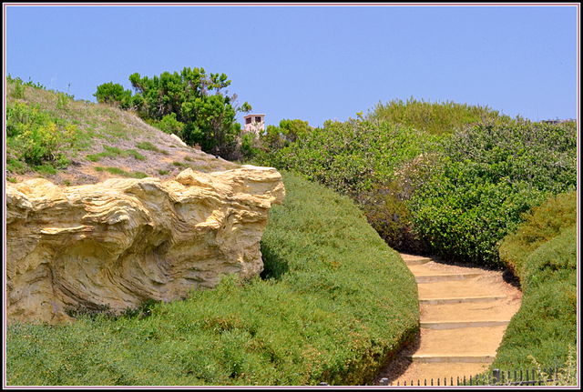
    The park’s Pelican Point Entrance boasts four parking lots, each with restrooms. At the Los Trancos entrance, a parking area on the inland side of PCH and a pedestrian tunnel leading under the highway facilitate access to the Crystal Cove Historical District.

    Interested in more hikes near Crystal Cove State Park? Check out HIKE Orange County

  • Gold Bluffs Beach a Magnificent Part of California Coastal Trail

    Gold Bluffs Beach a Magnificent Part of California Coastal Trail

    Wildlife-watching, waterfalls and a wilderness beach are highlights of a hike along the northern reaches of Gold Bluffs Beach in Redwood National Park. While even one of these en route attractions makes for a compelling hike, the mere prospect of so many engaging environments can put a hiker into sensory overload before reaching the trailhead.

    Gold Bluffs Beach and the hiking in Prairie Creek Redwoods State Park comprise one of those most inspiring lengths of the California Coastal Trail and I write about it with much enthusiasm in my narrative, “Hiking on the Edge: Dreams, Schemes and 1600 Miles on the California Coastal Trail.”

    Gold Bluffs Beach (both bluffs and beach) is prime Roosevelt elk territory. While nearby elk-viewing opportunities abound, the creatures seem all the more majestic in this wilderness setting.

    Roosevelt elk roam the bluffs above Gold Bluffs Beach in Prairie Creek Redwoods State Park. The California Coastal Trail at its most magnificent! (Photo SF Wolfman, wikimedia)
    Roosevelt elk roam the bluffs above Gold Bluffs Beach in Prairie Creek Redwoods State Park. The California Coastal Trail at its most magnificent! (Photo SF Wolfman, wikimedia)

    Waterfalls near the coast are a rarity, so the presence of three of them in close proximity to the California Coastal Trail is a special treat indeed. Gold Dust Falls, a long, slender tumbler, spills some 80 feet to the forest floor. An unnamed waterfall is located just south of Gold Dust; another is located just north.

    The hike gets off to an amazing start near the mouth of Fern Canyon. Check out The Trailmaster’s description of the Fern Canyon Hike

    This is an easy-moderate hike. From Fern Canyon to Gold Dust Falls is 2 miles round trip; to Butler Creek Backpack Camp is 4.5 miles round trip; to Ossagon Rocks is 6 miles round trip. No elevation gain to speak of.

    In the case of this hike, the journey north from Gold Bluffs Beach overshadows the destination; nevertheless, the destination—the odd Ossagon Rocks—are intriguing in their own way. The rocks resemble sea stacks, though they’re positioned right at land’s end, not in their usual offshore location.

    DIRECTIONS TO Gold BLUFFS BEACH

    From Highway 101 in Orick, drive 2 miles north to signed Davison Road. Turn left (west) and proceed 7 miles to road’s end at Gold Beach and the Prairie Creek Redwoods State Park Fern Canyon trailhead.

    THE HIKE

    Coastal Trail begins on the other side of Home Creek, an easy ford in summer, but may present a challenge during the rainy season. Usually a signpost on the north side of the creek shows the way to the start of Coastal Trail, as the California Coastal Trail is known in these parts.

    Join the path for a brief meander through the forest then out across the grass-topped dunes. The hiker is often out of sight of the surf, but never altogether removed from its thunderous roll, even when the Coastal Trail strays 0.1 mile inland.

    A mile out, the sound of falling water and an unsigned path forking right into the forest calls you to Coastal Trail’s first cascade, a long, wispy waterfall framed by ferns.

    Another 0.25 mile along the main path leads to the short connector trail leading to Gold Dust Falls. A well-placed bench offers repose and a place to contemplate the inspiring cataract. A minute or so more down the main trail delivers you to another brief spur trail and the third of Coastal Trail’s cascades.

    Coastal Trail edges from prairie to forest and reaches Butler Creek Camp, a hike-in retreat at 2.25 miles. The small camp is located at a convergence of environments—creekside alder woodland, a prairie matted with head-high native grasses, the creek mouth and the beach beyond.

    Cross Butler Creek and travel the grassy sand verbena-topped prairie for a final 0.5 mile to cross Ossagon Creek and junction with Ossagon Trail. Continue on Coastal Trail a bit farther north, then bid adieu to the path and head oceanward to Ossagon Rocks.

    Interested in more hikes near Gold Bluffs Beach? Check out HIKE the Redwoods

  • Tomales Bay State Park

    Tomales Bay State Park

    Johnstone and Jepson Trails: From Heart’s Desire Beach to Jepson Memorial Grove is 3 miles round trip with 300-foot elevation gain; to Shell Beach is 8 miles round trip

    Two lovely trails, named for a professor and a planner, explore Tomales Bay State Park. Botanist Willis Jepson, founder of the School of Forestry at the University of California, Berkeley, and author of the authoritative Manual of the Flowering Plants of California, is honored by the Jepson Trail.

    Conservationist Bruce Johnstone, Marin County planner, and his wife Elsie, worked long and hard to preserve Tomales Bay and place part of it in a state park. Johnstone Trail leads bayside from Heart’s Desire Beach to Shell Beach.

    Bay Area walkers have a little secret: When fog smothers Point Reyes and San Francisco Bay, try heading for Tomales Bay State Park. The park has a microclimate, and often has sunny days and pleasant temperatures when other neighboring coastal locales are damp and cold.

    DIRECTIONS

    From the town of Inverness, follow Sir Francis Drake Boulevard to Pierce Point Road. Turn right and drive a half-mile to the entrance to Tomales Bay State Park. Follow signs to the large parking lot at Heart’s Desire Beach.

    Point Reyes: Tomales Bay State Park by TomHarrisonMaps.com (click to enlarge)
    Point Reyes: Tomales Bay State Park by TomHarrisonMaps.com (click to enlarge)

    THE HIKE

    Signed Johnstone Trail departs from the south end of Heart’s Desire Beach and immediately climbs into a moss-draped forest of oak, bay, madrone, and wax myrtle.

    A half-mile of travel leads to Pebble Beach. At a trail junction, a short side trail goes straight down to Pebble Beach, but Johnstone Trail swings southwest and switchbacks up forested slopes. Ferns dot wetter areas of the coastal slope. The trail crosses a paved road and soon junctions.

    To continue to Shell Beach, bear left with the Johnstone Trail. The trail detours around private property, and contours over the coastal slope at an elevation of about 500 feet. The path leads through Bishop pine and a lush understory of salal and huckleberry bushes. After a few miles, the trail descends through madrone and oak forest to Shell Beach.

    Hikers content with looping back to Heart’s Desire Beach via Jepson Trail will continue straight at the above-mentioned junction. Bishop pine, along with its similar-looking piney cousins, the Monterey and knobcone, are known as fire pines, because they require the heat of fire to crack open their cones and release their seeds. Bishop pines are slow to propagate and are relatively rare in coastal California. (Another nice stand of Bishop pine is located in Montana de Oro State Park in San Luis Obispo County.)

    Surest way to distinguish a Bishop pine from its look-alike, the Monterey pine, is by counting the needles: Monterey pines have three needles to a bunch, Bishop pines have two needles to a cluster.

    From strategically placed benches, savor the fine bay views afforded by the Jepson Trail, which descends gently to Heart’s Desire Beach.

    Interested in more hikes in Point Reyes National Seashore? Check out my guide: HIKE Point Reyes.

  • Point Reyes: Bear Valley and Arch Rock

    Point Reyes: Bear Valley and Arch Rock

    From Bear Valley Visitor Center to Arch Rock is 8.8 miles round trip

    What’s not to like about a fairly flat footpath that leads through lovely forest, across wide meadows and ends at a drop-dead gorgeous overlook above the ocean? No wonder Bear Valley Trail, a former wagon road, is one of the most popular paths in the national seashore.

    DIRECTIONS

    Bear Valley Visitor Center is located just outside the town of Olema, 35 slow and curving miles north of San Francisco on Highway 1. A quicker route is by Highway 101, exiting on Sir Francis Drake Boulevard, and traveling 20 miles to Olema. Turn right on Coast Highway 1, proceed 0.1 mile, then turn left on Bear Valley Road, which leads 0.4 mile to parking for the Point Reyes National Seashore Visitor Center and the trailhead.

    Bear Valley and Arch Rock
    Point Reyes – Bear Valley Hiking Map by TomHarrisonMaps.com (click to enlarge)

    THE HIKE

    Bear Valley Trail leads through open meadow and, after 0.2 mile, passes a junction with Mt. Wittenberg Trail, which ascends Mt. Wittenberg.

    Beyond this junction, the trail enters a forest of Bishop pine and Douglas fir. Your path is alongside Bear Valley Creek. Notice that the creek flows north, in the opposite direction of Coast Creek, which accompanies Bear Valley Trail from Divide Meadow to the sea. This strange drainage pattern is one more example of how the mighty San Andreas Fault can shape the land.

    A half-mile along, pass a junction with Meadow Trail and, after almost another mile of travel, arrive at Divide Meadow, 1.6 miles from the trailhead. Well-named Divide Meadow divides Bear Valley Creek from Coast Creek. Bordered by Douglas fir, the meadow is a fine place for a picnic, as well as being a popular destination/turnaround point for many hikers. It’s also, literally, the hike’s high point (about 360 feet above sea level).

    Re-entering the forest, shady Bear Valley Trail continues another 1.5 mile to a junction with northbound Baldy Trail and southbound Glen Trail. At the 3.2-mile mark, Bear Valley Trail narrows from road to footpath (from which bikes are banned), and heads for the coast in the shade of Douglas fir.

    Four miles along, the trail ends at a junction with Coast Trail. Follow the signs to Arch Rock, past a second junction with Coast Trail.

    Near the ocean, the path crosses through coastal scrub and arrives at an open meadow on the precipitous bluffs above Arch Rock. Unpack your lunch and admire the sea stacks.

    Careful hikers can reach the arch by following a sketchy, eroded path down to Coast Creek, and then scramble over rocks to the ocean. The arch is accessible at very low tide. Keep an eye on the tides because you don’t want to get stranded on this beach.

    Be warned, though: Arch Rock, in the National Park Service view, is an overlook point with no beach access. For hikers who have just got to get to the beach, The Trailmaster recommends heading for Kelham Beach, accessible from Kelham Beach Trail, 0.8 mile north on Coast Trail.

    Interested in more hikes in Point Reyes National Seashore? Check out my guide: HIKE Point Reyes.

  • Point Reyes: Abbotts Lagoon

    Point Reyes: Abbotts Lagoon

    From Abbotts Lagoon to Point Reyes Beach is 3.2 miles round trip

    Something about Abbotts Lagoon personifies the word melancholy. Maybe it’s the lagoon itself, a large, moor-like environment that compares to some of those I’ve visited by trail in Scotland. Then there are the lonely, wind-swept grasslands and the (perpetual, it seems) gray skies. It’s the kind of place you photograph in black and white.

    While a bit on the somber side, the lagoon and lands beyond are by no means dreary and depressing; in fact, the landscape encourages reflection—an inward journey to accompany a fine outer one. And spring is positively jubilant with abundant wildflowers, particularly California poppies, iris, and lots of lupine.

    On a weekday excursion, your thoughts may very well be your only companion on this rather lightly visited trail, which leads 1.6 miles to Point Reyes Beach. A low ridge hides Abbotts Lagoon from the sight of passing motorists on Pierce Point Road; this positioning seems to discourage drop-in visitation of the kind that occurs else-where along the coast of the national seashore.

    Gray-hued the lagoon may be, but it’s anything but lifeless. Lots and lots of birds, both migratory and year-around residents congregate in an upper freshwater lagoon and a more brackish lower lagoon. Look for the western grebe and its pint-sized cousin, the pie-billed grebe, as well as lots of coots and terns.

    If you can arrange a ride or car shuttle, a one-way hike (4.5 miles) from Abbotts Lagoon along the beach north to the Kehoe Beach Trailhead on Pierce Point Road is a great way to go.

    DIRECTIONS TO ABBOTTS LAGOON TRAILHEAD

    From the hamlet of Olema, head north just 0.1 mile on Highway 1, then turn left on Bear Valley Road. Proceed 2.25 miles and fork left on Sir Francis Drake Highway. Drive 5.5 miles to Pierce Point Road, fork right and continue another 3.2 miles to the signed Abbotts Lagoon Trail and gravel parking lot on the left (west) side of the road.

    Point Reyes: Abbotts Lagoon by TomHarrisonMaps.com (click to enlarge)
    Point Reyes: Abbotts Lagoon by TomHarrisonMaps.com (click to enlarge)

    THE HIKE

    THE HIKE: The wide, level trail leads across open fields. Gently rising, the trail offers better and better views of the lagoon. A well-located bench offers a fine place for quiet contemplation of water and wildlife.

    The trail crests about the 0.8 mile-mark, then descends slightly to reach a bridge a mile from the trailhead. The footbridge bisects the upper and lower lagoons or as more lyrical naturalists refer to it—the wings of the lagoon.

    From here an unmarked path edges around the base of the dunes between the wings of the lagoon to reach the ocean shores of Point Reyes Beach. Seals and sea lions have been known to snooze on this beach. Walk to your heart’s con¬tent for miles, up-coast or down.

    Northbound hikers can travel along the dune-lined beach about 2.8 miles to junction Kehoe Beach Trail, then hoof it another 0.6 mile to the trailhead on Pierce Point Road.

    Interested in more hikes in Point Reyes National Seashore? Check out HIKE Point Reyes

  • Santa Barbara’s More Mesa Offers Hiking and More

    Santa Barbara’s More Mesa Offers Hiking and More

    More Mesa offers more: a defacto nature preserve, great bird-watching, a network of walking-hiking trails and access to Santa Barbara’s most isolated beach. I’ve been hiking More Mesa for more than 30 years, and it’s been my great pleasure to share this hike in my guidebooks for nearly that long.

    The More Mesa Preservation Coalition held a symposium recently to remind locals and conservationists statewide about the wonders of nature the mesa holds and the perils of development it could face.

    Birds galore over More Mesa, including the showy white-tailed kite.
    Birds galore over More Mesa, including the showy white-tailed kite.

    More Mesa has a diversity of habitats and attracts an abundance of bird life. It’s known for its bird life, including 16 different species of raptors. The white-tailed s kite, marsh hawk and other raptors, are quite active over the mesa in their pursuit of prey. Rare birds include the northern harrier and short-eared owl.

    This land has been threatened by development for decades. And it still is, though any development scheme faces vociferous opposition. Prominent Saudi developer Sheikh Khalid S. Al-Shobily purchased More Mesa in 2012, but has not announced any development plans.

    The mesa was once part of Thomas More’s Rancho La Goleta, who bought it in 1857 and grazed cattle here. More noticed natural tar seeping from mesa cliffs, gathered it up and sold it to the city of San Francisco, where the asphaltum was used to pave city streets.

    A mile-long walk up a residential street, across the bluffs, and down the cliffs on a combo stairs-pathway leads to a clean, mellow and sandy beach. More Mesa is a great walk without going down to the beach. The property is honeycombed with trails.

    More Mesa Coastal Trail: One of Trailmaster John McKinney's favorite Santa Barbara hikes.
    More Mesa Coastal Trail: One of Trailmaster John McKinney’s favorite Santa Barbara hikes.

    I like hiking a 2.5-mile loop around mesa. If you’re new to More Mesa, I suggest taking a counter-clockwise route. Head for the stairs to the beach, then take the path extending up-coast along the oceanside edge of More Mesa. Choose from a narrow footpath at the very edge of the bluffs or a wider one paralleling and enjoy views of the Channel Islanda and of the UCSB campus a few miles to the west

    The Trailmaster likes to walk the full length of the bluffs before turning inland near a line of homes and commercial nursery. (You can also follow the bluff trail to intersect other trails on your right that lead north toward the mountains and dip into oak-filled ravines.) Turn back east, along the inland edge of the mesa, continuing past a profusion of trails to close the loop and rejoin the main trail near the trailhead.

    From More Mesa, take a glorious sunset beach hike up-coast.
    From More Mesa, take a glorious sunset beach hike up-coast.

    Directions to More Mesa:

    From upper State Street at its junction with Highway 154, continue west along State as it becomes Hollister 1.2 miles to Puente Drive. Turn left (south). Puente Drive bends west, undergoes a name change to Vieja Drive, and passes Mockingbird Lane on your left 0.7 mile from Hollister. Public parking is not permitted along Mockingbird Lane; you must park along Puente Drive/Vieja Drive and walk up the lane past gated residential streets to the gated entrance to More Mesa. (Or exit Highway 101 on Turnpike. Head south to Hollister and turn left. Drive a few blocks to Puente Drive and follow above directions.)

    For more information about this hike (and many others), check out HIKE Santa Barbara

  • Santa Cruz Island Hiking

    Santa Cruz Island Hiking

    Day-trippers who board an Island Packers boat from Ventura Harbor and land at Scorpion Anchorage will typically have about five hours on Santa Cruz Island. Hikers have a choice of three trails, which can be combined to fashion hikes of various lengths. My favorites:

    Santa Cruz Island: Cavern Point

    From Scorpion Anchorage to Cavern Point is 1.2 miles round trip with 300-foot elevation gain

    The short, but steep, climb on Cavern Point Trail leads the hiker to a stunning viewpoint. Look for seals and sea lions bobbing in the waters around the point, as well as cormorants, pigeon guillemots and black oyster-catchers swooping along the rugged volcanic cliffs. (more…)

  • San Miguel Island

    San Miguel Island

    San Miguel, westernmost of the Channel Islands, has much to offer the hiker, particularly if you join a ranger-guided hike.

    Hiking down to Cuyler campground on San Miguel Island. (Todd Clark)
    Hike to Cuyler campground on San Miguel Island.(Todd Clark)

    Eight miles long, four miles wide, it rises as a plateau, 400 to 800 feet above the sea.

    Wind-driven sands cover many of the hills, which were severely overgrazed by sheep during the island’s ranching days. Owned by the U.S. Navy, it was used as a bombing site and missile tracking station.

    San Miguel is home to six pinniped species: California sea lion, northern elephant seal, steller sea lion, harbor seal, northern fur seal and Guadalupe fur seal. The island may host the largest elephant seal population on earth. As many as 15,000 seals and sea lions can be seen basking on the rocks during mating season.

    San Miguel offers some great hiking, and guided hikes. Cuyler Harbor Beach, Cabrillo Monument and the Lester Ranch site are the sights you can see on your own. From Cuyler Harbor, the hike to Lester Ranch is about 3 miles round trip with 700-foot elevation gain.

    Rangers and naturalists offer guided hikes to other parts of the island, soon after Island Packers boats arrive on San Miguel.

    A trail extends most of the way from Cuyler Harbor to the west end of the island at Point Bennett, where the pinniped population is centered. Trails pass the island’s two round peaks, San Miguel and Green Mountain, drop in and out of steep canyons and traverse the caliche forest, composed of fossil sand casts of ancient plants. Calcium carbonate reacted with the plants’ organic acid, creating a ghostly forest.

    PLANNING TO GO TO SAN MIGUEL ISLAND?

    Plan a very long day—or better yet, an overnight trip to San Miguel. It’s at least a five-hour boat trip from Ventura. Boat over to the island with Island Packers (805) 658-5730, the Channel Islands National Park primary concessionaire. Island Packers offers plenty of free parking, a gift shop and restrooms.

    For more information contact Channel Islands National Park or stop in at the visitor center (805) 658-5730 in Ventura Harbor at 1901 Spinnaker Drive.

    THE HIKE

    Follow the beach at Cuyler Harbor to the east. The harbor was named after the original government surveyor in the 1850s. The beach around the anchorage was formed by a bight of volcanic cliffs that extend to bold and precipitous Harris Point, the most prominent landmark on San Miguel’s coast.

    At the east end of the beach, about 0.75 mile from anchoring waters, a small footpath winds its way up the bluffs. It’s a relatively steep trail following along the edge of a stream-cut canyon. At the top of the canyon, the trail veers east and forks. The left fork leads a short distance to Cabrillo Monument.

    You will be able to see the trail above the east side of the canyon. When you get to the top of the canyon the ranger station and pit toilet are straight ahead. Instead of going straight you can turn east. The trail ascends a short distance to the Cabrillo Monument. The Lester Ranch is a short distance beyond that.

    Juan Rodriguez Cabrillo, Portuguese explorer, visited and wrote about San Miguel in October 1542. While on the island he fell and broke either an arm or a leg (historians are unsure about this). As a result of this injury he contracted gangrene and died on the island in January 1543 and it’s believed (historians disagree about this, too) he was buried here. In honor of Cabrillo, a monument was erected in 1937.

    The right fork continues to the remains of a ranch house. Of the various ranchers and ranch managers to live on the island, the most well known were the Lesters. They spent 12 years on the island and their adventures were occasionally chronicled by the local press.

    When the Navy evicted the Lesters from the island in 1942, Mr. Lester went to a hill overlooking Harris Point, in his view the prettiest part of the island, and shot himself. Within a month his family moved back to the mainland. Not much is left of the ranch now. The buildings burned down in the 1960s and only a rubble of brick and scattered household items remain.

    Interested in more hikes near San Miguel Island? Check out HIKE the Channel Islands

  • California Lost Coast Map

    California Lost Coast Map

    California Lost Coast Map is just what you need for planning a day hike or backpacking adventure. The Trailmaster created this map to share the wonders of this wilderness shoreline and is pleased that each year more and more hikers from across the country and around the world are discovering the beach and mountain trails on the Lost Coast.

    Get the California’s Lost Coast Map from Wilderness Press, which usually offers it online for 25 percent off.

    Find great hikes on California's Lost Coast with the help of a map created by Trailmaster John McKinney
    Find great hikes on California’s Lost Coast with the help of a map created by Trailmaster John McKinney

    Sinkyone Wilderness State Park, along with the BLM’s King Range National Conservation Area to the north, comprise California’s Lost Coast, 60 miles of the state’s wildest coastline located in northern Mendocino and southern Humboldt counties. One reason the coast is “lost” is because no highways cross it. So rugged is this country, highway engineers were forced to route Highway 1 many miles inland from the coast—and the region has remained sparsely settled and unspoiled. It’s magnificent vistas and varied terrain—dense forests, prairies, coastal bluffs, beaches—reward the hardy explorer.

    I created the first version of this map way back in 1988 when I spent a month as a volunteer ranger at Sinkyone Wilderness State Park. Just after I moved my belongings into the old ranch house, it began to rain. And rain. And rain some more. And by the next day the road to the park was closed by a minor mudslide, marooning me from the outside world.

    Lost Coast hikers tramp a rugged shoreline trail (photo by Bob Wick, BLM)
    Lost Coast hikers tramp a rugged shoreline trail (photo by Bob Wick, BLM)

    I had a glorious time. A state park and 20 miles of coastline all to myself. Well, almost to myself. The sky was filled with gulls and pelicans, sea lions and harbor seals gathered at Little Jackass Cove, gray whales were migrating near shore, and a herd of Roosevelt elk seemed to accompany me wherever I hiked.

    I figured a few more nature-loving, don’t mind the rain kind of hikers would love the Lost Coast, too, if only they could find it and know where to hike. So I hiked all the trails and supervised the production of a map.

    Every few years the map (published by Wilderness Press) gets an update, and of course I love to return to the Lost Coast to hike and to field check “California’s Lost Coast.” The trail system sure is a lot better these days, with pretty well-maintained trails and trailheads. That being said, much of it is still wilderness hiking, and far more remote than any other length of coast in California.

    The Lost Coast Map also includes descriptions of a number of my favorite day hikes in the King Range National Conservation Area and Sinkyone Wilderness State Park, some along the route of the Lost Coast Trail, which extends the length of the two jurisdictions. Lost Coast Trail is starting to appear on those Top Ten and Top Twenty North American Hikes lists, and I say deservedly so.

    On California's Lost Coast, the rugged peaks of the King Range seem to rise right out of the surf. (photo by Bob Wick, BLM)
    On California’s Lost Coast, the rugged peaks of the King Range seem to rise right out of the surf. (photo by Bob Wick, BLM)

    Since California’s Lost Coast is one of the rainiest regions in the state, if any map should be waterproof, this one is it. My only objection to the word “WATERPROOF!” on the front of the map is in way bigger type than John McKinney and I’m really going to have to speak to the otherwise bright and extremely meticulous editors at Wilderness Press about this…Imagine thinking WATERPROOF! is a more significant selling point than The Trailmaster’s trail-blazing and compelling prose…

    And in other Lost Coast News: Backpackers and those day hikers who like to make one-way journeys will be overjoyed to learn of three locally owned shuttle services that offer on-demand drop-off and pickup at all the major Lost Coast trailheads:

    Lost Coast Adventures (707)986-9895 or (707)502-7514
    Lost Coast Shuttle (707)986-7437
    Lost Coast Trail Transport Service 
(707)986-9909

    The BLM has a very helpful visitor center, with a great staff and information handouts. Backpackers in particular will need to drop by to find out about trail camps and keeping your food out of the paws of the increasing bear population.

    Have a great time on the Lost Coast!

    Hike On,

    John McKinney
    The Trailmaster