
Ocean Beach, Baker Beach, and Muir Beach. Fort Mason, Fort Funston, and Fort Point. Gerbode Valley, Oakwood Valley, Tennessee Valley. Muir Woods. The Presidio. The Golden Gate Promenade. Alcatraz.
Just saying the names feels expansive. Golden Gate National Recreation Area is epic—and so is its hiking. Not epic in the distant, bucket-list sense, but epic in a far rarer way: trails woven directly into daily life, history, weather, culture, and mood. This is a national parkland you don’t escape to. It’s one you live with.
The Golden Gate National Recreation Area protects more than 82,000 acres of what the National Park Service politely calls “ecologically and historically significant landscape surrounding the San Francisco Bay Area.” Translation: cliffs, beaches, headlands, forests, forts, neighborhoods, and some of the most emotionally charged scenery in America. With more than 12 million visitors a year—plus another million heading to nearby Muir Woods—it is the most visited national parkland in the United States.
And yet, many people don’t even realize they’re in a national park when they’re enjoying it.
Lunch near the old Cliff House. A quiet walk along Lovers’ Lane in the Presidio. A concert or performance at Fort Mason. A casual stroll along the waterfront with the Bay glittering beside you. These experiences slip so easily into everyday San Francisco life that their national park status almost feels beside the point. Almost.
The old slogan “Parks are for people” fits nowhere better than here. GGNRA may not publish a breakdown of how many visitors identify as hikers, but spend a day on its trails and you won’t need statistics. This is one of the most heavily—and happily—hiked landscapes in the country.
One reason is sheer scale. Golden Gate National Recreation Area is one of the largest urban parks in the world, more than two-and-a-half times the size of the city of San Francisco itself. But it isn’t one continuous park. It’s a mosaic: a collection of natural, historical, and recreational lands stretching from southern San Mateo County to northern Marin County, stitched together by water, fog, and footpaths.
That patchwork quality is part of the magic. Every hike feels slightly different, even when the Bay is always nearby.
Leading hikes here taught me just how deeply this place gets under people’s skin. When I guided walkers for The Wayfarers—an upscale walking vacation company—hikers came from across the U.S. and from Europe expecting scenery. What they didn’t expect was how emotionally attached they’d become in just a few days. A walk across the Presidio to Lands End. A traverse of the Marin Headlands. A hike from Tennessee Valley to Muir Beach. A crossing of the Golden Gate Bridge on foot. Time and again, I watched people slow down, look around, and realize they were having one of those rare hiking experiences that feels both exhilarating and oddly intimate.
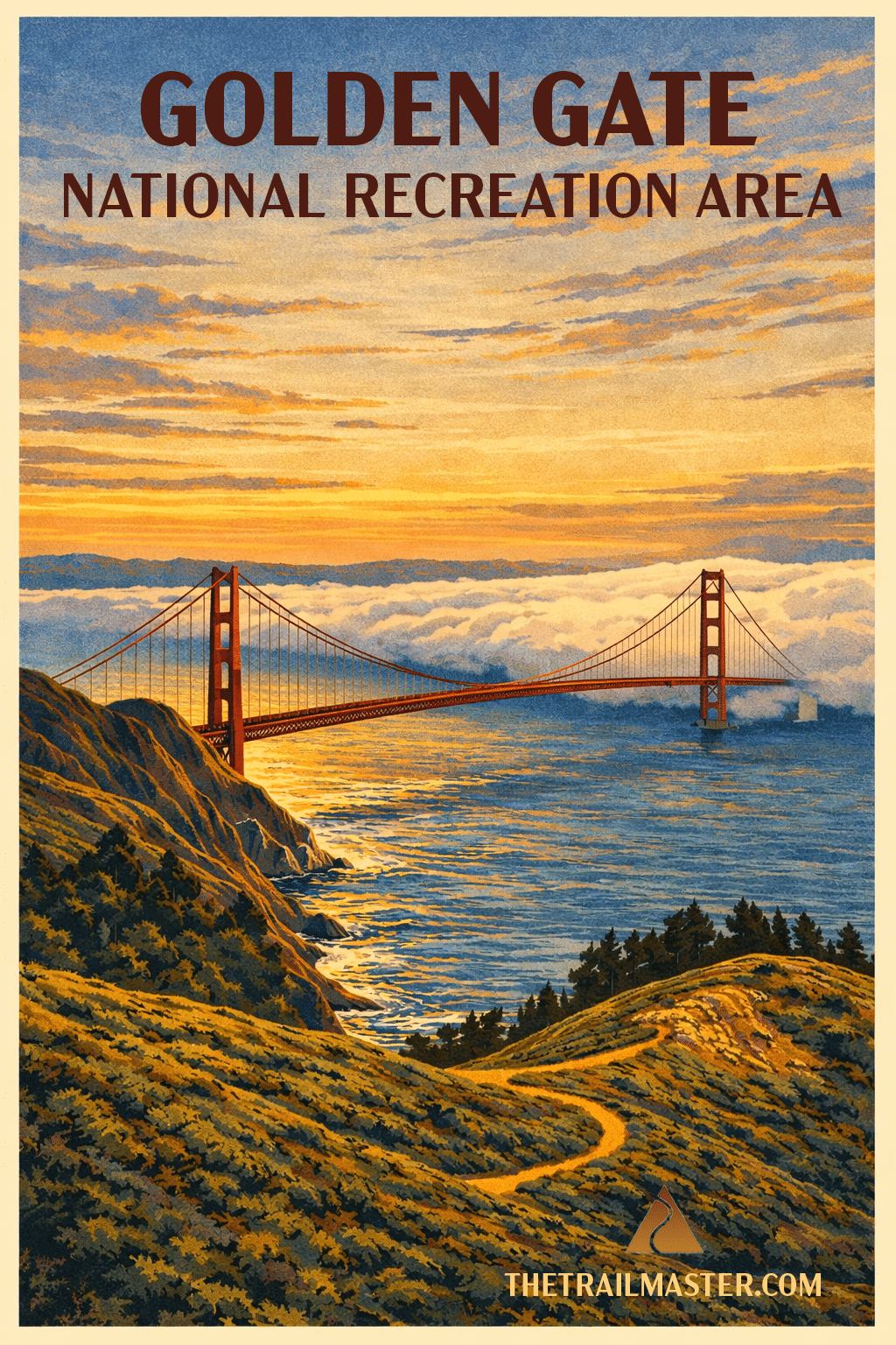
Part of the appeal is visual, of course. The Golden Gate Bridge reveals itself from countless angles: glowing through morning fog from the Coastal Trail, framed by surf at Baker Beach, looming overhead along the Bay shore, or stretching out beside you on the Golden Gate Promenade. And yes—you really should walk across it at least once in your life. (It still surprises me how many seasoned travelers don’t realize you can.)
But what truly defines hiking here isn’t just what you see. It’s what you feel.
Let’s start with the fog.
San Francisco fog is not background scenery; it’s an active participant. Sometimes it arrives quietly, “on little cat feet,” softening edges and muting sound. Other times it surges in like a living thing, swallowing ridges, bridges, and skylines before retreating just as suddenly. On a hike, fog can turn a familiar trail into something mysterious and almost cinematic. You don’t conquer it. You walk within it.
Fog also shapes the climate, and the climate shapes the hiking. Summers here are famously cool—sometimes startlingly so. While the Mark Twain attribution is wrong, the sentiment is spot-on: San Francisco summers can feel colder than winters elsewhere. The upside is extraordinary. Temperatures rarely climb above the mid-70s or dip below the mid-40s. That narrow, moderate range creates something close to ideal hiking conditions year-round. There are few places in America where you can comfortably hike twelve months a year without obsessing over heat or cold.
Another pleasure of hiking a national parkland embedded in a metropolis is simple and deeply human: food. You can pack trail mix and water if you like, but you can also start your hike with a great cup of coffee or a breakfast burrito and finish with seafood, sourdough, or a cold drink at a neighborhood brewery. Trailheads and restaurants coexist here in a way that feels indulgent without being frivolous.
Despite its urban setting, GGNRA often feels surprisingly remote. During the real-estate boom years of the 1970s and ’80s, San Francisco made a crucial choice: preserve its waterfront as public land. That decision gave the city a greenbelt lined with bluffs, beaches, and historic sites—and gave hikers uninterrupted access to the edge of the continent.
The Presidio is a perfect example. Transferred from the U.S. Army to the National Park Service in 1994, it has evolved into a singular blend of culture and nature. Trails wind past restored buildings, open meadows, eucalyptus groves, and quiet beaches. History is never far away, but neither is birdsong or the sound of waves. Alcatraz Island, America’s most infamous prison site, adds another layer to the park’s complex story—one more reminder that freedom, confinement, and landscape often intersect here.
Architecture lovers find plenty to admire: steep-pitched Victorians tucked into the Presidio and Olema Valley, massive brick fortifications like Civil War–era Fort Point, the haunting remains of Sutro Baths. These structures aren’t museum pieces behind glass. They’re part of the walk, encountered at human scale.
And then there’s the bridge.
The Golden Gate Bridge is the park’s namesake and emotional anchor. You can stand beneath it at Fort Point, feel its mass and thunder overhead. You can look down on it from Marin Headlands ridges, watching fog stream past its towers. You can spot it unexpectedly from forested trails or city streets. Hiking here means the bridge is never just a landmark—it’s a companion, a constant reference point between city and wild.
That interplay defines Golden Gate National Recreation Area. Urban and rural. Nature and culture. Solitude and community. On one hike, you might walk through fern-filled ravines, climb windswept bluffs, pass families out for an afternoon stroll, and end the day gazing across the Bay at a glowing skyline. Few places blend these elements so seamlessly.
This is nature nearby, not nature removed. With a short bus ride or drive, you can step onto trails that feel worlds away—redwood groves, coastal headlands, quiet valleys—yet remain firmly connected to the life of the city.
Tony Bennett’s lyric often comes to me on these trails: I left my heart in San Francisco, high on a hill. After decades of hiking here, I understand why so many people do. Golden Gate National Recreation Area doesn’t ask you to leave your life behind to experience it.
It invites you to walk straight into it—and, somewhere along the way, to give a little of your heart to the trail.
Golden Gate National Recreation Area Know Before You Go
Geography
The city is located on a narrow arm of land next to San Francisco Bay, the largest land-locked harbor in the world. San Francisco is surrounded on three sides by water: the Pacific Ocean, the Golden Gate strait, and San Francisco Bay.
Pacific waters temper San Francisco’s weather, keeping temperatures and overall climate unusually consistent and mild year-round. GGNRA’s hills, however, create distinct microclimates around them and cause wide variations in temperature and sky conditions in different parts of the park.
The famous fog blankets different elevations in varying ways, resulting in complex patterns of mist and sunshine. Most common on summer mornings, the fog rolls in from the cooler ocean and backs up against the hills. In winter, the fog comes from colder inland areas.
Natural History
San Francisco is one of the top U.S. cities for nature lovers, and thanks to GGNRA a high percentage of the city is set aside as parkland.
More than half of the bird species of North America have been sighted in GGNRA. This abundance of birds is related to the diversity of habitats in the parklands around San Francisco: coastal scrub, grass prairies, sandy and rocky shorelines, creeks and salt marshes, oak woodlands, redwood forests and more.
The park is home to more than 3,000 plant and animal species. Golden Gate National Recreation area and adjacent parklands were designated as the Golden Gate Biosphere Reserve by UNESCO in 1988.
Conservation History
The land now comprising GGNRA had long been under government ownership. American military occupation dating from the 1840s restricted development. As the Army’s properties became obsolete for modern defense, they were transferred to the National Park Service.
Park advocates managed to circumvent the requirement that national parklands be contiguous and convince lawmakers to create Golden Gate National Recreation Area in 1972. During the next three decades, the National Park Service acquired Alcatraz Island, Fort Mason, Fort Funston, Cliff House, Crissy Field, the Presidio and much more.
The Nature Conservancy purchased land in the Marin Headlands from a would-be developer and transferred it to GGNRA. Rancho Corral de Tierra, a former Mexican land grant on the San Mateo Peninsula was preserved through the efforts of the Peninsula Open Space Trust.
GGNRA has benefited enormously from the efforts of a stellar nonprofit support organization, the Golden Gate National Parks Conservancy. The hiking experience has been greatly enhanced by the terrific visitor centers at Muir Woods, Marin Headlands and Lands End. The Conservancy has helped improve Crissy Field and sites along the Golden Gate Promenade, and has also improved and signed many park trails.
For More Info
Golden Gate National Recreation Area, Building 201, Fort Mason, San Francisco, CA 94123. Call 415-561-4700. The Presidio Visitor Center is located at 210 Lincoln Boulevard on the Presidio’s Main Post. Call 415-561-4323. The robust nonprofit support organization for GGNRA is the Golden Gate National Parks Conservancy. Learn more at www.parksconservancy.org