The Trailmaster Blog

  • Montaña de Oro State Park

    Montaña de Oro State Park

    If spring has a signature color along the Central Coast, it’s gold.

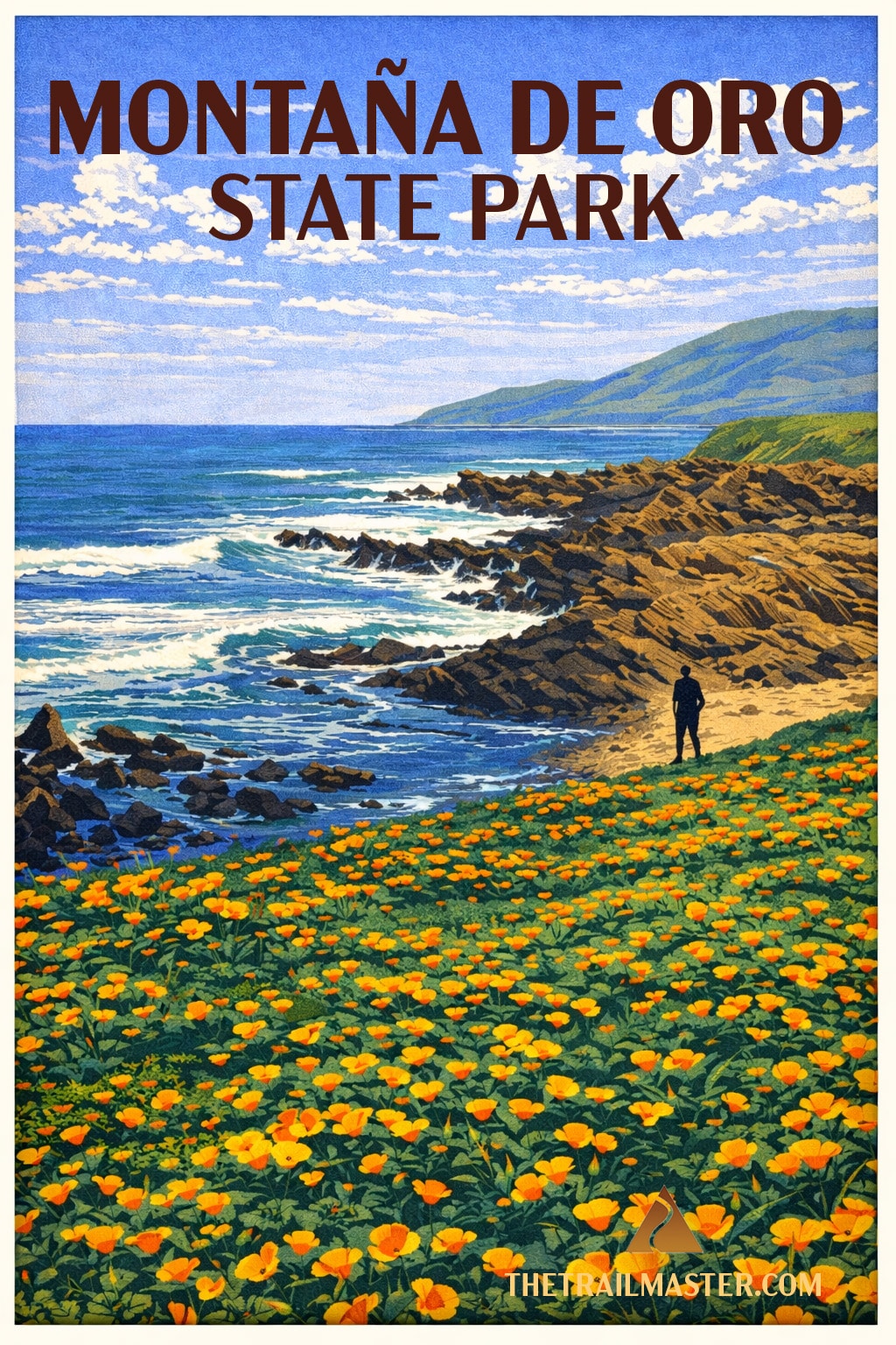
    At Montaña de Oro, the bluffs don’t just bloom—they glow. Mustard and poppies spill across the hillsides, lupine and verbena add their accents, and the Pacific keeps up a steady drumbeat below. It’s one of those rare places that feels both wild and welcoming, and I’ll say it plainly: this park ranks among my all-time top five of California’s 270 state parks. Every July 19, I celebrate my birthday the best way I know how—with a long hike here, the ocean at my side and the wind in my face.

    A few miles down the coast, the story takes a curious turn.

    At Point Buchon, the same wildflowers and wave-carved cliffs lead you through a landscape that feels untouched—until, around a bend, you find yourself looking at the Diablo Canyon Nuclear Power Plant. Nature and megawatts, side by side. Only in California.

    Full disclosure: in my younger, more combustible days, I was arrested for protesting that very plant. So I half expected to be turned away at the trailhead—“Sorry, Trailmaster, you’re on the blacklist.” Apparently not.

    Good news for all of us.

    Because these two coastal walks—one a beloved classic, the other a semi-secret—remind us that California’s edge is never just scenic.

    It’s storied.


    Montaña de Oro State Park
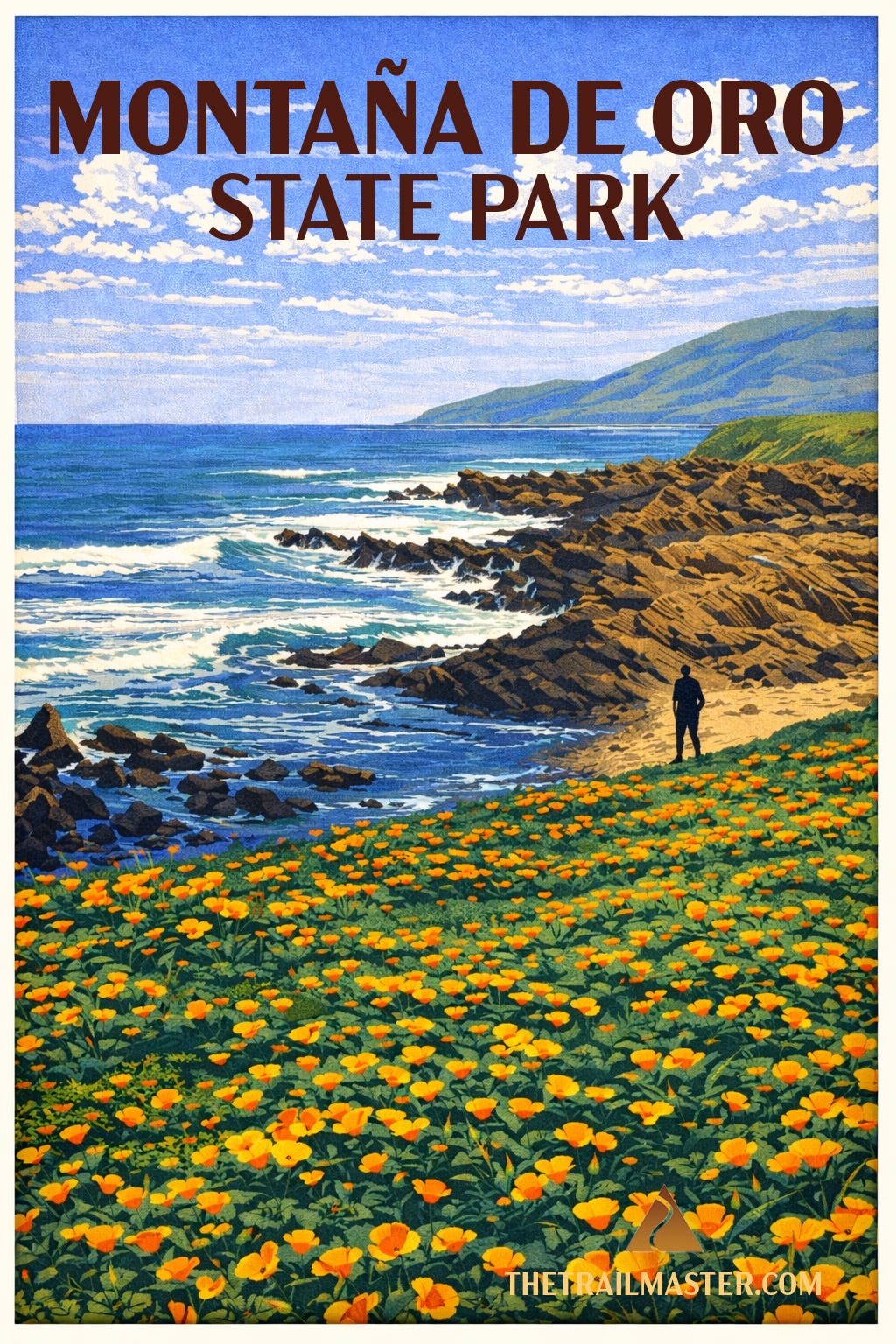
    Montaña de Oro means “mountain of gold,” and you don’t need a Spanish-English dictionary to figure out why. In springtime the coastal bluffs glow with golden mustard and poppies, accented by purple lupine, pink sand verbena, and the occasional bright orange nasturtium gone feral. But the name also speaks to the gold standard of hiking along the Central Coast.

    This park has everything a hiker dreams of: rugged bluffs, hidden coves, tidepools that could occupy a curious naturalist for hours, even inland trails climbing to peaks and ridges with far-reaching ocean views. Valencia Peak rises 1,347 feet and rewards the stout of heart with a sweeping panorama of Morro Rock, the Morro Bay estuary, and the long blue line of the Pacific. Coon Creek shelters a rare grove of Bishop pines, a southern outpost for this otherwise northern species.

    But the signature hike—the one you’ll tell your friends about, the one you’ll tuck away in your memory as one of the great coastal strolls in all California—is Bluff Trail. It’s nearly flat, accessible, and delivers nonstop drama: crashing surf, sculpted sea caves, blowholes, and pocket beaches tucked against the base of golden cliffs.

    Montaña de Oro’s story is also human. Much of the park was once Spooner Ranch, where Alexander and Arvin Spooner ran cattle, grew crops, and later rented cabins to tourists. Their old ranch house serves today as the visitor center. Before that, smugglers found Spooner’s Cove a handy place to land contraband, from aguardiente in Spanish colonial days to whiskey during Prohibition. Today it’s family picnics and tidepool explorations that fill the cove—though the wild winds remind you this coast still belongs more to the elements than to us.

    And the wildlife! Harbor seals nap on offshore rocks. Sea otters roll in the kelp beds, cracking shellfish on their bellies with polished stones. Offshore, pelicans glide in squadrons, cormorants dive in unison, and the sharp-eyed hiker might even spot black oyster catchers tap-dancing across tide-slick rocks with their neon bills flashing like traffic cones.

    This park is both wild and welcoming, a rare combination that explains why so many Californians, myself included, count it among their absolute favorites. If every trail tells a story, Bluff Trail (a 4.2-mile jaunt) tells one of timeless beauty and the endless meeting of land and sea.

    Directions, maps, and full trail guide:


    Point Buchon
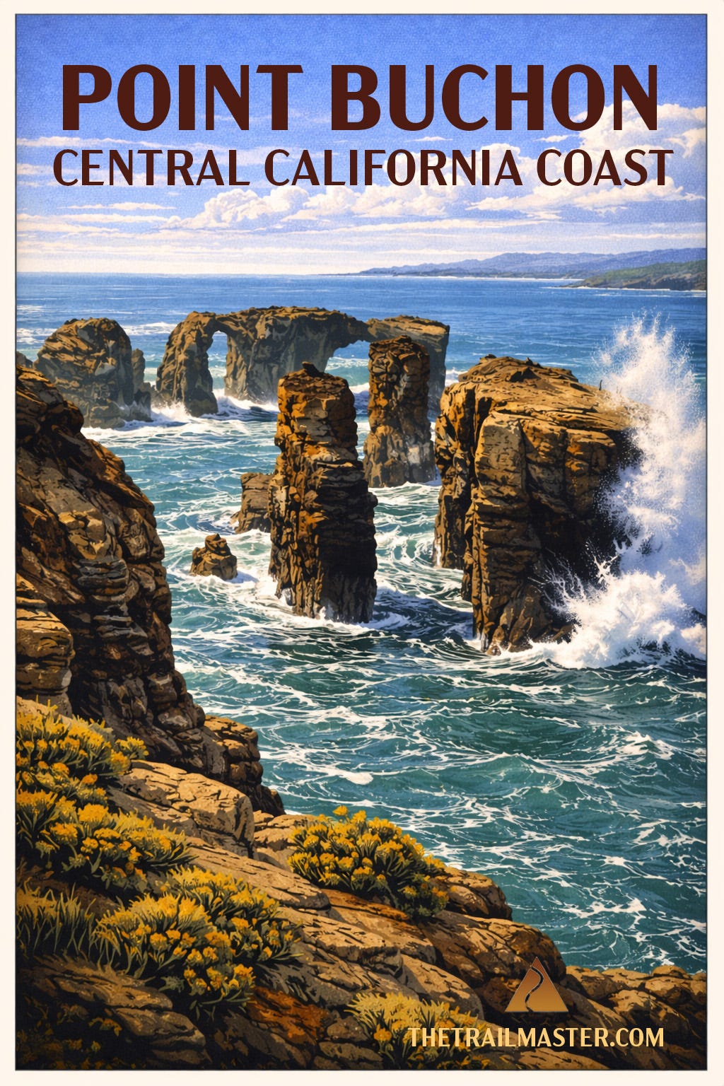
    Panoramic vistas from Point Buchon include drop-dead gorgeous headlands, wildflower-strewn bluffs, sea stacks, sea caves and…Diablo Canyon Nuclear Power Plant.

    Yes, you read that right. One of California’s most pristine coastal walks is in close proximity to a nuclear facility. Only on the Central Coast do you get this particular pairing: pelicans gliding past sandstone cliffs while, just down the shoreline, engineers monitor reactors designed to keep the lights on from San Luis Obispo to Silicon Valley. Nature and megawatts, side by side.

    This rare opportunity to hike PG&E-owned Diablo Canyon lands reveals a portion of 14 miles of coastline that have remained remarkably untouched. No subdivisions, no marinas—just wind, waves, and a landscape that looks much as it did centuries ago. Inland, coastal prairie rolls into oak woodland and pockets of bishop pine, a reminder that this is a meeting place of ecosystems as well as tectonic plates.

    The point itself takes its name—somewhat contentiously—from a Chumash leader. Spanish explorers, never shy about creative interpretation, rendered the name “Buchon,” possibly referencing a “goiter” or possibly just getting it wrong. Either way, the land long predates the name, and Chumash presence lingers in the quiet dignity of the place.

    Brown pelicans skim the surf in tight formation. Harbor seals and sea otters bob in the kelp beds below. In migration season, gray whales pass just offshore, their blows visible from the bluffs. Red-tailed hawks and kestrels patrol overhead, riding the same coastal winds that may, along this trail, test your balance and your hat.

    The trail itself feels like a cousin to Montaña de Oro’s Bluff Trail—same drama, fewer people, more sense that you’ve stumbled into something semi-secret. That’s partly by design. Access is limited (Thursday–Monday, reservations required at the trailhead), and the daily cap keeps things blissfully uncrowded.

    And yes, you’ll sign a waiver before heading out. Cliffs, surf, uneven terrain—fair enough. Nuclear meltdown not included. Probably.

    Minimal elevation gain makes this an approachable adventure, but don’t mistake “easy” for ordinary. This is the kind of hike where you stop often, not because you’re tired, but because the coastline keeps insisting you look again. Read the full trail guide for this 6.6-mile round trip hike.

    Directions, maps, and full trail guide


    Footnotes

    The northern coast of Montaña de Oro State Park has been described as a “gigantic sand pile.” Park your car at the Sandspit Beach lot. From there, you can head down a hill to the beach between tall sand dunes. Play in the dunes or hike for 4+ miles north toward Morro Rock along the Morro Bay Sandspit, the long finger of sand that separates the ocean from Morro Bay Estuary.

    On the drive to the trailhead, I love to stop at Carlock’s Bakery, located at 1024 Los Osos Valley Road in Los Osos. Friendly and family-run, it offers a large variety of daily-baked goods at fair prices: pastries, breads, donuts, and croissants.


    Hike On,
    John McKinney
    The Trailmaster

    “Every trail tells a story.”


    From the Trailmaster Library

    If you’d like to explore more California trails:

    Hike Southern California

    Other regions have tall mountains, forests, deserts and an awesome coastline, but only Southern California has all of them – and four-season hiking! You’re guaranteed to find a hike (many hikes!) you’ll like in this “greatest hits” collection. Every Trail Tells a Story. Hike On!


    Trailmaster T-shirts & Hats

    Hike On Hat
    Keep Calm and Hike On
  • Opening Day on the Trail

    Opening Day on the Trail

    There are seasons, and then there are seasons.

    Across much of the country, Baseball’s Opening Day signals the long-awaited return of spring—and for hikers, the start of getting back out on the trail. Snow melts, boots come out of the closet, and winter loosens its grip.

    Here in California, we don’t wait for permission.

    We hike year-round. Desert in winter, wildflowers in spring, coast in summer, mountains in fall. Still, there’s something about the crack of the bat and the first pitch of the season that feels like an invitation—to get outside, to stretch the legs, to wander a little farther down the trail.

    And yes, to argue a little baseball.

    The Dodgers and Giants brought their rivalry west from New York in the 1950s, and California has never been the same. I’ll confess: I bleed Dodger Blue. But I’ve happily bundled up for a cold night at Oracle Park, where the wind off the bay reminds you that baseball—and hiking—are best experienced in the elements.

    These days, that spirit carries onto the trail. The Dodger Blue Hiking Crew has turned postgame passion into pregame miles, drawing hundreds of fans to hikes like their World Series celebration in Griffith Park and the recent “Road to 3-Peat.”

    This week, we take that idea a step further.

    We’ll hike above Dodger Stadium to Angel’s Point—yes, that Angel’s—and wander the ghostly edges of Candlestick Point, where the wind still tells Giants stories.

    Because in California, the season never really ends. We just keep hiking.


    Elysian Park

    Elysian Park

    Let’s be clear: Elysian Park is Dodgers territory. Vistas of Dodger Stadium and downtown L.A. and an unexpectedly rugged trail traversing hillsides high above the Golden State Freeway are among the highlights of a 3-mile loop hike through the northern environs of the park.

    You’re hiking above Major League Baseball’s most beautiful ballpark—Dodger Stadium, a mid-century masterpiece that’s somehow both retro and timeless, like Vin Scully’s voice on a warm summer night. From Angel’s Point, those iconic hexagon scoreboards, the outfield pavilions, and the sweep of Chavez Ravine all lie below you like a postcard. On game days, you may hear the crack of the bat or the crowd’s roar drifting up the canyon walls. No team in baseball has fans this loyal, loud, or ready to talk postseason math with a stranger on the trail.

    This route also showcases Bishop Canyon, a hidden world tucked between freeways and ballparks. For decades it was a neglected landfill. In the 1990s, thanks to passionate neighbors and persistent activists, it transformed into an urban oasis—a place where soccer balls bounce, oak trees stand their ground, and joggers loop the fields below the Academy where generations of LAPD recruits have sweated through drills. A classic L.A. twist: the landfill that became a park is now one of the most pleasant green pockets in the central city.

    The star of this hike, of course, is Angel’s Point, where a whimsical sculpture—part weather vane, part lookout perch, part Home Depot color experiment—sits beside a living palm tree, offering one of the best sunset-viewing balconies in L.A. The panorama stretches from downtown’s shimmering skyline to the far-off summits of the San Gabriels.

    And because we’re in Elysian Park, that wild wedge of land older than the City of Los Angeles itself, expect everything from fragrant coastal sage scrub to the occasional coyote trotting confidently through this patchwork of urban wilderness. Elysian Park may not be top of mind for hikers, but it’s one of L.A.’s most surprising escapes.


    Candlestick Point

    Candlestick Point Then and Now

    To San Francisco baseball fans, Candlestick Park on Candlestick Point was the longtime home of their beloved Giants. The team relocated to more upscale digs in 2001, leaving the wind, the fog, and a lot of memories behind. The 49ers held on a bit longer, but by 2014 they too had moved on, and in 2015 the Stick was gone—demolished, as if trying to erase decades of cold nights and colder bleachers.

    Ah, but you don’t erase Candlestick that easily.

    From 1960 to 1999, Giants fans braved conditions that bordered on heroic. This was baseball played in a wind tunnel. Fly balls didn’t arc—they wandered. Flags snapped like they were trying to escape the peninsula. Pitchers adjusted their caps, their footing, and occasionally their dignity. And yet, this was where Willie Mays patrolled center field, where Juan Marichal dueled Sandy Koufax, where the Bay met the game in its rawest form. The last out of the 1962 World Series fell here, heartbreak carried off by the wind. Even near the end, when nostalgia outweighed comfort, fans came back for one more freezing night, one more stubborn cheer. Candlestick wasn’t pretty—but it was the brave heart of San Francisco.

    Long before and after the stadium years, this shoreline lived a rougher life. For decades, Candlestick Point was a kind of forgotten edge of the city, used as a dump and windswept afterthought. The State of California stepped in, and in 1977 created its first urban state recreation area—a bold idea at the time: bring open space to the city rather than expect the city to come to nature.

    Today, the park hums with activity. Windsurfers lean into those same legendary gusts, turning challenge into sport. Kayakers slide into the bay. Fishermen cast lines from the piers. Walkers and cyclists follow the Bay Trail, part of a grand vision to ring the entire bay with a continuous path.

    There’s art, too—most notably Orchestra for Natives of the Future, where you’re encouraged to make a little noise of your own. Appropriate, given the setting.

    And yes, the wind still blows. Hard. The same gusts that once humbled big-league outfielders now test hikers moving toward Sunrise Point.

    Candlestick has changed. But the edge-of-the-city feeling remains—raw, open, and very much alive.


    Footnotes

    The nearest, most accessible hike to Oracle Park is the Embarcadero Waterfront, a flat 1.5-mile walk to the Ferry Building. Giant fans (and not) can view the stadium from on high from Twin Peaks. A very short hike reveals a 360-degree panorama of the city, including the Mission Bay neighborhood where Oracle Park is located.

    For a glimpse of Angel Stadium, Halos fans need to head for the hills—the Anaheim Hills. Santiago Oaks Regional Park features several trails (Mountain Goat Trail comes to mind) that offer westward views toward Anaheim and the stadium.

    Nearest hiking to Petco Park, home field of the Padres, is on a couple of urban trails, including the 0.75-mile Martin Luther King Jr. Promenade and the1.75-mile Bay to Park Paseo.

    Ah, the Oakland As, soon to leave California (sigh) for Las Vegas (gasp). If you want to take a hike near Sutter Health Park, the team’s temporary home in West Sacramento, I suggest the 2.9-mile Sacramento River Walk located directly across the river.


    Hike On,
    John McKinney
    The Trailmaster

    “Every trail tells a story.”


    From the Trailmaster Library

    If you’d like to explore more California trails:

    Hike Southern California

    Other regions have tall mountains, forests, deserts and an awesome coastline, but only Southern California has all of them – and four-season hiking! You’re guaranteed to find a hike (many hikes!) you’ll like in this “greatest hits” collection. Every Trail Tells a Story. Hike On!


    Trailmaster T-shirts & Hats
    Hike On Hat
    Keep Calm and Hike On
  • Welcome to the Trail

    Welcome to the Trail

    Every trail tells a story—come walk with me

    I’ve made a career out of telling people to take a hike.

    Not in the way you’re thinking—though I’ve probably meant it that way once or twice—but as an invitation. An invitation to get outside, to walk a little farther, to see what’s just around the bend.

    For years, I’ve told those stories in books, in newspapers, and on trails all across California. But the truth is, I’ve always felt that hiking is about more than where you go.

    It’s about what you notice.
    What you remember.
    What stays with you long after the trail ends.

    That’s why I’m starting this newsletter.

    Each week, I’ll share a favorite California hike—not just where to go, but the story behind the place. The history, the characters, the small details that turn a walk into something more.

    Think of it as part trail guide, part campfire story.

    If you love California—the coast, the mountains, the deserts, the state parks and national parks—you’re in the right place.

    I’ve spent a lifetime walking these trails.

    Now I get to share them with you.


    Every Trail Tells a Story

    This short video says it better than I ever could in print.

    It’s the idea that’s guided every mile I’ve walked and every story I’ve told.

    Hike on with The Trailmaster John McKinney:


    Walk with me each week. Subscribe to the Trailmaster Newsletter


    What You’ll Find Here

    Each week, I’ll take you somewhere worth walking.

    Not just directions—but stories.

    • Trails across California—coast, mountains, deserts, and forests
    • The people, history, and small details most hikers miss
    • A weekly reason to step outside

    Because a trail isn’t just a line on a map.

    It’s an experience waiting to happen.


    California State Parks — 280 of ‘em.
    Who knew?

    State Parks map

    I’ll admit it—I’m a bit obsessed with California State Parks.

    Over the years, I’ve hiked and written about all 280 of them. And here’s something most people don’t realize: more than half are true “hiker parks,” with over 3,000 miles of trail threading through redwoods, deserts, coastlines, and mountain ranges.

    A few are famous.

    Many are not.

    Those are the ones I especially love to share.


    California’s National Parks —
    Icons and Beyond

    California has more national parks than any state in the country—nine in all.

    You’ll find the giants here: Yosemite, Sequoia, Joshua Tree.

    But you’ll also find quieter corners—places like Point Reyes, Lava Beds, and Mojave—where the crowds thin out and the stories deepen.

    I’ll take you to both.


    A Final Thought

    If you stick with me, you won’t just find new places to hike.

    You’ll see familiar places differently.


    California always has another trail waiting.

    Hike On,
    John McKinney
    The Trailmaster

    Every trail tells a story.

  • Trail Mix

    Trail Mix

    TRAIL MIX

    A Love Story in Every Handful

    celebration of trail mix
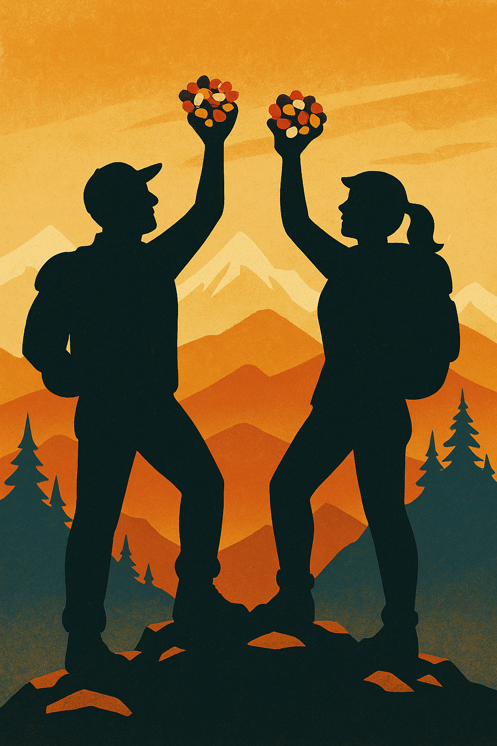
    Trail Mix: food, fuel, and part of the joy of hiking.

    I’ve eaten a lot of trail mix in my life. A lot. Enough that if you lined up every handful I’ve consumed along the Pacific Crest Trail, it would probably create a continuous, snackable line from Mexico to Canada. (Imagine the bears’ delight.)

    Trail mix has been hiking’s most dependable companion long before performance gels, electrolyte chews, or energy bars with names that sound like elite military units. Back in the day, before nutritionists got involved, we called it GORP—Good Old Raisins and Peanuts. And that’s exactly what it was: raisins. Peanuts. Maybe a stubborn almond or two if someone was feeling fancy.

    GORP fueled many a Boy Scout, Girl Scout, and wide-eyed Sierra Clubber into the great unknown. But let’s be honest: raisins and peanuts alone do not spark joy. They spark survival. That’s a different energy.

    Somewhere along the line, hikers revolted. We demanded flavor. We demanded crunch. We demanded those little bits of dried pineapple that look like sugar-coated treasure. We demanded M&Ms—nature’s perfect hiking candy, even though I’m pretty sure nature had nothing to do with them.

    And just like that, trail mix entered its Golden Age.

    The Trailmaster’s Trail Mix Memories

    I have vivid memories of where I’ve snacked on trail mix:

    • On a windy mountain peak, where I fumbled the bag and watched half my almonds fly off into the abyss. (Enjoy, ravens.)
    • Beside a babbling brook, where one renegade peanut invariably rolled into the water and floated off like it was late for an appointment downstream.
    • On the switchbacks of San Jacinto, where I rationed my mix carefully—”one handful per mile”—only to break that rule within 30 minutes.
    • In the redwoods, where everything, including me, smelled faintly of pine resin, and the chocolate pieces became pleasantly squishy but never, ever melted. Redwood sorcery.

    Trail mix tastes different depending on where you eat it. On a mountaintop? Gourmet. In the car on the way home? Somehow disappointing. On your couch? Wrong. Just… wrong.

    traditional trail mix
    Traditionalists say you can’t beat the Trail Mix basic recipe: Nuts, raisins, M&Ms

    The Great Trail Mix Debate

    Hikers love to claim they’ve created the perfect recipe. And each one swears theirs is superior, scientifically balanced, and nutritionally optimized.

    I’ve heard passionate arguments about:

    • Raisins: yes or absolutely not
    • Cashews: essential luxury or trail-mix heresy
    • Pretzel pieces: too salty or just salty enough
    • Chocolate: always M&Ms, never chocolate chips
    • Banana chips: delightful crunch or dehydrated disappointment
    • Coconut flakes: fine if you want to smell like sunscreen

    Me? I’m a bit of a trail mix anarchist. I’ll try anything once. I’ve thrown in espresso beans, ginger chews, even broken-up stroopwafels. (Don’t knock it till you hike it.)

    When making mix at home, I rarely create the same batch twice. Improvisation is half the fun—kind of like choosing which trail to hike in the morning.

    fruity trail mixStore-Bought Mixes: The Modern Marvels

    Store-bought trail mix has come a long way, too. Some are salty, some sweet, some sweet-and-salty, and some astonishingly healthy in a way that makes you think, This is good for me? Really?

    A current favorite of mine—especially when I’m trying to be good but still want something tasty—is  Power Up Trail Mix. Keto-friendly, clean ingredients, and genuinely delicious. It’s the kind of snack that makes you feel like you’ve made a responsible life choice simply by opening the bag.

    In Praise of the Humble Handful

    Trail mix will never be fancy. It doesn’t need to be. It’s not a meal; it’s a moment. A pause on the trail to enjoy nature, fuel up, and smile at how something so simple can make the day feel complete.

    Every trail tells a story. And more often than not, that story includes a handful of trail mix.

    Hike On.

  • Trekking Poles

    Trekking Poles

    TREKKING POLES

    Your Trusty Trail Companions (Even If They Never Say Much Back)**

    John McKinney cartoon with trekking polesI’ve hiked with people who treat trekking poles like they’re ski poles gone AWOL. I’ve also hiked with purists who sneer at poles—until they hit a patch of marbles masquerading as a trail and suddenly wish for a third (or fourth) leg. I fall somewhere in between: poles aren’t mandatory for every outing, but they sure do make hiking smarter, safer, and—yes—kinder to the knees we hope will carry us up many a mountain.

    Back when I started exploring California’s wilds, hikers used old-fashioned wooden walking sticks and re-purposed ski poles. These days? Trekking Poles are everywhere: telescoping, folding, anti-shock, ultralight, ergonomic. Some hikers carry trekking poles that are fancier than my first car.

    But beneath the tech and the titanium, the purpose remains the same: balance, rhythm, confidence, and protection. When you use poles well, they transform your hiking—not by making you faster (though that can happen), but by making you more stable, more efficient, and less beat-up at day’s end.

    Let’s walk through what they do, how to choose them, and how to avoid the many mistakes I’ve seen hikers make before even stepping onto the trail.

    Why Trekking Poles Help—And I Mean Really Help

    Ask ten hikers why they use poles and you’ll hear ten answers. Mine?

    Because the trail is rarely a sidewalk.

    Here’s what trekking poles actually do for you:

    • Save your knees on steep descents.
      Going downhill is where poles shine. Think of them as shock absorbers your knees didn’t know they ordered.
    • Provide balance on uneven terrain.
      Roots, rocks, ruts—California has them all in endless combinations. Poles widen your base of support and keep you from doing impromptu yoga poses you’re not warmed up for.
    • Assist with creek crossings.
      A good pole will steady you over slippery stones. A great pole will remind you to pick your foot beforecommitting your weight.
    • Offer a little trail diplomacy.
      Menacing dogs, mysterious rustling in the chaparral, or the world’s angriest wild turkey—poles give you presence.
    • Keep spiders from decorating your face.
      Wave a pole ahead and feel like royalty parting the webs.
    • Test suspicious ground.
      Gopher holes, mud disguised as not-mud, or a place snakes might nap.

    And maybe most important: poles keep you upright, which keeps your lungs open, which keeps your endurance humming.

    Trekking Poles  101

    A well-worn wooden staff has its charm—and a certain Gandalf-in-the-Sierra vibe—but modern trekking poles exist for a reason. Most poles today are made of aluminum or carbon fiber. Here’s the quick, Trailmaster breakdown:

    Aluminum:

    • Sturdy
    • Affordable
    • Can bend instead of snapping

    Carbon:

    • Lighter
    • Stiffer
    • Better for long days—until you fall sideways on them (carbon breaks more cleanly, which is a polite way of saying it snaps).

    Poles come in two- or three-section designs:

    Two-section:

    • Fewer moving parts
    • Stronger
    • Longer when collapsed (problematic for travel)

    Three-section:

    • More compact
    • Easier to pack in luggage
    • Slightly less durable

    For most hikers? Three-section poles are the sweet spot.

    Fit and Feel

    Poles should be adjusted so that your elbow forms about a 90-degree angle when the tip touches the ground. Ignore this and you’ll either hunch like a question mark or jab the air like a misguided flag-bearer.

    Grip materials matter too:

    • Cork: Breathes and molds to your hand
    • Rubber: More durable, excellent in cold weather
    • Foam: Comfortable, light, but not as long-lasting

    But here’s the Trailmaster truth: comfort is everything. And the only person who can judge comfort is the one holding the poles.

    That’s why whenever a family member—from age eight to eighty-five—needed poles, I marched them straight to REI, where a real human can watch their gait, adjust the poles, and make recommendations based on terrain, style, and ambition.

    For hikers ready to invest in a great pair, I often point them to trusted, durable options like the Leki Makalu Lite Cork Trekking Poles—lightweight, comfortable, reliable, and available at REI.

    TREKKING POLES AREN’T JUST GEAR—THEY’RE CONFIDENCE ON A STICK

    With poles, you don’t just walk the trail—you dance with it. You move in rhythm. You glide over roots, float down slopes, and stand taller.

    Trailmaster Tip? Use trekking poles as tools, not crutches. Let them help you, not hold you up. And when the trail gets tough—and it will—they’ll help keep you moving forward.

    Hike smart. Hike steady.
    Hike On.

  • Take a Hike Day

    Take a Hike Day

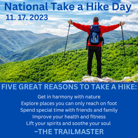
    Depending on who you ask, “Take A Hike Day” (November 17) is either about going for a walk in nature or telling someone to get lost.

    Naturally, The Trailmaster prefers you hit the trail rather than tell someone to go away. Hiking is by far the most popular form of outdoor recreation in the U.S., so I’m confident that many will take a hike in the way I do and say.


    Five Great Reasons to Take a Hike

    *Hiking helps you get in harmony with nature

    *Hiking lets you explore places you can only reach on foot

    * Hiking gives you special time with friends and family

    * Hiking improves your health and fitness

    * Hiking lifts your spirit and soothes your soul


    When I meet people unaware of my unusual occupation, they invariably ask: “So John, what do you do?”

    “I tell people to ‘Take a hike!’”

    “Seriously, what’s your real job?”

    If I had a pound of trail mix for every time I’ve been asked that question, I’d have a ton of trail snacks.

    The fact is, hiking and writing about hiking is my job—and has been for a long time. I served as the Los Angeles Times hiking columnist for 17 years and have written 30 books about hiking and nature. I’ve hiked from youth through middle-age, and plan to continue hiking and telling anyone who will listen to “Take a hike!” until I’m carried off the trail.

    I say “Take a hike” is not a negative and imperative declaration, but a  positive and caring suggestion.

    After celebrating Take a Hike Day on November 17th, in the days that follow you could celebrate Occult Day on the 18th, World Toilet Day on the 19th or Africa Industrialization Day on the 20th.

    But I say, “Take a Hike!” every day instead. Or at least take a hike as often as possible. Whenever and wherever you can.

    Take a hike and enjoy the greenery, the scenery and the wonderful world around you. Take a hike and reconnect with nature. Tell your friends and family to “Take a hike!”

    As for those kids always on the phones, meddlesome in-laws, and annoying co-workers, well, you know what to tell them.

  • Hike to the HOLLYWOOD Sign

    Hike to the HOLLYWOOD Sign

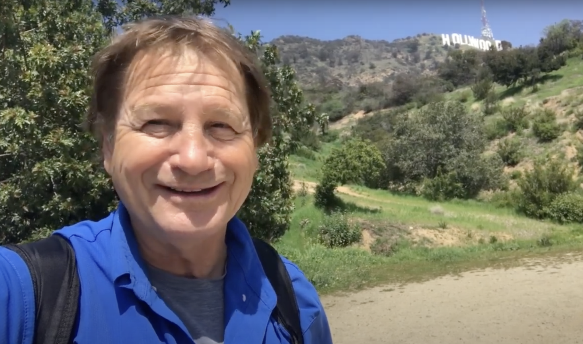
    Hike to the HOLLYWOOD Sign. Celebrate the 100th anniversary of the iconic landmark. Enjoy this fun new video HIKE TO THE HOLLYWOOD SIGN 

    When the HOLLYWOOD Sign was dedicated on July 13, 1923, no one imagined it would become an iconic symbol for the entertainment industry and greater Los Angeles. Four thousand blinking bulbs were added to the towering letters, and it was lit up for the first time December 8, 1923

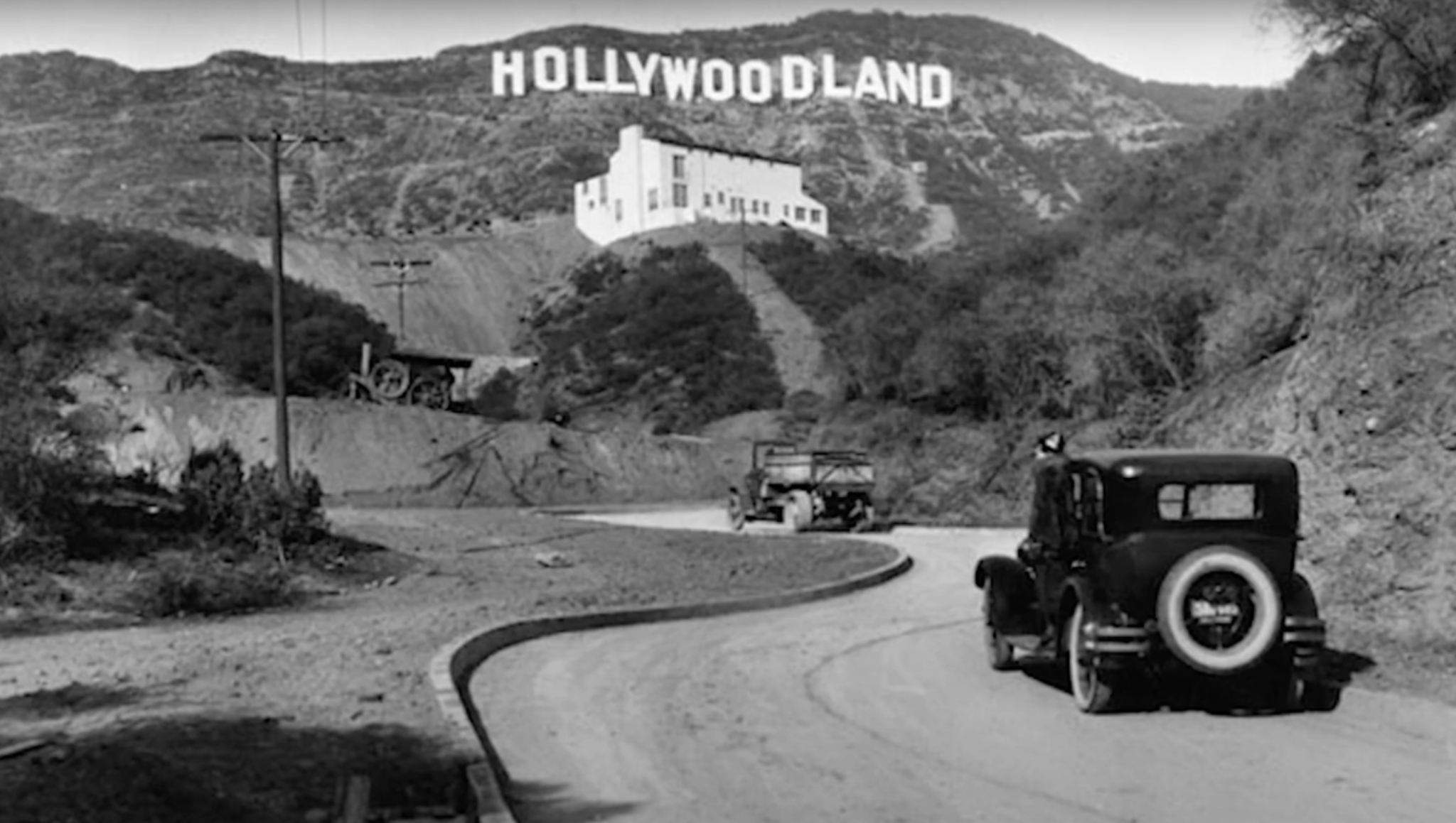
    A hundred years ago, it was the HOLLYWOODLAND sign, put up by real estate developers to promote the sales of new homes in the Hollywood Hills. At the time, the “sign was believed to be the largest in the world.

    Given the Writer Guild and Screen Actors Guild strikes and the uncertainty facing the TV-film industry, little wonder the sign has received scant attention in its centennial year. For a longer explanation of why the HOLLYWOOD Sign’s big year has been a bust, check out the Washington Post HOLLYWOOD Sign Story

    Nevertheless it continues to be a highly popular destination for hikers.  So let’s learn a little more about the Hollywood Sign before we hit the trail.

    In the 1920s, visitors drove not hiked to the HOLLYWOODLAND Sign as it was then known.

    A rather rickety real estate advertisement it was, 14 unevenly spaced, 50-foot-high letters that swayed in the breeze. It was built to last for a year or two, but Hollywood rapidly became the moviemaking capital of the world and the sign endured, now forever associated with the silver scree

    Hiking to the HOLLYWOOD Sign likely began in earnest during the 1930s when Depression era government workers constructed the Griffith Park trail system. In 1944, about 440 acres surrounding the HOLLYWOODLAND sign became part of Griffith Park.  When the sign finally got a little TLC in 1949, the “LAND” portion of the sign was removed.

    In 1978 the sign got an extreme makeover with steel letters supported by sturdy cement columns thanks to the generosity of celeb donors, including Hugh Hefner, Alice Cooper, and Gene Autry. Visit the Hollywood Sign Trust to learn more about the history of the HOLLYWOOD Sign.

    To learn about all the Best Day Hikes in Griffith Park and the Hollywood Hills, get a copy of The Trailmaster Guide, Hike Griffith Park & the Hollywood Hills. For a limited time only, The Trailmaster’s Hike Griffith Park & Hollywood Hills ebook is available on Amazon for just $1.99.

    Geography 101

    Mt. Lee NOT Mt. Hollywood is where you’ll find the HOLLYWOOD Sign

    First thing a hiker needs to know is that Mt. Hollywood, Griffith Park’s premiere peak, is NOT the mountain crowned by the HOLLYWOOD Sign. The HOLLYWOOD SIGN rests near the summit of Mt. Lee. You’ll get great photo angles on the sign and abundant selfie opportunities as you ascend Mt. Lee. (Resist the urge to climb over the fence in order to have your picture taken next to the sign; it’s strictly illegal.

    The Hollywood Hills form the eastern end of the Santa Monica Mountains and share a similar ecology to the range’s taller and wilder peaks to the west. The differences between the two ends of the range have more to do with human settlement than natural history; the Hollywood Hills are by far the most developed part of the mountains.

    Three of The Trailmaster’s  Favorite Hikes

    Hike to the HOLLYWOOD Sign from Innsdale Drive: Easy hike to Hollywood Sign Overlook (Selfie Heaven), followed by ascent on Mulholland Trail and Mt. Lee Drive to the sign.

    Hike to the HOLLYWOOD Sign from Wonderview Drive: A somewhat challenging route for the true hiker! Visit the Wisdom Tree and ascend Burbank Peak and Cahuenga Peak via Aileen Getty Trail on the way to the sign.

    Hike to the HOLLYWOOD Sign from Brush Canyon: Visit the Bronson Caves (“Bat Cave”), ascend Brush Canyon to Mulholland Trail, then over to Mt. Lee Drive to the sign.

    You can also hike to the HOLLYWOOD Sign from several popular locales in Griffith Park including Ferndell, Griffith Observatory, and Mt. Hollywood. Trailmaster recommendation: Climbing to Mt. Hollywood AND to the HOLLYWOOD Sign on the slopes of Mt. Lee adds up to a great hike!

    Hollywood Sign from Innsdale Drive

    From Innsdale Drive to Hollywood Sign Viewpoint
    is 2 miles round trip with 200-foot elevation gain; to HOLLYWOOD Sign is 4.6 miles round trip with 700- foot gain

    This hike does not save the best for last. Great views of the HOLLYWOOD Sign are yours from the beginning of the hike, which makes it highly appealing to the many visitors from across the nation and around the world looking for the easiest way to get photo ops.

    A combination of winding streets and dirt fire roads lead a short mile to Hollywood Sign Viewpoint, aka Selfie Heaven. Frame your photos with the flora en route: cactus, California holly, palm trees, bougainvillea, and bamboo.

    DIRECTIONS: From northbound Highway 101, exit on Barham Drive and drive north 0.3 mile to Lake Hollywood Drive. Turn right and follow the winding road, passing a junction with Wonder View Drive, then Lake Hollywood Reservoir. After 1.5 miles, turn left on Tahoe Drive and continue 0.25 mile to Canyon Lake Drive. Find curbside parking where you can, and the trailhead located 0.1 mile at the end of Canyon Lake Drive at Innsdale Drive.

    THE HIKE: Walk up the wide dirt road (Innsdale Trail for lack of a better name) and… wow, there it is, the HOLLYWOOD Sign. Curve around a bend and just 0.25-mile out, you’ll find yourself directly below the letters. Wow!

    The fire road angles right toward houses and at the 0.5-mile mark, squeeze past a driveway and reach a residential street (Mulholland). Turn left and make another left at the first junction. March past a thicket of signs, ascend past a last house to reach a dirt road, and wind across a hillside above the HollywoodLand neighborhood.

    A short mile from the trailhead, the dirt trail ends at a teal-colored gate. Ascend steps to a paved road located at the crest of Deronda Drive to meet Mt. Lee Drive and a junction. Walk 100 yards up the paved service road (toward a water tank) to Hollywood Sign View. Join visitors from around the world, nearly all taking and posting photos.

    Back to business and the route to the Hollywood Sign: 1.3 more miles up paved Mt. Leet Drive. As you ascend get views of Griffith Observatory and Mt. Hollywood to the east, and downtown L.A. to the southeast and, in 0.3 mile, meet a dirt fire road (Mulholland Trail) that leads toward Brush Canyon (see hike description). Keep left on the paved road for the final mile, and get more views: the Verdugo Mountains, San Gabriel Mountains, and downtown Burbank.

    Just short of the summit, look right and note the signed junction with steep Aileen Getty Ridge Trail that leads to Cahuenga Peak. (A great add-on to this hike!) Minutes later, pass along the chain link fence separating the road from the sign, and reach a vista point above the ‘H’ in the HOLLYWOOD Sign. Enjoy!

    Hollywood Sign from Wonderview Drive

    From Wonder View Drive to Cahuenga Peak is 2.4 miles round trip with 900-foot elevation gain; to Mt Lee is 3.2 miles round trip

    Wonder View Trail leads to the 1,820-foot summit of Cahuenga Peak, high point of the Hollywood Hills. The narrow and steep path (a true hiker’s route) continues to nearby Mt. Lee, which hosts the famed HOLLYWOOD Sign.

    In 2010, hikers and movie fans from across the nation and around the world were delighted to learn that creative conservation efforts, combined with fundraising from private and public sectors, succeeded in purchasing the peak and adding it to Griffith Park.

    When the developers announced plans to subdivide the peak into luxury estates, local conservationists, film fans, and celebs rallied to “Save the Peak.” Some

    $12 million was raised to purchase the 138-acre site. Hollywood notables, including Steven Spielberg and Tom Hanks, plus the Tiffany & Company Foundation, Hugh Hefner and Aileen Getty contributed serious cash, as did state and local agencies.

    Enjoy vistas from Burbank Peak and Cahuenga Peak on the way to Mt. Lee and the HOLLYWOOD Sign.


    As the story goes, Cahuenga, which names a pass, a peak and nowadays a boulevard was once a native Shoshone village located on the banks of the Los Angeles River near present-day Universal City. The peak is the 12th highest in the Hollywood Hills/Santa Monica Mountains.

    DIRECTIONS: From Highway 101 in North Hollywood, exit on Barham Boulevard and head north 0.3 mile. Turn right on Lake Hollywood Drive and continue 0.5 mile to intersect Wonder View Drive (no street parking). Park alongside Lake Hollywood Drive.


    THE HIKE: Walk 0.25 mile up paved Wonder View Drive to its end. Hike past a yellow vehicle gate on dirt road 300 feet to unsigned Burbank Peak Trail (formerly Wonder View Trail) on your right. Begin a steep eastward ascent east, zigzagging up the south slope of Cahuenga Peak. Enjoy wonderful views of Mt. Lee with its forest of antennae, Griffith Observatory, Mt. Hollywood, downtown L.A.

    Step off the trail and get wisdom or share it at the Wisdom Tree

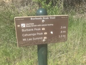
    After a quite aggressive 0.8-mile climb the rough trail gains a ridgeline and splits: the signed right fork leads to Cahuenga Peak and a short pathway leads left to a lone pine tree and the top of Burbank Peak (1,690 feet). Pause to read the summit logbook stashed below the Wisdom Tree; hikers have been known to get very creative with their philosophizing in this book. Clear-day panoramic views are terrific—particularly angles on the San Fernando Valley and San Gabriel Mountains.

    Join signed Aileen Getty Ridge Trail and hike east along a ridgeline 0.3 mile to the summit of Cahuenga Peak. The path then drops to a saddle between Cahuenga Peak and Mt. Lee (1,680 feet) and ends at Mount Lee Road. Turn right and walk up the paved road to the viewpoint above the HOLLYWOOD Sign.

    Hollywood Sign from Brush Canyon

    From Canyon Drive to HOLLYWOOD Sign is 6.4 miles round trip with 1,100-foot elevation gain

    Located in the southeast area of the Griffith Park, Brush Canyon is less developed and less crowded than other areas of the park. Cloaked in chaparral, Brush Canyon definitely lives up to its name. Apparently, its brushy nature was not a secret; “Brush Canyon” was on the map in the early years of the 20th century—even before the park was established.

    But brush isn’t the only flora in the Brush Canyon. Oak and sycamore thrive in the bottom of the canyon.

    Along with offering a convenient trailhead for a hike to the HOLLYWOOD Sign, Brush Canyon is an ideal place to start for a sojourn to other nearby summits—particularly the three noteworthy peaks that rise above the ridges of the canyon: Mt. Bell, Mt. Chapel and Mt. Hollywood.

    Due to the closure of the Hollyridge Trail, Canyon Drive trailhead has become a favorite trailhead for a hike to the HOLLYWOOD Sign. Expect lots of company on the trail from SoCal hikers and visitors from across the US and around the world.

    Enjoy the view from above the DOOWYLLOH Sign, uh, HOLLYWOOD Sign

    DIRECTIONS: From Franklin Avenue, on the southern boundary of Griffith Park, turn north on Bronson Avenue or Canyon Drive (the streets soon join and continue as Canyon). Follow Canyon Drive a winding mile through the hills into Griffith Park. Park alongside the road or in a lot near a picnic area or in a small parking lot by the trailhead at road’s end. Note: Park authorities close the road at sunset.

    THE HIKE: Those heading directly for the Bronson Caves will locate the trailhead on the right (east) side of Canyon Drive. Join a fire road and hike south a short distance to the caves.


    Walk past an info board with a large park map and join the fire road (Brush Canyon Trail). The trail passes handsome sycamores that line the canyon bottom but once the trail begins climbing northeast it leaves the trees behind and Brush Canyon lives up to its name. Chaparral flora frame views of the HOLLYWOOD Sign and Mt. Hollywood.

    After 1.25 miles and a stiff 600-foot gain, reach an overlook (great views of metro LA) and soon thereafter a signed junction with Mulholland Trail, a wide dirt road. Go left (west) on a more level course, pass a junction with Hollyridge Trail (that leads to the closed Beachwood Drive trailhead). Keep right, and wind west to meet Mt. Lee Drive, 2.2 miles from the trailhead.

    A 0.4-mile descent on Mt. Lee Drive leads to Hollywood Sign View (great views indeed and photo ops galore from this overlook; see hike description from Innsdale Drive). Ascend the steep paved road about 1 mile to the summit and a view of DOOWYLLOH, those giant white capital letters from above and behind the sign.

    A locked gate prevents hikers from reaching the top of Mt. Lee. But do enjoy the views from about 100 feet above the HOLLYWOOD Sign.

  • Hike with Kids

    Hike with Kids


    "Hike with Kids will encourage countless families and children to explore the great outdoors.”
    —Richard Louv, Last Child in the Woods
    HIKE With Kids is now Available!

    “It’s a gift from one generation to another to take kids on a hike,” says John McKinney author of 30 hiking-themed books whose weekly hiking column ran for 18 years in the Los Angeles Times. “As a parent myself, I wrote HIKE With Kids to inspire adults to take kids hiking and to provide the practicalities to do so.”

    (For hikers in many parts of the country, it’s not advisable to take a hike right now while the country is battling the Covid-19 pandemic, McKinney cautions. In some regions, it might be okay to hike, provided social distancing practices are observed and the trail is wide and lightly traveled.)

    Whether you’re indoors a lot or not, it’s a good time to learn about nature, nurture, and the fun you and your kids will have on a hike.

    Hike with Kids Is the Antidote We Need

    Recent studies have shown that more American children are replacing outdoor activities with those done indoors and, as a consequence, are suffering from what author-advocate Richard Louv calls “Nature Deficit Disorder.” But according to McKinney there is an antidote. Taking a hike in nature improves the health of children, increases their ability to concentrate and boosts their self-esteem, emotional wellbeing and leadership skills.

    From selecting gear to safety tips to favorite trail snacks, John reveals the best ways to share the joys of nature—and the fun of hiking with kids.

    • Discover which of the Ten Essentials are truly essential and the Six Secrets to Hiking with kids.
    • Gear-up with the right stuff, learn what to pack, and how to pick a hike kids will like.
    • Get tips for hiking with kids of all ages: babies and toddlers, tweens and teens.

    And be sure to check out “The Trailmaster’s Ten-Point Plan for Getting Kids Back on the Nature Trail.”

    “Beyond the substantial physical and emotional benefits found through hiking, kids who hike learn an appreciation for nature that lasts a lifetime,” say McKinney. “They’re the ones who will stand up and protect our natural environments in the future. Hiking is an investment in them and in our future.”

    Interested in Hike with Kids? Check it out HERE


  • Lost Coast Found with New Edition of Popular Map

    Lost Coast Found with New Edition of Popular Map

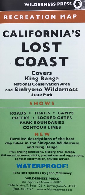
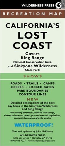
    A new and significantly revised edition of the popular map, California’s Lost Coast is now available. Featuring black sand beaches, redwood groves, and 60 miles of the state’s wildest coastline, the Lost Coast is a magnificent place to hike.

    Order the new California’s Lost Coast Map ($9.95)  from Wilderness Press for only $7.46 (save 25 percent). The map is also available from Amazon,  The Trailmaster Store, and California REI stores.

    New Edition of California's Lost Coast map now available
    New Edition of California’s Lost Coast map now available

    In recent years the Lost Coast has gained national—even international—attention as a top hiking destination, garnering rave reviews and earning it a place on numerous “Best Hikes” lists including:

                “North America’s 10 Most Memorable Hikes”—Backpacker

                “Great American Hikes: 20 Top Trails across the USA” —USA Today

                “Top 10 Coastal Hikes in California & Pacific Northwest”—The Guardian

    Lost Coast Brewery, located in Eureka, California, is also spreading the word about the Lost Coast to beer-lovers everywhere with its Lost Coast Ale and other award-winning beers. Its beer-making operation has increased dramatically in recent years, and Lost Coast beer is now sold around the state and across the nation, as well as in 11 countries. 

    Why Is this California’s Lost Coast?

    Sinkyone Wilderness State Park, along with the BLM’s King Range National Conservation Area to the north, comprise California’s Lost Coast, located in northern Mendocino and southern Humboldt counties. One reason the coast is “lost” is because no highways cross it. So rugged is this country, highway engineers were forced to route Highway 1 many miles inland from the coast—and the region has remained sparsely settled and unspoiled. It’s magnificent vistas and varied terrain—dense forests, prairies, bluffs and beaches—reward the visitor who plans an adventure on the Lost Coast.

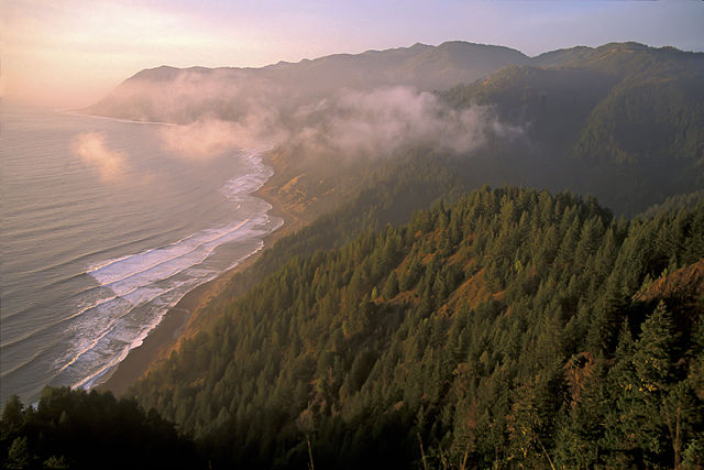
    On California's Lost Coast, the rugged peaks of the King Range seem to rise right out of the surf. (photo by Bob Wick, BLM)
    On California’s Lost Coast, the rugged peaks of the King Range seem to rise right out of the surf. (photo by Bob Wick, BLM)

    The new map incorporates recent changes in facilities and access that add up to altogether better visitor experience. The BLM has upgraded 7 campgrounds and its day-use recreation areas. Trail camps in the King Range and walk-in camps in the state park have also been improved. Roads and trails are in better shape than in years past, with improved signage as well.

    California’s Lost Coast map details the BLM’s new wilderness permit system for backpackers. Those backpackers and day hikers who like to make one-way journeys will be pleased to learn of a new shuttle service that offers drop-off and pickup at all the major Lost Coast trailheads. The map highlights the new Paradise Royale Mountain Bike Trail System, a great way for mountain bikers to experience the Lost Coast.

    While field-checking his California's Lost Coast map, Trailmaster John McKinney gets the latest info from a Sinkyone Wilderness State Park ranger.
    While field-checking his California’s Lost Coast map, Trailmaster John McKinney gets the latest info from a Sinkyone Wilderness State Park ranger.

    John McKinney, author of 30 books about hiking and longtime coastal trails advocate, created the 1st edition of this map while serving as a volunteer camp host at Sinkyone Wilderness and worked closely with the AdventureKeen team to produce this 3rd edition.

    John pioneered the California Coastal Trail and wrote a narrative about his adventure: Hiking on the Edge: Dreams, Schemes, and 1600 Miles on the California Coastal Trail.

  • Olympic Memories on Baldwin Hills Hike

    Olympic Memories on Baldwin Hills Hike

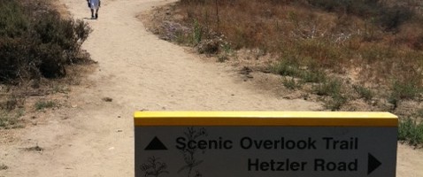
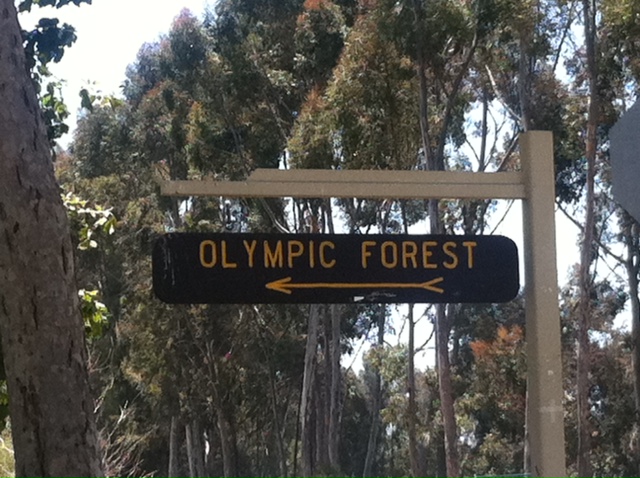
    olympic forestWhenever I take a Baldwin Hills hike I’m reminded that the city of Los Angeles twice hosted the Olympic games. One favorite Baldwin Hills hike is in Kenneth Hahn State Recreation Area. On my last visit I began hiking near the park’s Olympic Forest. When planted the forest included at least one tree for each of the 140 nations that participated in the 1984 Olympic Games.

    Adding to the international flavor is Doris’s Japanese Garden, also located near the trailhead. I enjoyed a stroll past a restful pond and plum trees to a waterfall.

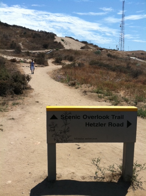
    I hiked the Walk for Health Trail. Every park should have one trail so named. Never mind, every hike is a walk for health.

    As I ascended the dirt path south above the Olympic Forest, I contemplated the paper mulberry from Tonga, the carob from Cyprus, the date palm from Egypt. Wouldn’t it be fun to be hiking along with Tongans, Cypriots, Egyptians and others from around the world?

    When Los Angeles Hosted the Olympics

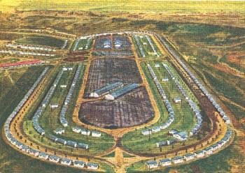
    the olympicsLos Angeles also hosted the Olympics in 1932, at which time the Baldwin Hills park site served as the Olympic Village hosting the athletes. Wow, L.A. sure must have looked different then.

    The trail climbs a hillside cloaked in the native coastal scrub to a cluster of pathways meeting close to Christine’s Point, the first of several viewpoints with benches and sunshades. I took a seat and enjoyed an air traffic controller’s view of LAX. Ah, this is what a Baldwin Hills hike is all about. Then I stood up, turned around, and admired clear-day vistas of the Hollywood Hills, San Gabriel Mountains and downtown L.A.

    Hike the Baldwin Hills for great views of L.A.

    Hiking may not be an Olympic event, but it sure is a satisfying workout, the best of outdoors recreation and as the signs along the Walk for Health Trail point out—good for the mind, body and spirit.

    Interested in more hikes in Los Angeles? Check out HIKE Los Angeles

  • Echo Mountain

    Echo Mountain

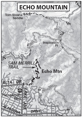
    Sam Merrill Trail: From Cobb Estate to Echo Mountain is 5.6 miles round trip with 1,400-foot elevation gain

    Professor Thaddeus Sobieski Coulincourt Lowe’s Echo Mountain Resort area can be visited not only by retracing the tracks of his “Railway to the Clouds” (See Mt. Lowe Railway hike), but also by way of a fine urban edge trail that ascends from the outskirts of Altadena.

    From Pasadena, visitors rode a trolley up Rubio Canyon, where a pavilion and hotel were located. Then they boarded the “airships” of the great cable incline, which carried them 3,000 feet (gaining 1,300 feet) straight up to the Echo Mountain Re¬sort Area. “Breathtaking” and “hair-raising” were the most frequent descriptions of ride that thrilled tourists from the 1890s to the 1930s. Atop Echo Mountain was a hotel and observatory.

    This historic hike visits the ruins of the one-time “White City” atop Echo Mountain. From the steps of the old Echo Mountain House are great clear-day views of the megalopolis.

    Pasadena and Altadena citizens have been proud to share their fascination with the front range of the San Gabriels. This pride has extend¬ed to the trails ascending from these municipalities into the mountains. Local citizens, under the auspices of the Forest Conservation Club, built a trail from the outskirts of Altadena to Echo Mountain during the 1930s. During the next decade, retired Los Angeles Superior Court clerk Samuel Merrill overhauled and maintained the path. When Merrill died in 1948, the trail was named for him.

    Sam Merrill Trail begins at the former Cobb Estate, now a part of Angeles National Forest. A plaque placed by the Altadena Historical Society dedicates the estate ground as “a quiet place for people and wildlife forever.”

    DIRECTIONS:

    From the Foothill Freeway (210) in Pasadena, exit on Lake Avenue and travel north 3.5 miles to its end at Loma Alta Drive. Park along Lake Avenue.

    Echo Mountain Map by TomHarrisonMaps.com (click to enlarge)
    Echo Mountain Map by TomHarrisonMaps.com (click to enlarge)

    THE HIKE:

    From the great iron gate of the old Cobb Estate, follow the trail along the chain-link fence. The path dips into Las Flores Canyon, crosses a seasonal creek in the canyon bottom, and begins to climb. With the earnest, but well-graded ascent, enjoy good vistas of the San Gabriel Valley and downtown Los Angeles.

    After 2.6 miles of, steep and mostly shadeless travel, arrive at a signed junction with Mt. Lowe Railway Trail (see hike description). Bear right and walk 100 yards along the bed of the old Mt. Lowe Railway to the Echo Mountain ruins. Just before the ruins is a very welcome drinking fountain.

    Up top, spot the railway’s huge bull wheel, now embedded in cement, and just below a pile of concrete rubble, all that remains of the railway depot. The steps and foundation of the Echo Mountain House are great places to take a break and enjoy the view straight down precipitous Rubio Canyon, the route of Lowe’s railway.

    Echo Mountain takes its name from the echo that supposedly bounces around the semicircle of mountain walls. You can try shouting into the strategically placed “megaphone” to get an echo but perhaps even echoes fade with time.

    Interested in more hikes in the San Gabriel Mountains? Check out my “Hike the San Gabriel Mountains Pocket Guide” at The Trailmaster Store

  • California Lost Coast Map

    California Lost Coast Map

    California Lost Coast Map is just what you need for planning a day hike or backpacking adventure. The Trailmaster created this map to share the wonders of this wilderness shoreline and is pleased that each year more and more hikers from across the country and around the world are discovering the beach and mountain trails on the Lost Coast.

    Get the California’s Lost Coast Map from Wilderness Press, which usually offers it online for 25 percent off.

    Find great hikes on California's Lost Coast with the help of a map created by Trailmaster John McKinney
    Find great hikes on California’s Lost Coast with the help of a map created by Trailmaster John McKinney

    Sinkyone Wilderness State Park, along with the BLM’s King Range National Conservation Area to the north, comprise California’s Lost Coast, 60 miles of the state’s wildest coastline located in northern Mendocino and southern Humboldt counties. One reason the coast is “lost” is because no highways cross it. So rugged is this country, highway engineers were forced to route Highway 1 many miles inland from the coast—and the region has remained sparsely settled and unspoiled. It’s magnificent vistas and varied terrain—dense forests, prairies, coastal bluffs, beaches—reward the hardy explorer.

    I created the first version of this map way back in 1988 when I spent a month as a volunteer ranger at Sinkyone Wilderness State Park. Just after I moved my belongings into the old ranch house, it began to rain. And rain. And rain some more. And by the next day the road to the park was closed by a minor mudslide, marooning me from the outside world.

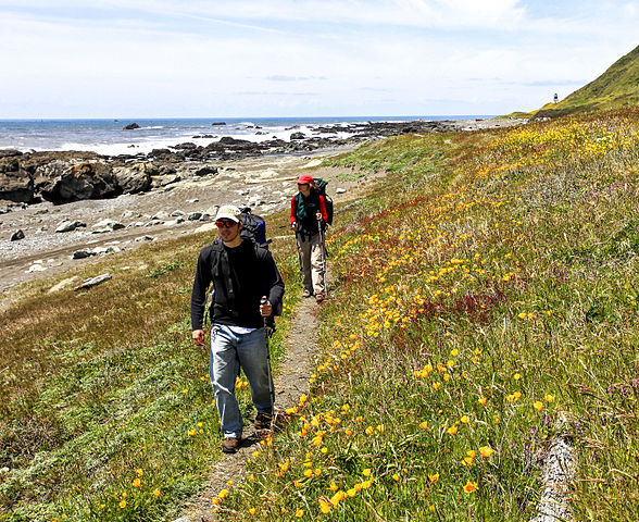
    Lost Coast hikers tramp a rugged shoreline trail (photo by Bob Wick, BLM)
    Lost Coast hikers tramp a rugged shoreline trail (photo by Bob Wick, BLM)

    I had a glorious time. A state park and 20 miles of coastline all to myself. Well, almost to myself. The sky was filled with gulls and pelicans, sea lions and harbor seals gathered at Little Jackass Cove, gray whales were migrating near shore, and a herd of Roosevelt elk seemed to accompany me wherever I hiked.

    I figured a few more nature-loving, don’t mind the rain kind of hikers would love the Lost Coast, too, if only they could find it and know where to hike. So I hiked all the trails and supervised the production of a map.

    Every few years the map (published by Wilderness Press) gets an update, and of course I love to return to the Lost Coast to hike and to field check “California’s Lost Coast.” The trail system sure is a lot better these days, with pretty well-maintained trails and trailheads. That being said, much of it is still wilderness hiking, and far more remote than any other length of coast in California.

    The Lost Coast Map also includes descriptions of a number of my favorite day hikes in the King Range National Conservation Area and Sinkyone Wilderness State Park, some along the route of the Lost Coast Trail, which extends the length of the two jurisdictions. Lost Coast Trail is starting to appear on those Top Ten and Top Twenty North American Hikes lists, and I say deservedly so.

    On California's Lost Coast, the rugged peaks of the King Range seem to rise right out of the surf. (photo by Bob Wick, BLM)
    On California’s Lost Coast, the rugged peaks of the King Range seem to rise right out of the surf. (photo by Bob Wick, BLM)

    Since California’s Lost Coast is one of the rainiest regions in the state, if any map should be waterproof, this one is it. My only objection to the word “WATERPROOF!” on the front of the map is in way bigger type than John McKinney and I’m really going to have to speak to the otherwise bright and extremely meticulous editors at Wilderness Press about this…Imagine thinking WATERPROOF! is a more significant selling point than The Trailmaster’s trail-blazing and compelling prose…

    And in other Lost Coast News: Backpackers and those day hikers who like to make one-way journeys will be overjoyed to learn of three locally owned shuttle services that offer on-demand drop-off and pickup at all the major Lost Coast trailheads:

    Lost Coast Adventures (707)986-9895 or (707)502-7514
    Lost Coast Shuttle (707)986-7437
    Lost Coast Trail Transport Service 
(707)986-9909

    The BLM has a very helpful visitor center, with a great staff and information handouts. Backpackers in particular will need to drop by to find out about trail camps and keeping your food out of the paws of the increasing bear population.

    Have a great time on the Lost Coast!

    Hike On,

    John McKinney
    The Trailmaster