Every Trail Tells a Story
Tomales Point
Elk, wildflowers, wind, and ocean-Point Reyes distilled to its essence.
A true “to-the-end-of-the-world” walk with sweeping views on both sides.
History underfoot, wildlife in view, and a finish that thrills every time.
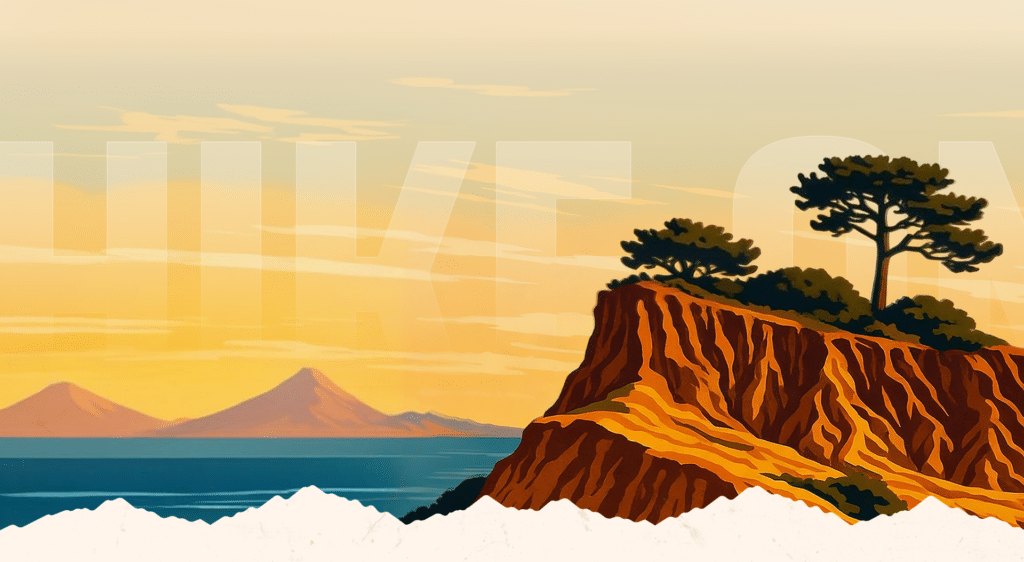
Tomales Point, solid granite carved by restless waves into bold cliffs, is quite the contrast to the softer slopes that comprise most of the California coast. Point Reyes has many distinguished “Points” but this is the most dramatic and a magnificent hike in all seasons: on a clear-winter day when the views are grand; in spring for the wildflowers; on those long summer days; in autumn when the tule elk are so active.
This is my favorite hike in Point Reyes, one I’ve shared with friends and family over and over again for many years. It’s almost a pilgrimage to me now, even a spiritual experience. One Sunday morning when I was hiking Tomales Point Trail-solo this time-I heard the sound of church bells ring out across the bay. I guessed the bells, loud and lovely could mark the end of a divine liturgy in the town of Marshall, but the sounded more grand, more powerful than those following the usual Sunday service. The bells sounded strangely amplified rather than diminished by a mile of saltwater. I felt soul-rejuvenated. Communion received. Heart uplifted.
What seals the deal, year after year, is the company. Tomales Point is the most reliable place in the seashore to see tule elk-California’s homegrown elk, once knocked to the ropes by overhunting and habitat loss. By the late 1800s they were down to a remnant handful in the Central Valley. From that seed herd, wildlife managers slowly rebuilt the population and, in the late 1970s, moved a small founding group to a reserve at Tomales Point. The animals took one look at this wind-brushed headland of grass and lupine and decided they’d won the lottery. Today, you’re apt to see a bull holding court with his harem, or a fraternity of bachelor bulls pretending not to care. In rutting season the headlands ring with their calls-think brass section with antlers.
Natural history here plays at grand scale. To your left, the Pacific pounds the bedrock edge of the North American Plate; to your right, quiet Tomales Bay slides along the San Andreas Rift like a silk ribbon. On fog days, the point is all mystery: the trail rolling through pewter light, elk drifting in and out like apparitions. On clear days, the world clicks into high-definition-Bodega Head to the north, the white seam of McClures Beach to the west, the long blue blade of the bay to the east. Spring laces the bluffs with tidy tips, iris, and poppies; fall braids gold into the grass and drama into the elk.
Human stories, too, leave their print. Solomon Pierce set a dairy here in 1858, shipping butter by schooner to San Francisco. The old ranch buildings at the trailhead are the prologue; the trail that follows is the long, lyrical chapter you came to read with your feet. Tomales Point is a hike that ends at the edge of the continent-and somehow also ends with you feeling larger than when you began.
Drive north on Sir Francis Drake Boulevard past the town of Inverness. Shortly after Sir Francis turns west, bear right (north) on Pierce Point Road, and continue nine miles to its end at Upper Pierce Point Ranch.
Begin at the signed trailhead by the historic dairy buildings. The wide path skirts a windbreak of Monterey cypress and crosses grasslands brightened in spring by blue lupine and fragrant coastal bush lupine. From the first hillock, look west to McClures Beach and Elephant Rock.
At one mile, descend into aptly named Windy Gap, then climb toward views of Driftwood Beach. The route rolls easily along the ridge; at about 2.2 miles you reach the high point (roughly 540 feet) with big looks into Tomales Bay-Hog Island and the village of Dillon Beach laid out like a map.
At 3.2 miles, drop to the site of Lower Pierce Ranch, marked by a pond and eucalyptus. The old road gives way to singletrack and soon reaches a vista of Bird Rock, often white with pelicans and busy with cormorants.
Around 3.9 miles the maintained trail ends. Continue on a fainter, sometimes sandy path to the tip-keeping to the main line when elk paths or social tracks try to lure you astray. One last gentle rise at 4.3 miles, then the narrowing finger of land descends to its rocky perch above the Pacific. Linger, watch the white lines of surf spool across the coast, then retrace your steps the way you came.